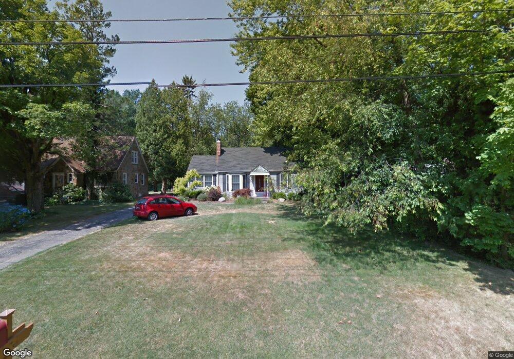
302 W Hamilton Ln Battle Creek, MI 49015
Minges Brook Riverside NeighborhoodEstimated Value: $197,000 - $223,717
2
Beds
2
Baths
1,120
Sq Ft
$187/Sq Ft
Est. Value
About This Home
This home is located at 302 W Hamilton Ln, Battle Creek, MI 49015 and is currently estimated at $208,929, approximately $186 per square foot. 302 W Hamilton Ln is a home located in Calhoun County with nearby schools including Lakeview Middle School, Lakeview High School, and Arbor Academy.
Ownership History
Date
Name
Owned For
Owner Type
Purchase Details
Closed on
Sep 11, 2009
Sold by
Utterback Larry A and Utterback Kelly J
Bought by
Burdette John B and Burdette Amanda M G
Current Estimated Value
Home Financials for this Owner
Home Financials are based on the most recent Mortgage that was taken out on this home.
Original Mortgage
$111,443
Outstanding Balance
$73,363
Interest Rate
5.32%
Mortgage Type
FHA
Estimated Equity
$135,566
Purchase Details
Closed on
May 17, 1996
Bought by
Utterback
Purchase Details
Closed on
Jan 17, 1995
Bought by
Andree
Create a Home Valuation Report for This Property
The Home Valuation Report is an in-depth analysis detailing your home's value as well as a comparison with similar homes in the area
Home Values in the Area
Average Home Value in this Area
Purchase History
| Date | Buyer | Sale Price | Title Company |
|---|---|---|---|
| Burdette John B | $113,500 | Chicago Title | |
| Utterback | $89,000 | -- | |
| Andree | $77,200 | -- |
Source: Public Records
Mortgage History
| Date | Status | Borrower | Loan Amount |
|---|---|---|---|
| Open | Burdette John B | $111,443 |
Source: Public Records
Tax History Compared to Growth
Tax History
| Year | Tax Paid | Tax Assessment Tax Assessment Total Assessment is a certain percentage of the fair market value that is determined by local assessors to be the total taxable value of land and additions on the property. | Land | Improvement |
|---|---|---|---|---|
| 2025 | -- | $88,200 | $0 | $0 |
| 2024 | $2,148 | $82,542 | $0 | $0 |
| 2023 | $2,446 | $72,168 | $0 | $0 |
| 2022 | $1,940 | $63,467 | $0 | $0 |
| 2021 | $2,382 | $58,962 | $0 | $0 |
| 2020 | $2,357 | $57,955 | $0 | $0 |
| 2019 | $2,232 | $56,678 | $0 | $0 |
| 2018 | $2,232 | $57,026 | $4,966 | $52,060 |
| 2017 | $2,164 | $52,362 | $0 | $0 |
| 2016 | $2,160 | $48,358 | $0 | $0 |
| 2015 | $2,011 | $45,650 | $7,860 | $37,790 |
| 2014 | $2,011 | $44,964 | $7,860 | $37,104 |
Source: Public Records
Map
Nearby Homes
- 292 W Hamilton Ln
- 15 Timothy Ln
- 219 W Hamilton Ln
- 118 Flora Ln
- 29 Langley Rd E
- 33 Langley Rd E
- 211 Beckwith Dr
- 215 Beckwith Dr
- 117 Pheasant Run
- 25 Minges Rd W
- 4281 Watkins Rd
- 148 Wahwahtaysee Way
- 4275 Watkins Rd
- 15 Birch Hill Dr
- 68 Birch Hill Dr
- 220 Deer Path Ln
- 4293 Beckley Rd
- 12800 Minges Rd S
- 244 Deer Path Ln
- 168 Pheasant Run
- 304 W Hamilton Ln
- 298 W Hamilton Ln
- 306 W Hamilton Ln
- 0 W Hamilton Ln
- V/L W Hamilton Ln
- 303 W Hamilton Ln
- 296 W Hamilton Ln
- 310 W Hamilton Ln
- 175 Adams Rd
- 307 W Hamilton Ln
- 13 Thornapple Dr
- 180 Adams Rd
- 163 Adams Rd
- 17 Thornapple Dr
- 311 W Hamilton Ln
- 162 Adams Rd
- 159 Adams Rd
- 313 W Hamilton Ln
- 314 W Hamilton Ln
- 25 Thornapple Dr