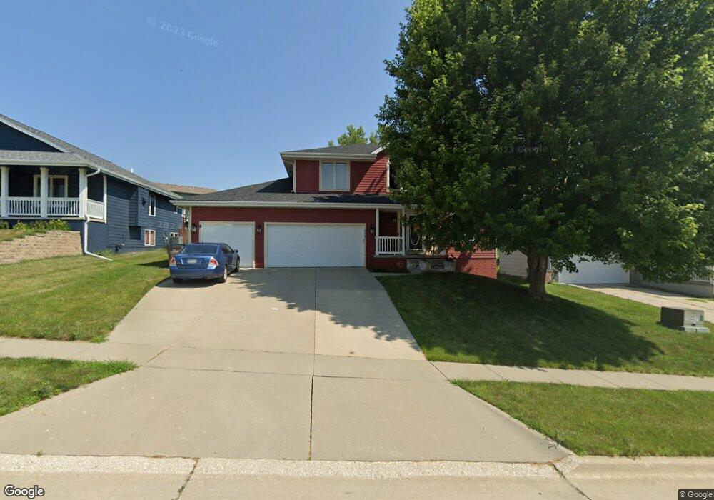
302 W Maple St Runnells, IA 50237
Estimated Value: $307,000 - $367,000
3
Beds
3
Baths
1,910
Sq Ft
$180/Sq Ft
Est. Value
About This Home
This home is located at 302 W Maple St, Runnells, IA 50237 and is currently estimated at $342,994, approximately $179 per square foot. 302 W Maple St is a home located in Polk County with nearby schools including Runnells Elementary School, Southeast Polk Spring Creek- 6th Grade, and Southeast Polk Junior High School.
Ownership History
Date
Name
Owned For
Owner Type
Purchase Details
Closed on
Sep 18, 2002
Sold by
Harvey Christopher L and Harvey Jennifer L
Bought by
Cruz Darrin M and Cruz Jennifer M
Current Estimated Value
Home Financials for this Owner
Home Financials are based on the most recent Mortgage that was taken out on this home.
Original Mortgage
$152,720
Outstanding Balance
$64,169
Interest Rate
6.32%
Estimated Equity
$278,825
Create a Home Valuation Report for This Property
The Home Valuation Report is an in-depth analysis detailing your home's value as well as a comparison with similar homes in the area
Home Values in the Area
Average Home Value in this Area
Purchase History
| Date | Buyer | Sale Price | Title Company |
|---|---|---|---|
| Cruz Darrin M | $190,500 | -- |
Source: Public Records
Mortgage History
| Date | Status | Borrower | Loan Amount |
|---|---|---|---|
| Open | Cruz Darrin M | $152,720 | |
| Closed | Cruz Darrin M | $38,180 |
Source: Public Records
Tax History Compared to Growth
Tax History
| Year | Tax Paid | Tax Assessment Tax Assessment Total Assessment is a certain percentage of the fair market value that is determined by local assessors to be the total taxable value of land and additions on the property. | Land | Improvement |
|---|---|---|---|---|
| 2025 | $5,668 | $368,400 | $33,300 | $335,100 |
| 2024 | $5,668 | $334,000 | $29,400 | $304,600 |
| 2023 | $5,422 | $334,000 | $29,400 | $304,600 |
| 2022 | $5,354 | $279,900 | $25,400 | $254,500 |
| 2021 | $5,024 | $279,900 | $25,400 | $254,500 |
| 2020 | $4,938 | $251,300 | $22,800 | $228,500 |
| 2019 | $4,790 | $251,300 | $22,800 | $228,500 |
| 2018 | $4,798 | $227,100 | $20,000 | $207,100 |
| 2017 | $4,948 | $227,100 | $20,000 | $207,100 |
| 2016 | $4,924 | $210,400 | $18,300 | $192,100 |
| 2015 | $4,924 | $210,400 | $18,300 | $192,100 |
| 2014 | $4,808 | $206,700 | $17,700 | $189,000 |
Source: Public Records
Map
Nearby Homes
- 203 Brown St
- 12028 SE 64th Ave
- 6121 SE 104th St
- 3333 220th Ave
- 3320 SE 96th St
- 3380 SE 96th St
- 2493 SE 108th St
- 0 S 128th Ave W
- 10579 W 129th St S
- 235 N Washington St
- 00 Highway 5
- 7930 SE Vandalia Dr
- 7820 SE Vandalia Dr
- 3350 SE 82nd St
- 24479 Elthon Place
- 2496 SE 83rd Ct
- 3356 SE 82nd St
- 2511 SE 82nd St
- 6335 S31 Hwy
- 7295 SE Vandalia Dr
- 300 W Maple St
- 206 W Maple St
- 305 Marshall Ct
- 401 Crestview Dr
- 303 W Maple St
- 305 W Maple St
- 302 Marshall Ct
- 204 W Maple St
- 405 Crestview Dr
- 307 Crestview Dr
- 207 W Maple St
- 300 1/2 W Park Ave
- 300 ½ W Park Ave
- 304 Marshall Ct
- 400 Maple Ct
- 205 W Maple St
- 304 W Park Ave
- 300 W Park Ave
- 308 W Park Ave
- 401 Maple Ct