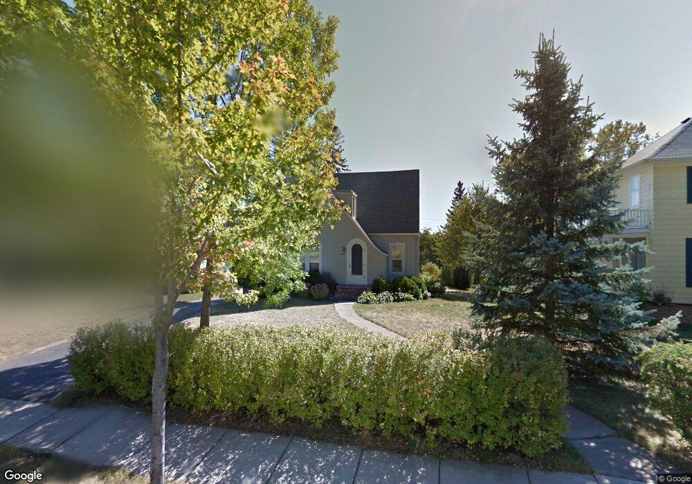
3020 Branch St Duluth, MN 55812
Congdon Park NeighborhoodEstimated Value: $487,413 - $655,000
4
Beds
3
Baths
2,339
Sq Ft
$231/Sq Ft
Est. Value
About This Home
This home is located at 3020 Branch St, Duluth, MN 55812 and is currently estimated at $539,353, approximately $230 per square foot. 3020 Branch St is a home located in St. Louis County with nearby schools including Congdon Elementary School, Ordean East Middle School, and East High School.
Ownership History
Date
Name
Owned For
Owner Type
Purchase Details
Closed on
May 11, 2010
Sold by
Austin Bryan
Bought by
Polacsek Bart and Polacsek Allyz
Current Estimated Value
Home Financials for this Owner
Home Financials are based on the most recent Mortgage that was taken out on this home.
Original Mortgage
$264,000
Outstanding Balance
$176,962
Interest Rate
5.13%
Mortgage Type
Purchase Money Mortgage
Estimated Equity
$362,391
Purchase Details
Closed on
Jun 17, 2005
Sold by
Gorghuber Mark S and Gorghuber Catherine E
Bought by
Austin Bryan
Home Financials for this Owner
Home Financials are based on the most recent Mortgage that was taken out on this home.
Original Mortgage
$199,920
Interest Rate
5.62%
Mortgage Type
Fannie Mae Freddie Mac
Create a Home Valuation Report for This Property
The Home Valuation Report is an in-depth analysis detailing your home's value as well as a comparison with similar homes in the area
Home Values in the Area
Average Home Value in this Area
Purchase History
| Date | Buyer | Sale Price | Title Company |
|---|---|---|---|
| Polacsek Bart | $322,500 | Rels | |
| Polacsek Bart | $322,500 | Rels | |
| Austin Bryan | $249,900 | Pioneer Abstract & Title Of | |
| Austin Bryan | $249,900 | Pioneer Abstract & Title Of |
Source: Public Records
Mortgage History
| Date | Status | Borrower | Loan Amount |
|---|---|---|---|
| Open | Polacsek Bart | $264,000 | |
| Previous Owner | Austin Bryan | $199,920 |
Source: Public Records
Tax History Compared to Growth
Tax History
| Year | Tax Paid | Tax Assessment Tax Assessment Total Assessment is a certain percentage of the fair market value that is determined by local assessors to be the total taxable value of land and additions on the property. | Land | Improvement |
|---|---|---|---|---|
| 2024 | $6,132 | $452,200 | $43,200 | $409,000 |
| 2023 | $6,132 | $436,900 | $42,700 | $394,200 |
| 2022 | $2,565 | $384,900 | $37,900 | $347,000 |
| 2021 | $5,026 | $318,400 | $30,900 | $287,500 |
| 2020 | $4,860 | $318,400 | $30,900 | $287,500 |
| 2019 | $4,728 | $300,700 | $27,400 | $273,300 |
| 2018 | $4,418 | $295,300 | $27,400 | $267,900 |
| 2017 | $4,028 | $295,300 | $27,400 | $267,900 |
| 2016 | $3,930 | $0 | $0 | $0 |
| 2015 | $2,874 | $184,600 | $12,200 | $172,400 |
| 2014 | $2,874 | $184,600 | $12,200 | $172,400 |
Source: Public Records
Map
Nearby Homes
- 2510 E Superior St
- 2525 E 1st St
- 3406 E 4th St
- 124 N 24th Ave E
- 2418 E 4th St
- 2328 E 3rd St
- 3631 London Rd
- 3725 London Rd
- 3731 London Rd
- 2314 E 5th St
- 3735 London Rd Unit 16
- 3735 London Rd
- 200x E 3rd St
- xxx E 2nd St
- 2109 Jefferson St
- 2101 E 1st St
- 2126 Water St
- 145 Waverly Place
- 1914 E 1st St
- 1901 E Superior St
- 3016 Branch St
- 3026 Branch St
- 3010 Branch St
- 3015 Greysolon Rd
- 3030 Branch St
- 3009 Greysolon Rd
- 3025 Branch St
- 3023 Branch St
- 106 S 30th Ave E
- 3027 Branch St
- 102 S 30th Ave E
- 3001 Greysolon Rd
- 3015 Branch St
- 3031 Branch St
- 3103 Greysolon Rd
- 29 S Hawthorne Rd
- 3011 Branch St
- 108 S Hawthorne Rd
- 26 S 30th Ave E
- 3111 Greysolon Rd