

3021 SE Indian Ln Juniper Canyon, OR 97754
Juniper Canyon NeighborhoodEstimated payment $1,334/month
Highlights
- Horse Property
- 40 Acre Lot
- Wire Fence
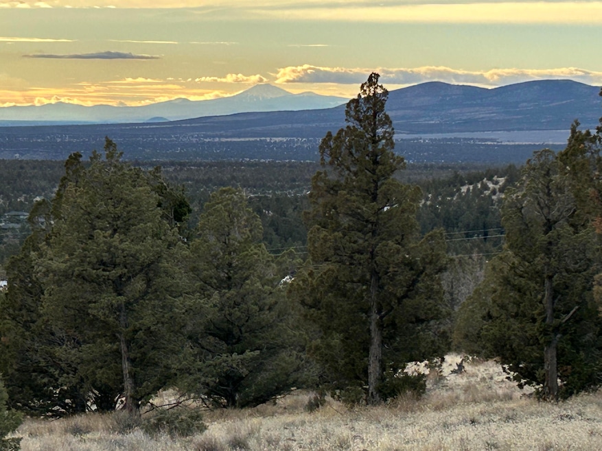
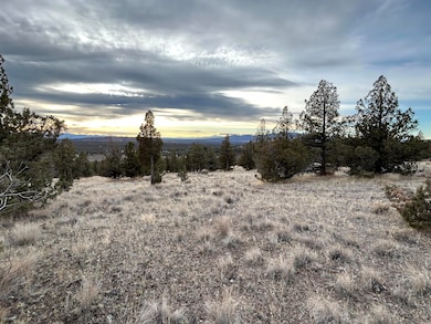
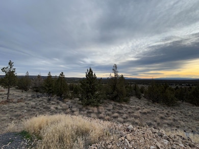
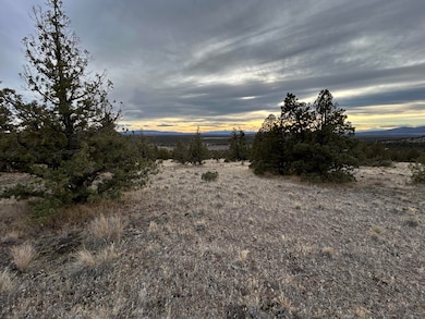
- Panoramic View
- No HOA
- Native Plants
About This Lot
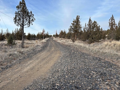
Discover the perfect blend of privacy, open space and development potential on this 40 acre property located in the heart of Crook County, Oregon. Positioned to capture Cascade Mountain views, this parcel offers a rare opportunity for those seeking a scenic homesite, investment land or recreational retreat. The property consists of 40 fenced acres of gently rolling terrain with beautiful natural landscape. The RRM5 zoning with power on the property offers subdivision and development potential. Easy access to nearby recreational opportunities including Prineville Reservoir and ample public lands. Peaceful, private setting while still within convenient reach to Prineville and local services. Whether you're a builder, investor or someone dreaming of a high desert escape, this property offers the flexibility and freedom to create something truly special. Enjoy star filled nights, panoramic views and the quiet of wide open spaces.
Property Details
Property Type
- Land
Est. Annual Taxes
- $266
Lot Details
- 40 Acre Lot
- Dirt Road
- Wire Fence
- Native Plants
- Sloped Lot
- Property is zoned RRM5, RRM5
Property Views
- Panoramic
- Mountain
- Territorial
Schools
- Crooked River Elementary School
- Crook County Middle School
- Crook County High School
Additional Features
- Mobile Home Allowed
- Septic Needed
Listing and Financial Details
- Assessor Parcel Number 2338
Community Details
Overview
- No Home Owners Association
Recreation
- Horse Property
Map
Home Values in the Area
Average Home Value in this Area
Tax History
| Year | Tax Paid | Tax Assessment Tax Assessment Total Assessment is a certain percentage of the fair market value that is determined by local assessors to be the total taxable value of land and additions on the property. | Land | Improvement |
|---|---|---|---|---|
| 2025 | $266 | $21,870 | -- | -- |
| 2024 | $259 | $21,240 | -- | -- |
| 2023 | $251 | $20,630 | $0 | $0 |
| 2022 | $243 | $20,030 | $0 | $0 |
| 2021 | $243 | $19,450 | $0 | $0 |
| 2020 | $236 | $18,893 | $0 | $0 |
| 2019 | $228 | $17,809 | $0 | $0 |
| 2018 | $222 | $17,809 | $0 | $0 |
| 2017 | $219 | $17,290 | $0 | $0 |
| 2016 | $209 | $16,297 | $0 | $0 |
| 2015 | $200 | $16,297 | $0 | $0 |
| 2013 | -- | $15,361 | $0 | $0 |
Property History
| Date | Event | Price | List to Sale | Price per Sq Ft |
|---|---|---|---|---|
| 12/04/2025 12/04/25 | For Sale | $250,000 | -- | -- |
Purchase History
| Date | Type | Sale Price | Title Company |
|---|---|---|---|
| Deed In Lieu Of Foreclosure | -- | None Listed On Document |
Source: Oregon Datashare
MLS Number: 220212623
APN: 002338
Disclaimer: Certain information contained herein is derived from information provided by parties other than Homes.com. All information provided is deemed reliable, but is not guaranteed to be accurate and should be independently verified.
![]() © 2025 Oregon Datashare (KCAR | MLSCO | SOMLS). All rights reserved. The data relating to real estate for sale on this web site comes in part from the Internet Data Exchange Program of the Oregon Datashare. Real estate listings held by IDX Brokerage firms other than Ten-X are marked with the Internet Data Exchange logo or the Internet Data Exchange thumbnail logo and detailed information about them includes the name of the listing Brokers. Information provided is for consumers' personal, non-commercial use and may not be used for any purpose other than to identify prospective properties the viewer may be interested in purchasing. The consumer will not copy, retransmit nor redistribute any of the content from this website. Information provided is deemed reliable, but not guaranteed.
© 2025 Oregon Datashare (KCAR | MLSCO | SOMLS). All rights reserved. The data relating to real estate for sale on this web site comes in part from the Internet Data Exchange Program of the Oregon Datashare. Real estate listings held by IDX Brokerage firms other than Ten-X are marked with the Internet Data Exchange logo or the Internet Data Exchange thumbnail logo and detailed information about them includes the name of the listing Brokers. Information provided is for consumers' personal, non-commercial use and may not be used for any purpose other than to identify prospective properties the viewer may be interested in purchasing. The consumer will not copy, retransmit nor redistribute any of the content from this website. Information provided is deemed reliable, but not guaranteed.
- 2501 SE Pilot Dr
- 2575 SE Maphet Rd
- Lot 95 SE Hondo Ct
- Lot 90 SE Hondo Ct
- Lot 96 SE Hondo Ct
- Lot 93 SE Hondo Ct
- Lot 91 SE Hondo Ct
- 0 SE Hondo Ct Unit Lot 98 201510614
- 1832 SE Blue Skies Ln
- 2330 SE Texas Cir
- 11058 SE Galveston Loop
- Lot 84 SE Galveston Loop
- Lot 85 SE Galveston Loop
- Lot 106 SE Galveston Loop
- Lot 108 SE Galveston Loop
- Lot 100 SE Galveston Loop
- Lot 86 SE Galveston Loop
- Lot 63 SE Galveston Loop
- Lot 87 SE Galveston Loop
- Lot 107 SE Galveston Loop
- 940 NW 2nd St
- 2252 NE Colleen Rd
- 4455 NE Vaughn Ave Unit The Prancing Peacock
- 748 NE Oak Place Unit 748 NE Oak Place, Redmond, OR 97756
- 748 NE Oak Place
- 629 SW 5th St
- 787 NW Canal Blvd
- 1329 SW Pumice Ave
- 1950 SW Umatilla Ave
- 2050 SW Timber Ave
- 418 NW 17th St Unit 3
- 3025 NW 7th St
- 4633 SW 37th St
- 3667 SW Pumice Stone Ave
- 4399 SW Coyote Ave
- 2960 NW Northwest Way
- 63190 Deschutes Market Rd
- 951 Golden Pheasant Dr Unit ID1330988P
- 21302 NE Brooklyn Ct
- 21302 NE Brooklyn Ct
