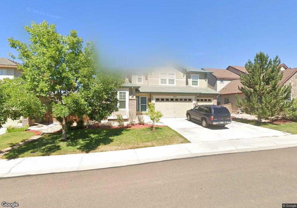
3025 E 142nd Dr Thornton, CO 80602
Fallbrook Farms NeighborhoodEstimated Value: $673,225 - $888,000
3
Beds
3
Baths
2,883
Sq Ft
$268/Sq Ft
Est. Value
About This Home
This home is located at 3025 E 142nd Dr, Thornton, CO 80602 and is currently estimated at $773,806, approximately $268 per square foot. 3025 E 142nd Dr is a home located in Adams County with nearby schools including Prairie Hills Elementary School, Rocky Top Middle School, and Horizon High School.
Ownership History
Date
Name
Owned For
Owner Type
Purchase Details
Closed on
Mar 5, 2008
Sold by
Csi Construction Inc
Bought by
Thompson Thomas M and Thompson Kimberly A
Current Estimated Value
Home Financials for this Owner
Home Financials are based on the most recent Mortgage that was taken out on this home.
Original Mortgage
$709,000
Outstanding Balance
$427,812
Interest Rate
5.5%
Mortgage Type
Purchase Money Mortgage
Estimated Equity
$345,994
Purchase Details
Closed on
Jan 25, 2008
Sold by
Beazer Homes Holdings Corp
Bought by
Slaughter Steven J and Slaughter Michelle R
Home Financials for this Owner
Home Financials are based on the most recent Mortgage that was taken out on this home.
Original Mortgage
$709,000
Outstanding Balance
$427,812
Interest Rate
5.5%
Mortgage Type
Purchase Money Mortgage
Estimated Equity
$345,994
Create a Home Valuation Report for This Property
The Home Valuation Report is an in-depth analysis detailing your home's value as well as a comparison with similar homes in the area
Home Values in the Area
Average Home Value in this Area
Purchase History
| Date | Buyer | Sale Price | Title Company |
|---|---|---|---|
| Thompson Thomas M | $959,000 | Utc Colorado | |
| Slaughter Steven J | $381,281 | Land Title Guarantee Company |
Source: Public Records
Mortgage History
| Date | Status | Borrower | Loan Amount |
|---|---|---|---|
| Open | Thompson Thomas M | $709,000 | |
| Previous Owner | Slaughter Steven J | $305,000 |
Source: Public Records
Tax History
| Year | Tax Paid | Tax Assessment Tax Assessment Total Assessment is a certain percentage of the fair market value that is determined by local assessors to be the total taxable value of land and additions on the property. | Land | Improvement |
|---|---|---|---|---|
| 2025 | $4,531 | $46,040 | $8,300 | $37,740 |
| 2024 | $4,531 | $42,320 | $7,630 | $34,690 |
| 2023 | $4,485 | $47,490 | $8,250 | $39,240 |
| 2022 | $4,488 | $35,200 | $8,480 | $26,720 |
| 2021 | $5,539 | $35,200 | $8,480 | $26,720 |
| 2020 | $5,679 | $36,900 | $8,720 | $28,180 |
| 2019 | $5,687 | $36,900 | $8,720 | $28,180 |
| 2018 | $5,416 | $34,410 | $7,920 | $26,490 |
| 2017 | $5,057 | $34,410 | $7,920 | $26,490 |
| 2016 | $4,312 | $28,710 | $5,570 | $23,140 |
| 2015 | $4,314 | $28,710 | $5,570 | $23,140 |
| 2014 | -- | $26,260 | $4,940 | $21,320 |
Source: Public Records
Map
Nearby Homes
- 3067 E 143rd Ave
- 3347 E 142nd Dr
- 14447 Madison St
- 14057 Fillmore Dr
- 3592 E 141st Place
- 3593 E 141st Place
- 13963 Cook St
- 13904 Cook St
- 13845 Adams Cir
- 2705 E 148th Dr
- 2084 E 143rd Ave
- 14628 Vine St
- 1981 E 141st Ave
- 1936 E 144th Dr
- 14749 Gaylord St
- 4225 E 145 Ave
- 14776 Race St
- 13638 Garfield St Unit C
- 13604 Garfield St Unit E
- 14985 Elizabeth St
- 2981 E 142nd Dr
- 3035 E 142nd Dr
- 3028 E 143rd Ave
- 2911 E 142nd Dr
- 3008 E 143rd Ave
- 3038 E 143rd Ave
- 3055 E 142nd Dr
- 3026 E 142nd Dr
- 2978 E 143rd Ave
- 3016 E 142nd Dr
- 3058 E 143rd Ave
- 3036 E 142nd Dr
- 2990 E 142nd Dr
- 3065 E 142nd Dr
- 2908 E 143rd Ave
- 3056 E 142nd Dr
- 2950 E 142nd Dr
- 3068 E 143rd Ave
- 3076 E 142nd Dr
- 3027 E 143rd Ave
Your Personal Tour Guide
Ask me questions while you tour the home.