Estimated Value: $437,000 - $527,000
4
Beds
4
Baths
2,498
Sq Ft
$190/Sq Ft
Est. Value
About This Home
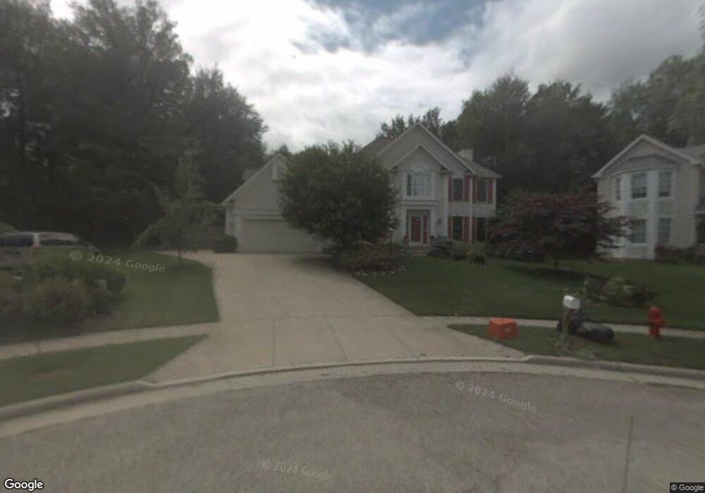
This home is located at 3027 Hillside Trail, Stow, OH 44224 and is currently estimated at $474,798, approximately $190 per square foot. 3027 Hillside Trail is a home located in Summit County with nearby schools including Stow-Munroe Falls High School, Holy Family Elementary School, and St Patrick Elementary School.
Ownership History
Date
Name
Owned For
Owner Type
Purchase Details
Closed on
Mar 14, 2002
Sold by
Strom Linda V
Bought by
Masi James and Holcomb Patrick T
Current Estimated Value
Home Financials for this Owner
Home Financials are based on the most recent Mortgage that was taken out on this home.
Original Mortgage
$221,200
Interest Rate
6.95%
Create a Home Valuation Report for This Property
The Home Valuation Report is an in-depth analysis detailing your home's value as well as a comparison with similar homes in the area
Home Values in the Area
Average Home Value in this Area
Purchase History
| Date | Buyer | Sale Price | Title Company |
|---|---|---|---|
| Masi James | $276,500 | Minnesota Title Agency Inc |
Source: Public Records
Mortgage History
| Date | Status | Borrower | Loan Amount |
|---|---|---|---|
| Closed | Masi James | $221,200 | |
| Closed | Masi James | $41,450 |
Source: Public Records
Tax History Compared to Growth
Tax History
| Year | Tax Paid | Tax Assessment Tax Assessment Total Assessment is a certain percentage of the fair market value that is determined by local assessors to be the total taxable value of land and additions on the property. | Land | Improvement |
|---|---|---|---|---|
| 2025 | $7,135 | $126,960 | $21,158 | $105,802 |
| 2024 | $7,135 | $126,960 | $21,158 | $105,802 |
| 2023 | $7,135 | $126,960 | $21,158 | $105,802 |
| 2022 | $5,794 | $90,927 | $15,005 | $75,922 |
| 2021 | $5,187 | $90,927 | $15,005 | $75,922 |
| 2020 | $5,097 | $90,930 | $15,010 | $75,920 |
| 2019 | $5,839 | $97,500 | $15,010 | $82,490 |
| 2018 | $5,743 | $97,500 | $15,010 | $82,490 |
| 2017 | $4,982 | $97,500 | $15,010 | $82,490 |
| 2016 | $5,128 | $82,070 | $15,010 | $67,060 |
| 2015 | $4,982 | $82,070 | $15,010 | $67,060 |
| 2014 | $4,987 | $82,070 | $15,010 | $67,060 |
| 2013 | $5,235 | $86,780 | $15,010 | $71,770 |
Source: Public Records
Map
Nearby Homes
- 3127 Deercrest Path
- 2973 Mourning Dove Cir
- 3511 Whit Ave
- 3383 Suffolk Downs
- 1265 W Main St
- 1181 Norwood St
- 3128 Bay Meadows Cir
- 566 Beech Dr
- 600 Silver Meadows Blvd
- 505 Longmere Dr
- 2991 Heatherwood Ct Unit 30B
- 978 Silver Meadows Blvd
- 4035 Villas Dr
- 3896 Lake Run Blvd
- 400 Cathy Dr
- 779 Atwood Dr
- 430 W Elm St
- 2194 Santom Rd E
- 346 Harris St
- 3642 Northport Dr
- 3032 Hillside Trail
- 3035 Hillside Trail
- 3321 Pine Hollow Dr
- 3311 Pine Hollow Dr
- 3331 Pine Hollow Dr
- 3043 Hillside Trail
- 3040 Hillside Trail
- 3016 Ridgeline Trail
- 3024 Ridgeline Trail
- 3051 Hillside Trail
- 3341 Pine Hollow Dr
- 3052 Hillside Trail
- 3032 Ridgeline Trail
- 3330 Pine Hollow Dr
- 3320 Pine Hollow Dr
- 3310 Pine Hollow Dr
- 3060 Hillside Trail
- 3186 Deercrest Path
- 3176 Deercrest Path
- 2988 Ridgeline Trail