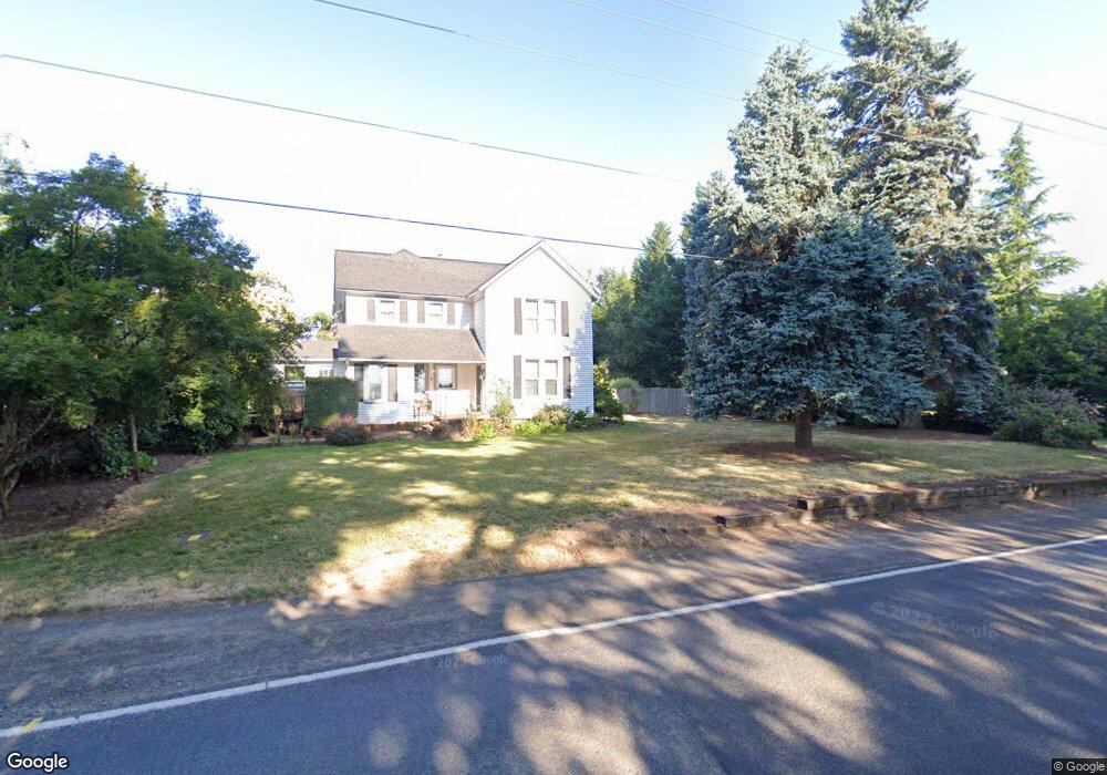
30273 Barlow Rd Hubbard, OR 97032
Estimated Value: $534,000 - $813,000
4
Beds
2
Baths
2,790
Sq Ft
$242/Sq Ft
Est. Value
About This Home
This home is located at 30273 Barlow Rd, Hubbard, OR 97032 and is currently estimated at $674,433, approximately $241 per square foot. 30273 Barlow Rd is a home located in Clackamas County with nearby schools including Philander Lee Elementary School, Baker Prairie Middle School, and Canby High School.
Ownership History
Date
Name
Owned For
Owner Type
Purchase Details
Closed on
Apr 15, 2014
Sold by
Castle Lawrence Alan and Haley Ayron Diane
Bought by
Davis Isom L and Davis Kayleen G
Current Estimated Value
Home Financials for this Owner
Home Financials are based on the most recent Mortgage that was taken out on this home.
Original Mortgage
$256,000
Outstanding Balance
$194,461
Interest Rate
4.32%
Mortgage Type
New Conventional
Estimated Equity
$479,972
Create a Home Valuation Report for This Property
The Home Valuation Report is an in-depth analysis detailing your home's value as well as a comparison with similar homes in the area
Home Values in the Area
Average Home Value in this Area
Purchase History
| Date | Buyer | Sale Price | Title Company |
|---|---|---|---|
| Davis Isom L | $320,000 | Wfg Title |
Source: Public Records
Mortgage History
| Date | Status | Borrower | Loan Amount |
|---|---|---|---|
| Open | Davis Isom L | $256,000 |
Source: Public Records
Tax History Compared to Growth
Tax History
| Year | Tax Paid | Tax Assessment Tax Assessment Total Assessment is a certain percentage of the fair market value that is determined by local assessors to be the total taxable value of land and additions on the property. | Land | Improvement |
|---|---|---|---|---|
| 2024 | $3,757 | $296,826 | -- | -- |
| 2023 | $3,757 | $288,181 | $0 | $0 |
| 2022 | $3,417 | $279,788 | $0 | $0 |
| 2021 | $3,278 | $271,639 | $0 | $0 |
| 2020 | $3,234 | $263,728 | $0 | $0 |
| 2019 | $3,053 | $256,047 | $0 | $0 |
| 2018 | $3,054 | $248,589 | $0 | $0 |
| 2017 | $2,981 | $241,349 | $0 | $0 |
| 2016 | $2,876 | $234,319 | $0 | $0 |
| 2015 | $2,797 | $227,494 | $0 | $0 |
| 2014 | $2,717 | $220,868 | $0 | $0 |
Source: Public Records
Map
Nearby Homes
- 30413 S Stuwe Rd
- 6150 S Miller Rd
- 29497 S Meridian Rd
- 8487 S Sconce Rd
- 8601 S Sconce Rd
- 30700 S Highway 170
- 29474 S Highway 170
- 9060 S Highway 211
- 17765 Monnier Rd NE
- 27200 S Barlow Rd
- 8949 S Gribble Rd
- 26882 S Bolland Rd
- 12875 Peggys Place NE
- 3197 Rainbow Loop Unit 10
- 3370 Maple St Unit 44
- 3370 Maple St
- 9573 S Gribble Rd
- 18767 Highway 99e
- 9750 S Gribble Rd
- 20800 Yosemite St NE
- 30277 S Barlow Rd
- 30400 S Barlow Rd
- 30248 S Barlow Rd
- 30432 S Barlow Rd
- 30432 S Barlow Rd
- 30050 S Barlow Rd
- 6886 S Miller Rd
- 7034 S Barnards Rd
- 6846 S Miller Rd
- 7194 S Barnards Rd Unit 1
- 7194 S Barnards Rd
- 6923 S Whiskey Hill Rd
- 7150 S Barnards Rd
- 6806 S Miller Rd
- 6875 S Whiskey Hill Rd
- 6849 S Whiskey Hill Rd
- 7236 S Barnards Rd
- 30570 S Barlow Rd
- 7051 S Barnards Rd
- 7290 S Barnards Rd