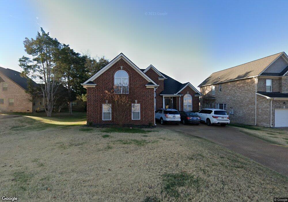
3028 Clyde Cir Mount Juliet, TN 37122
Estimated Value: $521,613 - $559,000
--
Bed
3
Baths
2,315
Sq Ft
$234/Sq Ft
Est. Value
About This Home
This home is located at 3028 Clyde Cir, Mount Juliet, TN 37122 and is currently estimated at $541,903, approximately $234 per square foot. 3028 Clyde Cir is a home located in Wilson County with nearby schools including Stoner Creek Elementary School, West Wilson Middle School, and Mt. Juliet High School.
Ownership History
Date
Name
Owned For
Owner Type
Purchase Details
Closed on
May 18, 2012
Sold by
Green Adam Michael
Bought by
Worden Michael P and Worden Tamah D
Current Estimated Value
Home Financials for this Owner
Home Financials are based on the most recent Mortgage that was taken out on this home.
Original Mortgage
$211,105
Outstanding Balance
$146,058
Interest Rate
3.87%
Mortgage Type
FHA
Estimated Equity
$395,845
Purchase Details
Closed on
Sep 8, 2006
Sold by
Eastland Construction Inc
Bought by
Green Adam Michael
Purchase Details
Closed on
Sep 30, 2005
Bought by
Eastland Construction Inc
Create a Home Valuation Report for This Property
The Home Valuation Report is an in-depth analysis detailing your home's value as well as a comparison with similar homes in the area
Home Values in the Area
Average Home Value in this Area
Purchase History
| Date | Buyer | Sale Price | Title Company |
|---|---|---|---|
| Worden Michael P | $215,000 | -- | |
| Green Adam Michael | $253,900 | -- | |
| Eastland Construction Inc | $288,000 | -- |
Source: Public Records
Mortgage History
| Date | Status | Borrower | Loan Amount |
|---|---|---|---|
| Open | Worden Michael P | $211,105 |
Source: Public Records
Tax History Compared to Growth
Tax History
| Year | Tax Paid | Tax Assessment Tax Assessment Total Assessment is a certain percentage of the fair market value that is determined by local assessors to be the total taxable value of land and additions on the property. | Land | Improvement |
|---|---|---|---|---|
| 2024 | $1,775 | $92,975 | $22,500 | $70,475 |
| 2022 | $1,775 | $92,975 | $22,500 | $70,475 |
| 2021 | $1,877 | $92,975 | $22,500 | $70,475 |
| 2020 | $1,770 | $92,975 | $22,500 | $70,475 |
| 2019 | $218 | $65,775 | $13,750 | $52,025 |
| 2018 | $1,766 | $65,775 | $13,750 | $52,025 |
| 2017 | $1,766 | $65,775 | $13,750 | $52,025 |
| 2016 | $1,766 | $65,775 | $13,750 | $52,025 |
| 2015 | $1,822 | $65,775 | $13,750 | $52,025 |
| 2014 | $1,694 | $61,153 | $0 | $0 |
Source: Public Records
Map
Nearby Homes
- 4015 Sleepyhollow Way
- 3016 Clyde Cir
- 1050 Stonehollow Way
- 2011 Stonebrook Cir
- 620 Hollow Wood Trail
- 421 Riverstone Place
- 300 Tararack Ct
- 3140 Hidden Creek Dr
- 701 Plowson Rd
- 467 Tomlinson Pointe Dr
- 463 Tomlinson Pointe Dr
- 469 Tomlinson Pointe Dr
- 3289 Tomlinson Pointe Dr
- 471 Tomlinson Pointe Dr
- 445 Tomlinson Pointe Dr
- 462 Tomlinson Pointe Dr
- 464 Tomlinson Pointe Dr
- McCourt Plan at Tomlinson Pointe - Longford Collection
- Kildare Plan at Tomlinson Pointe - Longford Collection
- Bowen Plan at Tomlinson Pointe - Carlow Collection
- 3026 Clyde Cir
- 794 Rolling Creek Dr
- 4026 Sleepyhollow Way
- 3041 Clyde Cir
- 3043 Clyde Cir
- 3024 Clyde Cir
- 3039 Clyde Cir
- 4024 Sleepyhollow Way
- 3045 Clyde Cir
- 798 Rolling Creek Dr
- 3037 Clyde Cir
- 1061 Stonehollow Way
- 4019 Sleepyhollow Way
- 3022 Clyde Cir
- 788 Rolling Creek Dr
- 4022 Sleepyhollow Way
- 3035 Clyde Cir
- 1053 Stonehollow Way
- 4017 Sleepyhollow Way