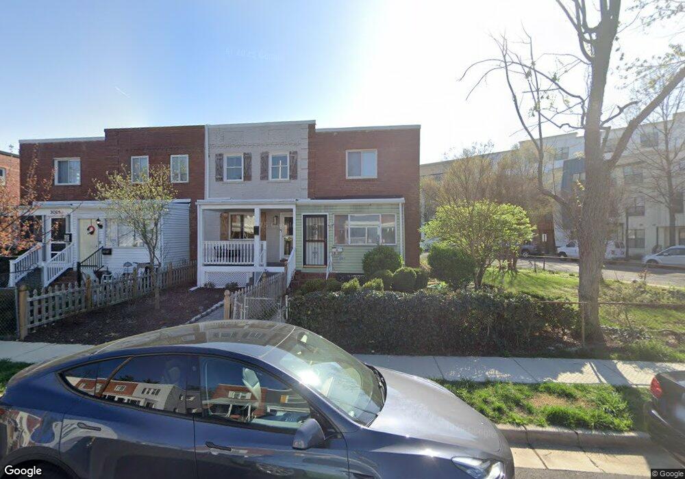
3028 Manning St Alexandria, VA 22305
Del Ray NeighborhoodEstimated Value: $623,129 - $680,000
--
Bed
1
Bath
930
Sq Ft
$698/Sq Ft
Est. Value
About This Home
This home is located at 3028 Manning St, Alexandria, VA 22305 and is currently estimated at $649,376, approximately $698 per square foot. 3028 Manning St is a home located in Alexandria City with nearby schools including Cora Kelly Magnet Elementary, George Washington Middle School, and Alexandria City High School.
Ownership History
Date
Name
Owned For
Owner Type
Purchase Details
Closed on
Jan 28, 1999
Sold by
Okine Regina
Bought by
Brown Frances
Current Estimated Value
Home Financials for this Owner
Home Financials are based on the most recent Mortgage that was taken out on this home.
Original Mortgage
$77,000
Outstanding Balance
$18,116
Interest Rate
6.67%
Estimated Equity
$631,260
Create a Home Valuation Report for This Property
The Home Valuation Report is an in-depth analysis detailing your home's value as well as a comparison with similar homes in the area
Home Values in the Area
Average Home Value in this Area
Purchase History
| Date | Buyer | Sale Price | Title Company |
|---|---|---|---|
| Brown Frances | $85,000 | -- |
Source: Public Records
Mortgage History
| Date | Status | Borrower | Loan Amount |
|---|---|---|---|
| Open | Brown Frances | $77,000 |
Source: Public Records
Tax History Compared to Growth
Tax History
| Year | Tax Paid | Tax Assessment Tax Assessment Total Assessment is a certain percentage of the fair market value that is determined by local assessors to be the total taxable value of land and additions on the property. | Land | Improvement |
|---|---|---|---|---|
| 2025 | $7,115 | $571,073 | $372,618 | $198,455 |
| 2024 | $7,115 | $571,073 | $372,618 | $198,455 |
| 2023 | $6,371 | $573,950 | $372,618 | $201,332 |
| 2022 | $6,128 | $552,051 | $350,719 | $201,332 |
| 2021 | $5,767 | $519,506 | $318,836 | $200,670 |
| 2020 | $5,808 | $490,521 | $289,851 | $200,670 |
| 2019 | $5,133 | $454,265 | $253,595 | $200,670 |
| 2018 | $5,133 | $454,265 | $253,595 | $200,670 |
| 2017 | $4,751 | $420,465 | $230,523 | $189,942 |
| 2016 | $4,170 | $388,669 | $198,727 | $189,942 |
| 2015 | $3,864 | $370,432 | $180,490 | $189,942 |
| 2014 | $3,821 | $366,319 | $175,233 | $191,086 |
Source: Public Records
Map
Nearby Homes
- 6 Ashby St Unit D
- 12 Ashby St Unit F
- 1 Herbert St
- 3401 Commonwealth Ave Unit A
- 319 Laverne Ave
- 9 E Glebe Rd Unit C
- 297 E Raymond Ave
- 211 E Glebe Rd Unit C
- 2933 Landover St
- 313 Calvert Ave
- 317 Calvert Ave
- 3306 Landover St
- 210 Aspen St
- 403a Hume Ave Unit A
- 31 W Reed Ave
- 6 W Mount Ida Ave
- 141 Lynhaven Dr
- 309 Wesmond Dr
- 234 Wesmond Dr
- 28 E Reed Ave
- 3030 Manning St
- 3026 Manning St
- 3032 Manning St
- 3022 Manning St
- 3020 Manning St
- 3018 Manning St
- 3019 Fulton St
- 3015 Fulton St
- 3016 Manning St
- 3013 Fulton St
- 3039 Manning St
- 3035 Manning St
- 3033 Manning St
- 3043 Manning St
- 3031 Manning St
- 3045 Manning St
- 3047 Manning St
- 3010 Manning St
- 3049 Manning St
- 3027 Manning St