Estimated Value: $251,000 - $273,116
3
Beds
2
Baths
1,440
Sq Ft
$180/Sq Ft
Est. Value
About This Home
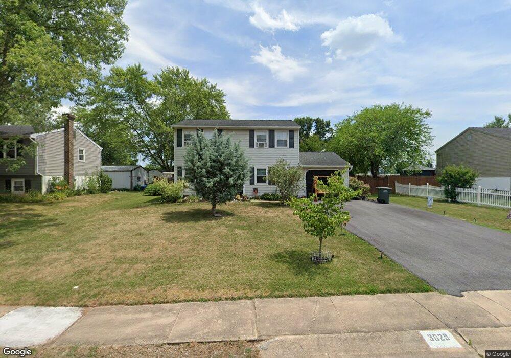
This home is located at 3029 Muirfield Rd, Dover, PA 17315 and is currently estimated at $259,279, approximately $180 per square foot. 3029 Muirfield Rd is a home located in York County with nearby schools including Dover Area High School and Lighthouse Christian School.
Ownership History
Date
Name
Owned For
Owner Type
Purchase Details
Closed on
Mar 11, 2017
Sold by
Cornelius Eric R and Putnam Cornelius Paula
Bought by
Cornelius Eric R and Putnam Cornelius Paula
Current Estimated Value
Home Financials for this Owner
Home Financials are based on the most recent Mortgage that was taken out on this home.
Original Mortgage
$124,000
Outstanding Balance
$63,341
Interest Rate
4.19%
Mortgage Type
New Conventional
Estimated Equity
$195,938
Purchase Details
Closed on
Feb 14, 2000
Sold by
Swartz James K and Swartz Melissa A
Bought by
Cornelius Eric R
Home Financials for this Owner
Home Financials are based on the most recent Mortgage that was taken out on this home.
Original Mortgage
$91,404
Interest Rate
8.15%
Mortgage Type
FHA
Purchase Details
Closed on
Nov 2, 1992
Bought by
Swartz James K and Swartz Milissa A
Create a Home Valuation Report for This Property
The Home Valuation Report is an in-depth analysis detailing your home's value as well as a comparison with similar homes in the area
Home Values in the Area
Average Home Value in this Area
Purchase History
| Date | Buyer | Sale Price | Title Company |
|---|---|---|---|
| Cornelius Eric R | -- | None Available | |
| Cornelius Eric R | $91,900 | -- | |
| Swartz James K | $87,900 | -- |
Source: Public Records
Mortgage History
| Date | Status | Borrower | Loan Amount |
|---|---|---|---|
| Open | Cornelius Eric R | $124,000 | |
| Closed | Cornelius Eric R | $91,404 |
Source: Public Records
Tax History Compared to Growth
Tax History
| Year | Tax Paid | Tax Assessment Tax Assessment Total Assessment is a certain percentage of the fair market value that is determined by local assessors to be the total taxable value of land and additions on the property. | Land | Improvement |
|---|---|---|---|---|
| 2025 | $3,764 | $114,730 | $32,910 | $81,820 |
| 2024 | $3,730 | $114,730 | $32,910 | $81,820 |
| 2023 | $3,730 | $114,730 | $32,910 | $81,820 |
| 2022 | $3,662 | $114,730 | $32,910 | $81,820 |
| 2021 | $3,455 | $114,730 | $32,910 | $81,820 |
| 2020 | $3,424 | $114,730 | $32,910 | $81,820 |
| 2019 | $3,381 | $114,730 | $32,910 | $81,820 |
| 2018 | $3,297 | $114,730 | $32,910 | $81,820 |
| 2017 | $3,297 | $114,730 | $32,910 | $81,820 |
| 2016 | $0 | $114,730 | $32,910 | $81,820 |
| 2015 | -- | $114,730 | $32,910 | $81,820 |
| 2014 | -- | $114,730 | $32,910 | $81,820 |
Source: Public Records
Map
Nearby Homes
- 4755 Orchid Way Unit 36
- 2856 W Canal Rd
- 4140 Strawbridge Ct
- 4144 Trabert Ct
- 4101 Strawbridge Ct
- 4651 S Salem Church Rd
- 3975 Craig Ave
- 3220 Hub Ct
- 4571 S Salem Church Rd
- 3636 Fieldstone Dr
- 3632 Fieldstone Dr
- 3634 Fieldstone Dr
- 3619 Fieldstone Dr
- 3617 Fieldstone Dr
- 3639 Fieldstone Dr
- 3637 Fieldstone Dr
- 3635 Fieldstone Dr
- 3633 Fieldstone Dr
- 3615 Fieldstone Dr
- 2689 Victorian Dr
- 3035 Muirfield Rd
- 3021 Muirfield Rd
- 3032 Muirfield Rd
- 3045 Muirfield Rd
- 3040 Muirfield Rd
- 3024 Muirfield Rd
- 4401 Wynnefield Dr
- 3053 Muirfield Rd
- 4400 Wynnefield Dr
- 4404 Wynnefield Dr
- 3014 Muirfield Rd
- 3056 Muirfield Rd
- 4393 Wynnefield Dr
- 4408 Wynnefield Dr
- 4398 Wynnefield Dr
- 3061 Muirfield Rd
- 4414 Wynnefield Dr
- 4388 Wynnefield Dr
- 3064 Muirfield Rd
- 4389 Wynnefield Dr