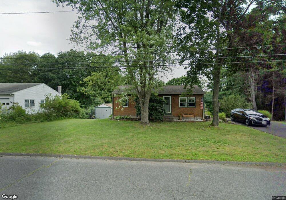
303 Brookside Cir Florence, MA 01062
Florence NeighborhoodEstimated Value: $339,705 - $348,000
4
Beds
2
Baths
864
Sq Ft
$396/Sq Ft
Est. Value
About This Home
This home is located at 303 Brookside Cir, Florence, MA 01062 and is currently estimated at $342,426, approximately $396 per square foot. 303 Brookside Cir is a home located in Hampshire County with nearby schools including Northampton High School.
Ownership History
Date
Name
Owned For
Owner Type
Purchase Details
Closed on
Dec 9, 2016
Sold by
Turati Linda E
Bought by
Turati Alan J
Current Estimated Value
Purchase Details
Closed on
Dec 15, 1997
Sold by
Zurawski Darlene J and Zurawski Max
Bought by
Renkowic Linda E and Turati Alan J
Home Financials for this Owner
Home Financials are based on the most recent Mortgage that was taken out on this home.
Original Mortgage
$80,000
Interest Rate
7.14%
Mortgage Type
Purchase Money Mortgage
Purchase Details
Closed on
Jul 2, 1991
Sold by
Shaver James D and Shaver Deborah K
Bought by
Zurawski Max and Zurawski Darlene J
Create a Home Valuation Report for This Property
The Home Valuation Report is an in-depth analysis detailing your home's value as well as a comparison with similar homes in the area
Home Values in the Area
Average Home Value in this Area
Purchase History
| Date | Buyer | Sale Price | Title Company |
|---|---|---|---|
| Turati Alan J | -- | -- | |
| Renkowic Linda E | $102,000 | -- | |
| Zurawski Max | $103,500 | -- |
Source: Public Records
Mortgage History
| Date | Status | Borrower | Loan Amount |
|---|---|---|---|
| Previous Owner | Zurawski Max | $77,500 | |
| Previous Owner | Zurawski Max | $85,000 | |
| Previous Owner | Zurawski Max | $80,000 | |
| Previous Owner | Zurawski Max | $91,800 |
Source: Public Records
Tax History
| Year | Tax Paid | Tax Assessment Tax Assessment Total Assessment is a certain percentage of the fair market value that is determined by local assessors to be the total taxable value of land and additions on the property. | Land | Improvement |
|---|---|---|---|---|
| 2025 | $3,778 | $271,200 | $134,500 | $136,700 |
| 2024 | $4,151 | $273,300 | $128,300 | $145,000 |
| 2023 | $3,784 | $238,900 | $116,500 | $122,400 |
| 2022 | $3,476 | $194,300 | $109,200 | $85,100 |
| 2021 | $3,384 | $194,800 | $104,200 | $90,600 |
| 2020 | $3,273 | $194,800 | $104,200 | $90,600 |
| 2019 | $3,059 | $176,100 | $89,200 | $86,900 |
| 2018 | $3,016 | $177,000 | $89,200 | $87,800 |
| 2017 | $2,954 | $177,000 | $89,200 | $87,800 |
| 2016 | $2,860 | $177,000 | $89,200 | $87,800 |
| 2015 | $2,846 | $180,100 | $89,200 | $90,900 |
| 2014 | $2,772 | $180,100 | $89,200 | $90,900 |
Source: Public Records
Map
Nearby Homes
- 815 Burts Pit Rd
- 723 Lot B Ryan Rd
- 72 Emerson Way
- 296 Ryan Rd Unit A
- 296 Ryan Rd
- 296 Ryan Rd Unit B
- 635 Florence Rd
- 697 Florence Rd
- 589 Florence Rd
- 42 Clark St
- 967 Florence Rd
- 832 Westhampton Rd
- 296 Old Wilson Rd
- 0 W Farms Rd
- 37 Landy Ave
- 892 Westhampton Rd
- 404 Sylvester Rd
- 98 Park Hill Rd
- 67 Park St Unit A
- 20-11 Sylvester Rd
- 311 Brookside Cir
- 295 Brookside Cir
- 300 Brookside Cir
- 308 Brookside Cir
- 287 Brookside Cir
- 316 Brookside Cir
- 286 Brookside Cir
- 21 Longview Dr
- 327 Brookside Cir
- 29 Longview Dr
- 324 Brookside Cir
- 279 Brookside Cir
- 32 Woods Rd
- 37 Longview Dr
- 45 Longview Dr
- 335 Brookside Cir
- 271 Brookside Cir
- 332 Brookside Cir
- 264 Brookside Cir
- 20 Longview Dr
Your Personal Tour Guide
Ask me questions while you tour the home.