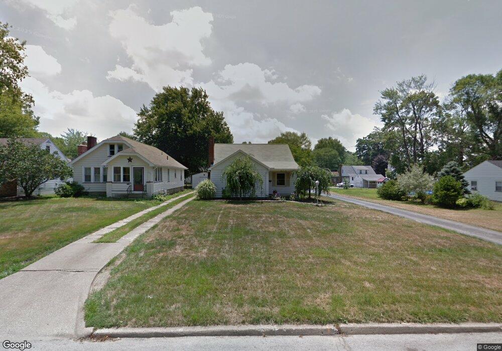
303 Erskine Ave Youngstown, OH 44512
Estimated Value: $164,312 - $177,000
4
Beds
2
Baths
1,832
Sq Ft
$94/Sq Ft
Est. Value
About This Home
This home is located at 303 Erskine Ave, Youngstown, OH 44512 and is currently estimated at $171,328, approximately $93 per square foot. 303 Erskine Ave is a home located in Mahoning County with nearby schools including Boardman Glenwood Junior High School, Boardman High School, and Horizon Science Academy - Youngstown.
Ownership History
Date
Name
Owned For
Owner Type
Purchase Details
Closed on
Apr 9, 2001
Sold by
Bush Marshall M and Bush Daniel
Bought by
Huebner Scot
Current Estimated Value
Purchase Details
Closed on
Dec 18, 1995
Sold by
Reto Robert M
Bought by
Perry Michael J
Home Financials for this Owner
Home Financials are based on the most recent Mortgage that was taken out on this home.
Original Mortgage
$79,050
Interest Rate
7.45%
Mortgage Type
VA
Purchase Details
Closed on
Aug 2, 1991
Bought by
Reto Robert M
Create a Home Valuation Report for This Property
The Home Valuation Report is an in-depth analysis detailing your home's value as well as a comparison with similar homes in the area
Home Values in the Area
Average Home Value in this Area
Purchase History
| Date | Buyer | Sale Price | Title Company |
|---|---|---|---|
| Huebner Scot | -- | -- | |
| Huebner Scot | -- | -- | |
| Huebner Scot | -- | -- | |
| Perry Michael J | $77,500 | -- | |
| Reto Robert M | $65,000 | -- |
Source: Public Records
Mortgage History
| Date | Status | Borrower | Loan Amount |
|---|---|---|---|
| Previous Owner | Perry Michael J | $79,050 |
Source: Public Records
Tax History Compared to Growth
Tax History
| Year | Tax Paid | Tax Assessment Tax Assessment Total Assessment is a certain percentage of the fair market value that is determined by local assessors to be the total taxable value of land and additions on the property. | Land | Improvement |
|---|---|---|---|---|
| 2024 | $2,300 | $44,940 | $4,180 | $40,760 |
| 2023 | $1,953 | $29,480 | $3,970 | $25,510 |
| 2022 | $1,953 | $29,480 | $3,970 | $25,510 |
| 2021 | $1,954 | $29,480 | $3,970 | $25,510 |
| 2020 | $1,964 | $29,480 | $3,970 | $25,510 |
| 2019 | $1,864 | $24,560 | $3,300 | $21,260 |
| 2018 | $1,587 | $24,560 | $3,300 | $21,260 |
| 2017 | $1,570 | $24,560 | $3,300 | $21,260 |
| 2016 | $2,028 | $31,490 | $3,500 | $27,990 |
| 2015 | $1,988 | $31,490 | $3,500 | $27,990 |
| 2014 | $1,993 | $31,490 | $3,500 | $27,990 |
| 2013 | $1,968 | $31,490 | $3,500 | $27,990 |
Source: Public Records
Map
Nearby Homes
- 329 Afton Ave
- 167 Afton Ave
- 0 Indianola Rd
- 149 Argyle Ave
- 0 Mathews Rd Unit 5038026
- 127 Melrose Ave
- 0 Cranberry Ln Unit 5170595
- 429 Tudor Ln
- 175 Homestead Dr
- 4715 Euclid Blvd
- 424 Mathews Rd
- 81 Melrose Ave
- 6001 Applecrest Dr
- 197 Mathews Rd Unit B
- 767 Indianola Rd
- 148 Clifton Dr
- 44 Gertrude Ave
- 4552 New England Blvd
- 732 Forest Ridge Dr
- 796 Edenridge Dr
- 309 Erskine Ave
- 313 Erskine Ave
- 273 Erskine Ave
- 304 Afton Ave
- 319 Erskine Ave
- 310 Afton Ave
- 269 Erskine Ave
- 274 Afton Ave
- 316 Afton Ave
- 323 Erskine Ave
- 304 Erskine Ave
- 322 Afton Ave
- 312 Erskine Ave
- 270 Afton Ave
- 263 Erskine Ave
- 318 Erskine Ave
- 270 Erskine Ave
- 329 Erskine Ave
- 326 Afton Ave
- 264 Afton Ave