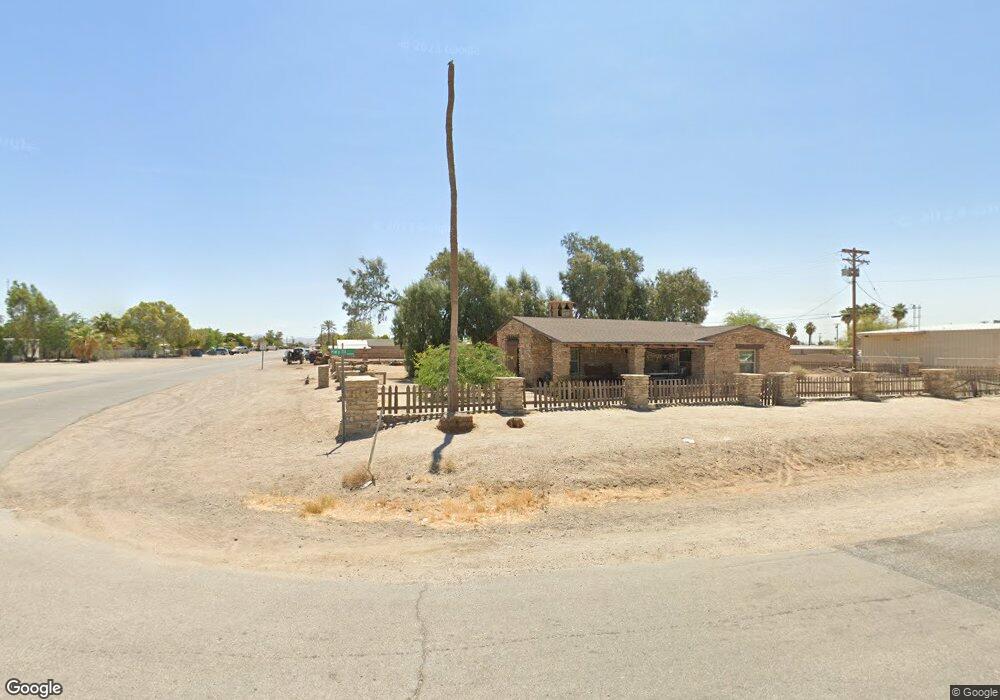
303 W Winslow Ave Niland, CA 92257
Estimated Value: $624,959 - $780,000
--
Bed
2
Baths
1,444
Sq Ft
$486/Sq Ft
Est. Value
About This Home
This home is located at 303 W Winslow Ave, Niland, CA 92257 and is currently estimated at $702,480, approximately $486 per square foot. 303 W Winslow Ave is a home located in Imperial County with nearby schools including Grace Smith Elementary School, Fremont Primary School, and Bill E. Young Jr. Middle School.
Ownership History
Date
Name
Owned For
Owner Type
Purchase Details
Closed on
Jul 28, 2014
Sold by
Orni 21 Llc
Bought by
Said Sepehr and Said Ella
Current Estimated Value
Purchase Details
Closed on
Jun 18, 2005
Sold by
Dzung Dan Thai
Bought by
Said Sepehr and Said Ella Z
Purchase Details
Closed on
Mar 24, 2004
Sold by
Nguyen Collette E
Bought by
Dzung Dang Thai
Purchase Details
Closed on
Mar 6, 2002
Sold by
Harmon James H
Bought by
Nguyen Collette E
Create a Home Valuation Report for This Property
The Home Valuation Report is an in-depth analysis detailing your home's value as well as a comparison with similar homes in the area
Home Values in the Area
Average Home Value in this Area
Purchase History
| Date | Buyer | Sale Price | Title Company |
|---|---|---|---|
| Said Sepehr | -- | Stewart Title Company | |
| Said Sepehr | $359,000 | First American Title | |
| Dzung Dang Thai | -- | Southland Title | |
| Nguyen Collette E | $140,000 | First American Title Ins Co |
Source: Public Records
Tax History Compared to Growth
Tax History
| Year | Tax Paid | Tax Assessment Tax Assessment Total Assessment is a certain percentage of the fair market value that is determined by local assessors to be the total taxable value of land and additions on the property. | Land | Improvement |
|---|---|---|---|---|
| 2025 | $4,634 | $349,400 | $330,400 | $19,000 |
| 2023 | $4,634 | $349,400 | $330,400 | $19,000 |
| 2022 | $4,447 | $349,400 | $330,400 | $19,000 |
| 2021 | $4,550 | $349,400 | $330,400 | $19,000 |
| 2020 | $5,754 | $448,584 | $384,550 | $64,034 |
| 2019 | $5,652 | $439,789 | $377,010 | $62,779 |
| 2018 | $5,578 | $431,167 | $369,618 | $61,549 |
| 2017 | $5,259 | $422,714 | $362,371 | $60,343 |
| 2016 | $5,359 | $414,426 | $355,266 | $59,160 |
| 2015 | -- | $408,202 | $349,930 | $58,272 |
| 2014 | -- | $400,207 | $343,076 | $57,131 |
Source: Public Records
Map
Nearby Homes
- 0 Highway 111 Unit 24362365IC
- 0 H-111
- 33 W 4th St
- 8965 Wilkins Rd
- 102 5th St
- 251 Main St
- 102 E 4th St
- 51 W 4th St
- 150 Niland Ave
- 603 6th St
- 0 Noffsinger Rd Unit 25543891PS
- 0 Noffsinger Rd Unit 219127188DA
- 0 E 5th St Unit 25540751IC
- 254 Noffsinger Rd
- 0 021370019000 Unit 25000994
- 0 Beal Rd Unit 24455733IC
- 0 Beal Rd Unit 23282709IC
- 0 Beal Rd Unit 23282697IC
- 0 Beal Rd
- 0 Highline Canal Unit CV25027707