Estimated Value: $459,000 - $671,000
About This Home
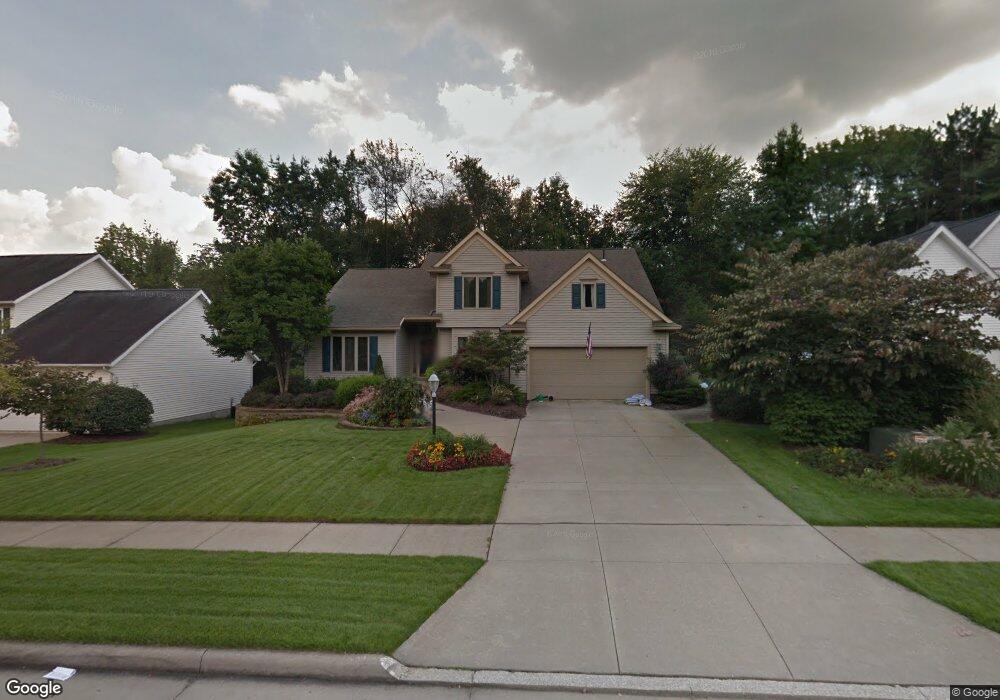
This home is located at 3032 Highpoint Trail, Stow, OH 44224 and is currently estimated at $521,774, approximately $233 per square foot. 3032 Highpoint Trail is a home located in Summit County with nearby schools including Stow-Munroe Falls High School, Holy Family Elementary School, and St Patrick Elementary School.
Ownership History
We collect this data history from publicly available records. To have your information removed, we recommend requesting removal directly through your county’s website.
Purchase Details
Purchase Details
Purchase Details
Home Financials for this Owner
Home Financials are based on the most recent Mortgage that was taken out on this home.Purchase Details
Home Financials for this Owner
Home Financials are based on the most recent Mortgage that was taken out on this home.Purchase Details
Home Financials for this Owner
Home Financials are based on the most recent Mortgage that was taken out on this home.Home Values in the Area
Average Home Value in this Area
Purchase History
We collect this data history from publicly available records. To have your information removed, we recommend requesting removal directly through your county’s website.
| Date | Buyer | Sale Price | Title Company |
|---|---|---|---|
| -- | Kingdom Title | ||
| -- | None Available | ||
| -- | None Available | ||
| -- | American Title Solutions | ||
| $296,832 | -- | ||
| $62,900 | -- |
Mortgage History
We collect this data history from publicly available records. To have your information removed, we recommend requesting removal directly through your county’s website.
| Date | Status | Borrower | Loan Amount |
|---|---|---|---|
| Open | $297,000 | ||
| Closed | $207,000 | ||
| Previous Owner | $199,200 |
Tax History
We collect this data history from publicly available records. To have your information removed, we recommend requesting removal directly through your county’s website.
| Year | Tax Paid | Tax Assessment Tax Assessment Total Assessment is a certain percentage of the fair market value that is determined by local assessors to be the total taxable value of land and additions on the property. | Land | Improvement |
|---|---|---|---|---|
| 2026 | $11,392 | $142,398 | $22,862 | $119,536 |
| 2024 | $7,991 | $142,398 | $22,862 | $119,536 |
| 2023 | $7,991 | $142,398 | $22,862 | $119,536 |
| 2022 | $6,540 | $101,172 | $16,216 | $84,956 |
| 2021 | $6,079 | $101,172 | $16,216 | $84,956 |
| 2020 | $5,719 | $101,180 | $16,220 | $84,960 |
| 2019 | $6,140 | $102,680 | $16,220 | $86,460 |
| 2018 | $6,039 | $102,680 | $16,220 | $86,460 |
| 2017 | $5,194 | $102,680 | $16,220 | $86,460 |
| 2016 | $5,346 | $85,700 | $16,220 | $69,480 |
| 2015 | $5,194 | $85,700 | $16,220 | $69,480 |
| 2014 | $5,199 | $85,700 | $16,220 | $69,480 |
| 2013 | $5,581 | $92,680 | $16,220 | $76,460 |
Map
- 3464 Hunters Crossing
- 3069 Snowshoe Cir
- 3591 Dayton Ave
- 1330 Chelton Dr
- 1327 Chelton Dr
- 3341 Roberta's Way
- 391 Louise Ave
- 525 Irma St
- 1265 W Main St
- 1314 Denise Dr
- 1262 Carol Dr
- 1271 Carol Dr
- 511 Suzanne Dr
- 1074 Jessie Ave
- 0 Middlebury Rd
- 1064 Munroe Falls Kent Rd
- 2932 Heatherwood Ct
- 2917 Windsor Ct Unit 106
- 3949 Lake Run Blvd
- 1566 Northeast Ave
- 3040 Highpoint Trail
- 3024 Highpoint Trail
- 3054 Highpoint Trail
- 2987 Highpoint Trail
- 3045 Ridgeline Trail
- 3055 Ridgeline Trail
- 3035 Highpoint Trail
- 3043 Highpoint Trail
- 3027 Highpoint Trail
- 3037 Ridgeline Trail
- 3051 Highpoint Trail
- 3019 Highpoint Trail
- 3029 Ridgeline Trail
- 3011 Highpoint Trail
- 3143 Deercrest Path
- 3135 Deercrest Path
- 3076 Deercrest Path
- 3046 Ridgeline Trail
- 3068 Deercrest Path
- 3021 Ridgeline Trail
Ask me questions while you tour the home.