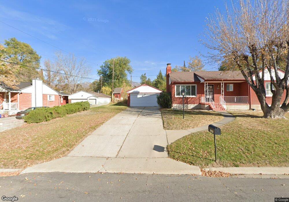
3033 S 400 W Bountiful, UT 84010
Estimated Value: $517,000 - $561,000
4
Beds
2
Baths
2,277
Sq Ft
$234/Sq Ft
Est. Value
About This Home
This home is located at 3033 S 400 W, Bountiful, UT 84010 and is currently estimated at $533,325, approximately $234 per square foot. 3033 S 400 W is a home located in Davis County with nearby schools including Boulton School, South Davis Junior High School, and Woods Cross High School.
Ownership History
Date
Name
Owned For
Owner Type
Purchase Details
Closed on
Jan 2, 2022
Sold by
Smith Davie R
Bought by
Smith Davie R and Clark-Smith Nancy
Current Estimated Value
Purchase Details
Closed on
Dec 16, 2005
Sold by
Baker Susan
Bought by
Smith Davie R and Smith Nancy C
Home Financials for this Owner
Home Financials are based on the most recent Mortgage that was taken out on this home.
Original Mortgage
$163,600
Interest Rate
6.31%
Mortgage Type
New Conventional
Purchase Details
Closed on
Jun 15, 2005
Sold by
Garrett Darryl T and Garrett Edith R
Bought by
Baker Susan
Home Financials for this Owner
Home Financials are based on the most recent Mortgage that was taken out on this home.
Original Mortgage
$182,700
Interest Rate
5.72%
Mortgage Type
Fannie Mae Freddie Mac
Create a Home Valuation Report for This Property
The Home Valuation Report is an in-depth analysis detailing your home's value as well as a comparison with similar homes in the area
Purchase History
| Date | Buyer | Sale Price | Title Company |
|---|---|---|---|
| Smith Davie R | -- | None Listed On Document | |
| Smith Davie R | -- | Hillcreek Land Title Ins | |
| Baker Susan | -- | Aspen Title Insurance Agency |
Source: Public Records
Mortgage History
| Date | Status | Borrower | Loan Amount |
|---|---|---|---|
| Previous Owner | Smith Davie R | $163,600 | |
| Previous Owner | Baker Susan | $182,700 |
Source: Public Records
Tax History
| Year | Tax Paid | Tax Assessment Tax Assessment Total Assessment is a certain percentage of the fair market value that is determined by local assessors to be the total taxable value of land and additions on the property. | Land | Improvement |
|---|---|---|---|---|
| 2025 | $2,942 | $266,750 | $149,313 | $117,437 |
| 2024 | $2,843 | $262,350 | $138,889 | $123,461 |
| 2023 | $2,763 | $460,000 | $250,406 | $209,594 |
| 2022 | $2,824 | $250,250 | $135,379 | $114,871 |
| 2021 | $2,378 | $339,000 | $177,389 | $161,611 |
| 2020 | $2,109 | $301,000 | $149,581 | $151,419 |
| 2019 | $2,096 | $296,000 | $145,334 | $150,666 |
| 2018 | $1,957 | $272,000 | $142,185 | $129,815 |
| 2016 | $1,682 | $134,475 | $51,425 | $83,050 |
| 2015 | $1,618 | $122,320 | $51,425 | $70,895 |
| 2014 | $1,408 | $108,877 | $51,425 | $57,452 |
| 2013 | -- | $111,133 | $42,766 | $68,367 |
Source: Public Records
Map
Nearby Homes
- 337 W 2900 S
- 404 W 2700 S
- 468 W 3200 S
- 552 W 2900 S
- 554 W 2900 S
- 544 W 2900 S
- 336 W 3500 S
- 3285 S Davis Blvd
- 558 Eastpointe Cir
- 678 W 3200 S
- 304 W 2300 S
- 19 E North Canyon Rd
- 69 E North Canyon Rd
- 8 E 3500 S
- 652 W 3600 S
- 746 W 3200 S
- 294 Springridge Dr
- 3716 S Oakridge Cir
- 2183 Penman Ln
- 2095 S Main St Unit 13
Your Personal Tour Guide
Ask me questions while you tour the home.