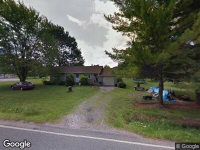
3034 Bradley Brownlee Rd Cortland, OH 44410
Cortland NeighborhoodEstimated Value: $139,000 - $237,000
2
Beds
1
Bath
1,216
Sq Ft
$148/Sq Ft
Est. Value
About This Home
This home is located at 3034 Bradley Brownlee Rd, Cortland, OH 44410 and is currently estimated at $180,322, approximately $148 per square foot. 3034 Bradley Brownlee Rd is a home located in Trumbull County with nearby schools including Currie Elementary School, Baker Elementary School, and Mathews High School.
Ownership History
Date
Name
Owned For
Owner Type
Purchase Details
Closed on
Apr 5, 2022
Sold by
Lehman Woodrow W
Current Estimated Value
Purchase Details
Closed on
Feb 25, 2000
Sold by
Heberling Jon D and Heberling Darla K
Bought by
Lehman Ross E
Purchase Details
Closed on
Nov 15, 1994
Sold by
Heberling Janet M
Bought by
Heberling Jon D
Home Financials for this Owner
Home Financials are based on the most recent Mortgage that was taken out on this home.
Original Mortgage
$52,000
Interest Rate
6.5%
Mortgage Type
New Conventional
Purchase Details
Closed on
Jan 1, 1990
Bought by
Janet M Heberling
Create a Home Valuation Report for This Property
The Home Valuation Report is an in-depth analysis detailing your home's value as well as a comparison with similar homes in the area
Home Values in the Area
Average Home Value in this Area
Purchase History
| Date | Buyer | Sale Price | Title Company |
|---|---|---|---|
| Lehman Ross E | $87,000 | -- | |
| Heberling Jon D | $65,000 | -- | |
| Janet M Heberling | -- | -- |
Source: Public Records
Mortgage History
| Date | Status | Borrower | Loan Amount |
|---|---|---|---|
| Previous Owner | Lehman Ross E | $55,000 | |
| Previous Owner | Lehman Ross E | $52,000 | |
| Previous Owner | Lehman Ross E | $20,000 | |
| Previous Owner | Lehman Ross E | $10,000 | |
| Previous Owner | Heberling Jon D | $52,000 |
Source: Public Records
Tax History Compared to Growth
Tax History
| Year | Tax Paid | Tax Assessment Tax Assessment Total Assessment is a certain percentage of the fair market value that is determined by local assessors to be the total taxable value of land and additions on the property. | Land | Improvement |
|---|---|---|---|---|
| 2023 | $1,957 | $47,390 | $4,620 | $42,770 |
| 2022 | $1,895 | $37,170 | $4,200 | $32,970 |
| 2021 | $1,899 | $37,170 | $4,200 | $32,970 |
| 2020 | $1,905 | $37,170 | $4,200 | $32,970 |
| 2019 | $1,823 | $32,560 | $3,890 | $28,670 |
| 2018 | $1,775 | $32,560 | $3,890 | $28,670 |
| 2017 | $1,769 | $32,560 | $3,890 | $28,670 |
| 2016 | $1,669 | $30,140 | $3,890 | $26,250 |
| 2015 | $1,536 | $30,140 | $3,890 | $26,250 |
| 2014 | $1,442 | $28,460 | $3,890 | $24,570 |
| 2013 | $1,531 | $30,040 | $3,890 | $26,150 |
Source: Public Records
Map
Nearby Homes
- 7 Tami Ct
- 211 Golf Dr Unit 211
- 303 Golf Dr
- 205 Tournament Trail Unit 205
- 703 Tournament Trail
- 0 St Andrews Unit 5113795
- 172 Winter Ln
- 0 Turnberry Place
- 4479 Ridge Rd
- 260 Michaels Ct
- 247 Maple Ave
- 4344 Ridge Rd
- 276 Maple Ave
- 0 Charles
- 471 Charles Ave
- 118 Woodland Trace
- 452 Rosewae Ave
- 448 S Colonial Dr
- 105 Fairview Dr
- 124 Diamond Way Unit 124
- 3034 Bradley Brownlee Rd
- 3022 Bradley Brownlee Rd
- 3063 Bradley Brownlee Rd
- 3029 Bradley Brownlee Rd
- 3064 Bradley Brownlee Rd
- 3080 Bradley Brownlee Rd
- 3006 Bradley Brownlee Rd
- 3015 Bradley Brownlee Rd
- 3094 Bradley Brownlee Rd
- 3101 Bradley Brownlee Rd
- 3032 Bradley Brownlee Rd
- 3119 Bradley Brownlee Rd
- 2993 Bradley Brownlee Rd
- 3042 Bradley Brownlee Rd
- 3048 Bradley Brownlee Rd Unit A
- 3048 Bradley Brownlee Rd
- 3116 Bradley Brownlee Rd
- 3116 Bradley Brownlee Rd
- 50 Tami Ct
- 4880 State Route 5