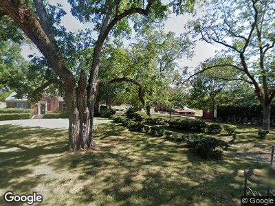
3034 Poplar Trace N Talbotton, GA 31827
Estimated Value: $495,000 - $864,185
4
Beds
2
Baths
2,564
Sq Ft
$265/Sq Ft
Est. Value
About This Home
This home is located at 3034 Poplar Trace N, Talbotton, GA 31827 and is currently estimated at $679,593, approximately $265 per square foot. 3034 Poplar Trace N is a home located in Talbot County with nearby schools including Central School.
Ownership History
Date
Name
Owned For
Owner Type
Purchase Details
Closed on
May 6, 2024
Sold by
Flint River Plantation Llc
Bought by
Redland Enterprises Llc
Current Estimated Value
Purchase Details
Closed on
May 31, 2018
Sold by
Lumsden Stanley M
Bought by
Flint River Plantation Llc
Purchase Details
Closed on
Jan 31, 2014
Sold by
Parham Ben H
Bought by
Lumsden Stanley M
Create a Home Valuation Report for This Property
The Home Valuation Report is an in-depth analysis detailing your home's value as well as a comparison with similar homes in the area
Home Values in the Area
Average Home Value in this Area
Purchase History
| Date | Buyer | Sale Price | Title Company |
|---|---|---|---|
| Redland Enterprises Llc | -- | -- | |
| Flint River Plantation Llc | -- | -- | |
| Lumsden Stanley M | $1,015,000 | -- |
Source: Public Records
Tax History Compared to Growth
Tax History
| Year | Tax Paid | Tax Assessment Tax Assessment Total Assessment is a certain percentage of the fair market value that is determined by local assessors to be the total taxable value of land and additions on the property. | Land | Improvement |
|---|---|---|---|---|
| 2024 | $3,651 | $221,185 | $170,951 | $50,234 |
| 2023 | $3,366 | $198,940 | $155,442 | $43,498 |
| 2022 | $5,952 | $193,285 | $148,018 | $45,267 |
| 2021 | $3,126 | $174,537 | $128,711 | $45,826 |
| 2020 | $2,996 | $169,021 | $128,711 | $40,310 |
| 2019 | $2,957 | $165,599 | $125,025 | $40,574 |
| 2018 | $4,987 | $165,599 | $125,025 | $40,574 |
| 2017 | $2,863 | $165,599 | $125,025 | $40,574 |
| 2016 | $5,385 | $174,373 | $125,025 | $49,348 |
| 2015 | -- | $188,912 | $139,564 | $49,348 |
| 2013 | -- | $206,034 | $158,399 | $47,635 |
Source: Public Records
Map
Nearby Homes
- 164 ACRES Carl Mathis Rd
- 98 ACRES +/- George Smith Rd
- 3046 Sunrise Rd
- 86 Carl Mathis Rd Unit 164 ACRES
- 0 Woodland Rd Unit 10482958
- 0 Woodland Rd Unit 10463835
- 1181 Kelly Rd
- 0 Green Oak Cir Unit 10506664
- 1083 Talbotton Hwy
- 0 None Unit 10431111
- 1077 W Wire Rd
- 346 Kelly Rd
- 0 Hwy 80 Unit 10484991
- 0 Hwy 80 Unit 7546340
- 800 Smoke Rise Dr
- 809 George W Towns Rd
- 434 George W Towns Rd
- 32 Green Oak Cir
- 745 Goshen Rd
- 650 Goshen Rd
