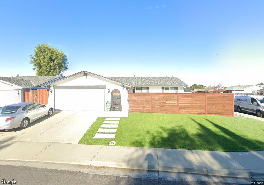
3037 Locke Ct Fremont, CA 94555
Northgate-Union City NeighborhoodEstimated Value: $1,632,455 - $1,753,000
4
Beds
2
Baths
1,402
Sq Ft
$1,204/Sq Ft
Est. Value
About This Home
This home is located at 3037 Locke Ct, Fremont, CA 94555 and is currently estimated at $1,688,114, approximately $1,204 per square foot. 3037 Locke Ct is a home located in Alameda County with nearby schools including Warwick Elementary School, Thornton Middle School, and American High School.
Ownership History
Date
Name
Owned For
Owner Type
Purchase Details
Closed on
May 9, 2013
Sold by
Manalo Jaime and Santos Jennifer M
Bought by
Lau Kam Shing and So Choi Mei
Current Estimated Value
Home Financials for this Owner
Home Financials are based on the most recent Mortgage that was taken out on this home.
Original Mortgage
$404,000
Outstanding Balance
$287,048
Interest Rate
3.54%
Mortgage Type
New Conventional
Estimated Equity
$1,401,066
Purchase Details
Closed on
Apr 13, 2006
Sold by
Haas Michele K
Bought by
Manalo Jaime
Home Financials for this Owner
Home Financials are based on the most recent Mortgage that was taken out on this home.
Original Mortgage
$421,000
Interest Rate
6.35%
Mortgage Type
New Conventional
Purchase Details
Closed on
Jun 16, 2005
Sold by
Manalo Timothy P and Manalo Zenaida G
Bought by
Manalo Maria Gemma G and Santos Jennifer M
Purchase Details
Closed on
Sep 10, 2002
Sold by
Cendant Mobility Financial Corp
Bought by
Manalo Timothy P and Manalo Zenadia G
Home Financials for this Owner
Home Financials are based on the most recent Mortgage that was taken out on this home.
Original Mortgage
$360,000
Interest Rate
6.24%
Purchase Details
Closed on
Jul 17, 2002
Sold by
Decastro Hernando T and Decastro Miguela T
Bought by
Cendant Mobility Financial Corp
Home Financials for this Owner
Home Financials are based on the most recent Mortgage that was taken out on this home.
Original Mortgage
$360,000
Interest Rate
6.24%
Purchase Details
Closed on
Nov 20, 1998
Sold by
Jacques Gary W and Jacques Barbara J
Bought by
Decastro Hernando T and Decastro Miguela T
Home Financials for this Owner
Home Financials are based on the most recent Mortgage that was taken out on this home.
Original Mortgage
$206,250
Interest Rate
6.84%
Mortgage Type
Balloon
Create a Home Valuation Report for This Property
The Home Valuation Report is an in-depth analysis detailing your home's value as well as a comparison with similar homes in the area
Home Values in the Area
Average Home Value in this Area
Purchase History
| Date | Buyer | Sale Price | Title Company |
|---|---|---|---|
| Lau Kam Shing | $617,000 | First American Title | |
| Manalo Jaime | -- | Alliance Title Company | |
| Santos Jennifer M | -- | Alliance Title Company | |
| Manalo Jaime | -- | Alliance Title Company | |
| Manalo Maria Gemma G | -- | -- | |
| Manalo Timothy P | $450,000 | First American Title | |
| Cendant Mobility Financial Corp | -- | First American Title | |
| Decastro Hernando T | $275,000 | Fidelity National Title |
Source: Public Records
Mortgage History
| Date | Status | Borrower | Loan Amount |
|---|---|---|---|
| Open | Lau Kam Shing | $404,000 | |
| Previous Owner | Manalo Jaime | $421,000 | |
| Previous Owner | Manalo Timothy P | $360,000 | |
| Previous Owner | Decastro Hernando T | $206,250 |
Source: Public Records
Tax History Compared to Growth
Tax History
| Year | Tax Paid | Tax Assessment Tax Assessment Total Assessment is a certain percentage of the fair market value that is determined by local assessors to be the total taxable value of land and additions on the property. | Land | Improvement |
|---|---|---|---|---|
| 2025 | $9,259 | $759,761 | $227,805 | $531,956 |
| 2024 | $9,259 | $744,866 | $223,339 | $521,527 |
| 2023 | $9,009 | $730,262 | $218,960 | $511,302 |
| 2022 | $8,891 | $715,947 | $214,668 | $501,279 |
| 2021 | $8,674 | $701,910 | $210,459 | $491,451 |
| 2020 | $8,689 | $694,716 | $208,302 | $486,414 |
| 2019 | $8,591 | $681,099 | $204,219 | $476,880 |
| 2018 | $8,424 | $667,748 | $200,216 | $467,532 |
| 2017 | $8,214 | $654,654 | $196,290 | $458,364 |
| 2016 | $8,074 | $641,821 | $192,442 | $449,379 |
| 2015 | $7,966 | $632,183 | $189,552 | $442,631 |
| 2014 | $7,829 | $619,800 | $185,839 | $433,961 |
Source: Public Records
Map
Nearby Homes
- 34926 Moina Shaiq Common
- 2404 Maraschino Place
- 34179 Bowling Green Common
- 2221 Partridge Way Unit 3
- 35383 Purcell Place
- 2139 Canary Ct Unit 2
- 4015 Clydesdale Common
- 34539 Nantucket Common
- 2224 Peacock Place Unit 3
- 34917 Sea Cliff Terrace
- 34552 Nantucket Common
- 34512 Nantucket Common
- 2835 Beard Terrace
- 3840 Springfield Common
- 2108 Dalton Way
- 3851 Milton Terrace
- 34579 Bluestone Common
- 35282 Cano Ct
- 3355 Winter Wren Place
- 1793 H St