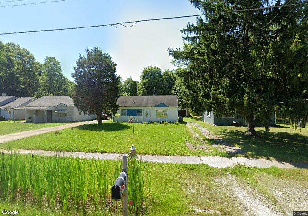
3037 McGuffey Rd Youngstown, OH 44505
McGuffey Heights NeighborhoodEstimated Value: $35,000 - $58,000
2
Beds
1
Bath
816
Sq Ft
$54/Sq Ft
Est. Value
About This Home
This home is located at 3037 McGuffey Rd, Youngstown, OH 44505 and is currently estimated at $44,063, approximately $53 per square foot. 3037 McGuffey Rd is a home located in Mahoning County with nearby schools including M.L. King Elementary School, Williamson Elementary School, and East High School.
Ownership History
Date
Name
Owned For
Owner Type
Purchase Details
Closed on
Apr 21, 2023
Bought by
Hernandez Victor Manuel
Current Estimated Value
Purchase Details
Closed on
May 13, 2021
Sold by
Bell David Ryan
Bought by
Lopez Dylan
Purchase Details
Closed on
Jan 28, 2020
Sold by
Franklin Kenneth D
Bought by
Bell David Ryan
Purchase Details
Closed on
Feb 21, 2014
Sold by
Backus Forrest W
Bought by
Franklin Kenneth D
Purchase Details
Closed on
Mar 9, 2009
Sold by
Johnson Cleo C and Ross Lawrence
Bought by
Backus Forrest
Purchase Details
Closed on
Sep 24, 1975
Bought by
Rogers Eugene and Rogers Helen
Create a Home Valuation Report for This Property
The Home Valuation Report is an in-depth analysis detailing your home's value as well as a comparison with similar homes in the area
Home Values in the Area
Average Home Value in this Area
Purchase History
| Date | Buyer | Sale Price | Title Company |
|---|---|---|---|
| Hernandez Victor Manuel | $15,000 | -- | |
| Hernandez Victor Manuel | $15,000 | None Listed On Document | |
| Lopez Dylan | $4,000 | None Available | |
| Bell David Ryan | $1,000 | None Available | |
| Franklin Kenneth D | $1,000 | None Available | |
| Backus Forrest | $5,000 | None Available | |
| Rogers Eugene | -- | -- |
Source: Public Records
Tax History
| Year | Tax Paid | Tax Assessment Tax Assessment Total Assessment is a certain percentage of the fair market value that is determined by local assessors to be the total taxable value of land and additions on the property. | Land | Improvement |
|---|---|---|---|---|
| 2025 | $142 | $3,330 | $550 | $2,780 |
| 2024 | $161 | $3,330 | $550 | $2,780 |
| 2023 | $160 | $3,330 | $550 | $2,780 |
| 2022 | $148 | $2,370 | $990 | $1,380 |
| 2021 | $152 | $2,370 | $990 | $1,380 |
| 2020 | $153 | $2,370 | $990 | $1,380 |
| 2019 | $160 | $2,190 | $920 | $1,270 |
| 2018 | $187 | $2,190 | $920 | $1,270 |
| 2017 | $161 | $2,190 | $920 | $1,270 |
| 2016 | $164 | $2,440 | $920 | $1,520 |
| 2015 | $169 | $2,440 | $920 | $1,520 |
| 2014 | $163 | $2,440 | $920 | $1,520 |
| 2013 | $153 | $2,440 | $920 | $1,520 |
Source: Public Records
Map
Nearby Homes
- 1214 Brighton St
- 2849 McGuffey Rd
- 1251 Jacobs Rd
- 1720 Jacobs Rd
- 1003 Liberty Rd
- 603 Liberty Rd
- 2051 Blair Ave
- 2526 Stocker Ave
- 206 Beachwood Dr
- 2915 Megan Cir
- V/L Jacobs Rd
- 819 Lyden Ave
- 3786 Choice Ct
- 3240 Oak Street Extension
- 32 Maranatha Dr
- 36 Maranatha Dr
- 24 Maranatha Dr
- 146 Greeley Ln
- 111 Bassett Ln
- 1538 Republic Ave
- 3041 McGuffey Rd
- 3033 McGuffey Rd
- 3045 McGuffey Rd
- 3049 McGuffey Rd
- 3053 McGuffey Rd
- 3040 McGuffey Rd
- 3046 McGuffey Rd
- 3057 McGuffey Rd
- 3061 McGuffey Rd
- 3019 Shannon Ave
- 3015 Shannon Ave
- 3009 Shannon Ave
- 3067 McGuffey Rd
- 3005 Shannon Ave
- 1207 Jacobs Rd
- 3069 McGuffey Rd
- 3016 Shannon Ave
- 2981 McGuffey Rd
- 3012 Shannon Ave
- 3103 McGuffey Rd
Your Personal Tour Guide
Ask me questions while you tour the home.