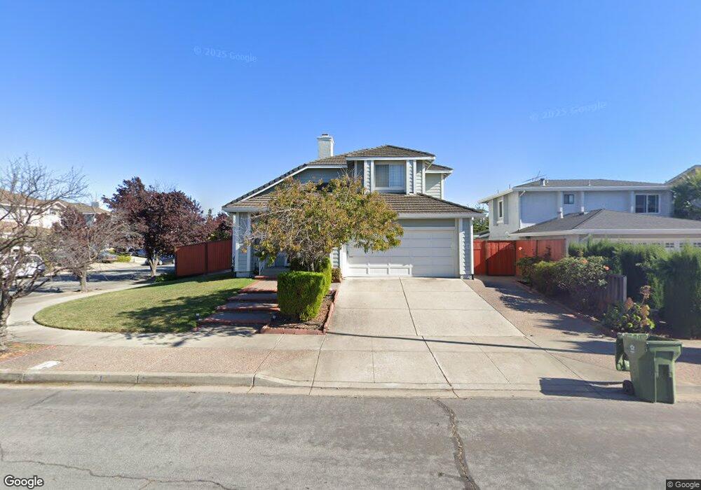
3038 Summit Dr Fremont, CA 94555
Northgate-Union City NeighborhoodEstimated Value: $1,734,000 - $2,442,000
4
Beds
3
Baths
2,678
Sq Ft
$832/Sq Ft
Est. Value
About This Home
This home is located at 3038 Summit Dr, Fremont, CA 94555 and is currently estimated at $2,228,980, approximately $832 per square foot. 3038 Summit Dr is a home located in Alameda County with nearby schools including Warwick Elementary School, Thornton Middle School, and American High School.
Ownership History
Date
Name
Owned For
Owner Type
Purchase Details
Closed on
Jan 9, 2003
Sold by
Cheung Wing and Cheung Kit Mei
Bought by
Dennis Roland C and Chan Flora
Current Estimated Value
Home Financials for this Owner
Home Financials are based on the most recent Mortgage that was taken out on this home.
Original Mortgage
$488,000
Outstanding Balance
$192,661
Interest Rate
5%
Estimated Equity
$2,036,319
Purchase Details
Closed on
Dec 23, 1998
Sold by
Cheung Wing and Cheung Kit Mei
Bought by
Cheung Wing and Cheung Kit Mei
Purchase Details
Closed on
Jun 10, 1997
Sold by
Hsu Angela P
Bought by
Hsu Yung
Home Financials for this Owner
Home Financials are based on the most recent Mortgage that was taken out on this home.
Original Mortgage
$213,800
Interest Rate
7.92%
Mortgage Type
Balloon
Purchase Details
Closed on
Jun 6, 1997
Sold by
Hsu Yung
Bought by
Cheung Wing and Cheung Kit Mei
Home Financials for this Owner
Home Financials are based on the most recent Mortgage that was taken out on this home.
Original Mortgage
$213,800
Interest Rate
7.92%
Mortgage Type
Balloon
Create a Home Valuation Report for This Property
The Home Valuation Report is an in-depth analysis detailing your home's value as well as a comparison with similar homes in the area
Home Values in the Area
Average Home Value in this Area
Purchase History
| Date | Buyer | Sale Price | Title Company |
|---|---|---|---|
| Dennis Roland C | $688,000 | Commonwealth Land Title Co | |
| Cheung Wing | -- | -- | |
| Hsu Yung | -- | Golden California Title Co | |
| Cheung Wing | $395,000 | Golden California Title Co |
Source: Public Records
Mortgage History
| Date | Status | Borrower | Loan Amount |
|---|---|---|---|
| Open | Dennis Roland C | $488,000 | |
| Previous Owner | Cheung Wing | $213,800 |
Source: Public Records
Tax History
| Year | Tax Paid | Tax Assessment Tax Assessment Total Assessment is a certain percentage of the fair market value that is determined by local assessors to be the total taxable value of land and additions on the property. | Land | Improvement |
|---|---|---|---|---|
| 2025 | $11,734 | $989,361 | $298,908 | $697,453 |
| 2024 | $11,734 | $969,828 | $293,048 | $683,780 |
| 2023 | $11,421 | $957,681 | $287,304 | $670,377 |
| 2022 | $11,277 | $931,906 | $281,672 | $657,234 |
| 2021 | $11,070 | $913,501 | $276,150 | $644,351 |
| 2020 | $11,119 | $911,070 | $273,321 | $637,749 |
| 2019 | $10,991 | $893,208 | $267,962 | $625,246 |
| 2018 | $10,776 | $875,700 | $262,710 | $612,990 |
| 2017 | $10,506 | $858,534 | $257,560 | $600,974 |
| 2016 | $10,330 | $841,705 | $252,511 | $589,194 |
| 2015 | $10,195 | $829,067 | $248,720 | $580,347 |
| 2014 | $10,022 | $812,830 | $243,849 | $568,981 |
Source: Public Records
Map
Nearby Homes
- 30 Palm Dr Unit 30
- 3091 Seymour Place
- 2623 Copa Del Oro Dr
- 2814 Chamier Place
- 3327 Trafalgar Rd
- 33499 Quail Run Rd
- 269 Oahu Cir
- 259 Molokai Cir Unit 259
- 2523 Copa Del Oro Dr
- 301 Maui Cir
- 179 Kona Cir
- 3754 Bobwhite Terrace
- 33479 Alvarado Niles Rd
- 33934 Sagrantino Terrace
- 2612 Nevada St
- 3863 Milton Terrace
- 418 Fiji Cir Unit 418
- 3868 Fiano Common
- 34373 Auckland Ct
- 33010 Lake Mead Dr
- 3048 Summit Dr
- 3058 Summit Dr
- 2926 Mountain Dr
- 3051 Alpine Ct
- 3068 Summit Dr
- 3061 Alpine Ct
- 2947 Mountain Dr
- 2937 Mountain Dr
- 2976 Mountain Dr
- 2957 Mountain Dr
- 3049 Summit Dr
- 3078 Summit Dr
- 2927 Mountain Dr
- 3071 Alpine Ct
- 3059 Summit Dr
- 2967 Mountain Dr
- 3069 Summit Dr
- 2917 Mountain Dr
- 3088 Summit Dr
- 3081 Alpine Ct
Your Personal Tour Guide
Ask me questions while you tour the home.