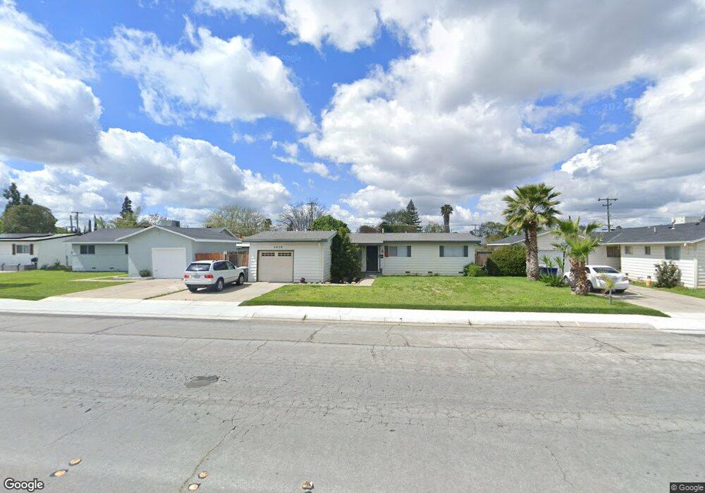
3039 N Parsons Ave Merced, CA 95340
North Merced NeighborhoodEstimated Value: $258,000 - $295,161
3
Beds
2
Baths
1,008
Sq Ft
$281/Sq Ft
Est. Value
About This Home
This home is located at 3039 N Parsons Ave, Merced, CA 95340 and is currently estimated at $283,540, approximately $281 per square foot. 3039 N Parsons Ave is a home located in Merced County with nearby schools including Donn B. Chenoweth Elementary School, Herbert Hoover Middle School, and Merced High School.
Ownership History
Date
Name
Owned For
Owner Type
Purchase Details
Closed on
Feb 7, 2007
Sold by
Bean Boscolo Betitia J
Bought by
Bean Betitia J
Current Estimated Value
Home Financials for this Owner
Home Financials are based on the most recent Mortgage that was taken out on this home.
Original Mortgage
$178,000
Interest Rate
6.19%
Mortgage Type
Purchase Money Mortgage
Create a Home Valuation Report for This Property
The Home Valuation Report is an in-depth analysis detailing your home's value as well as a comparison with similar homes in the area
Home Values in the Area
Average Home Value in this Area
Purchase History
| Date | Buyer | Sale Price | Title Company |
|---|---|---|---|
| Bean Betitia J | -- | Alliance Title Company | |
| Bean Boscolo Betitia J | -- | Alliance Title Company | |
| Bean Boscolo Betitia J | -- | Alliance Title Company |
Source: Public Records
Mortgage History
| Date | Status | Borrower | Loan Amount |
|---|---|---|---|
| Closed | Bean Boscolo Betitia J | $178,000 |
Source: Public Records
Tax History
| Year | Tax Paid | Tax Assessment Tax Assessment Total Assessment is a certain percentage of the fair market value that is determined by local assessors to be the total taxable value of land and additions on the property. | Land | Improvement |
|---|---|---|---|---|
| 2025 | $957 | $88,780 | $22,182 | $66,598 |
| 2024 | $957 | $87,041 | $21,748 | $65,293 |
| 2023 | $944 | $85,335 | $21,322 | $64,013 |
| 2022 | $930 | $83,662 | $20,904 | $62,758 |
| 2021 | $928 | $82,023 | $20,495 | $61,528 |
| 2020 | $934 | $81,183 | $20,285 | $60,898 |
| 2019 | $920 | $79,592 | $19,888 | $59,704 |
| 2018 | $839 | $78,033 | $19,499 | $58,534 |
| 2017 | $871 | $76,504 | $19,117 | $57,387 |
| 2016 | $857 | $75,005 | $18,743 | $56,262 |
| 2015 | $844 | $73,879 | $18,462 | $55,417 |
| 2014 | $826 | $72,433 | $18,101 | $54,332 |
Source: Public Records
Map
Nearby Homes
- 1611 E Olive Ave
- 2993 N Parsons Ave
- 1521 E Alexander Ave
- 3018 Marie Ct
- 3056 Bedford Dr
- 1975 E Alexander Ave
- 3205 N Parsons Ave
- 1964 Sierra Ct
- 1965 Kimberly Ave
- 1247 Aspen St
- 2109 La Paz Ct
- 1056 E Alexander Ave
- 1445 Brookdale Dr
- 3045 Silver Elm Ct
- 2870 El Camino Real
- 2971 Chestnut Ave
- 1789 E North Bear Creek Dr
- 3317 Shamrock Ave
- 2348 Katy Ln
- 891 Hansen Ave
- 3045 N Parsons Ave
- 1622 Buckingham Ct
- 3053 N Parsons Ave
- 3025 N Parsons Ave
- 1619 Buckingham Ct
- 1700 Elayne Dr
- 3059 N Parsons Ave Unit 1
- 3059 N Parsons Ave
- 3019 N Parsons Ave
- 1618 Tamworth Ct
- 1618 Buckingham Ct
- 1701 Elayne Dr
- 1595 Buckingham Ct
- 1712 Elayne Dr
- 3065 N Parsons Ave
- 1594 Tamworth Ct
- 1702 Joseph Ct
- 1721 Elayne Dr
- 1594 Buckingham Ct
- 1622 Tamworth Ct
Your Personal Tour Guide
Ask me questions while you tour the home.