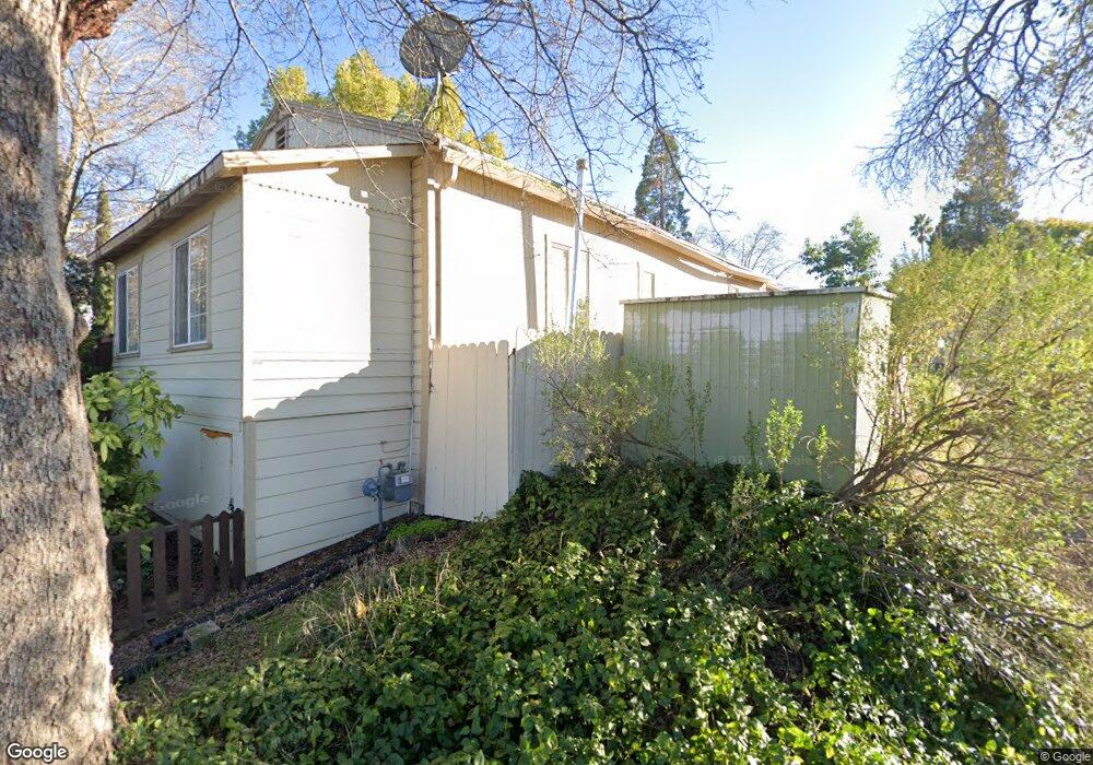
304 2nd St Newcastle, CA 95658
Estimated Value: $338,000 - $411,000
2
Beds
1
Bath
958
Sq Ft
$398/Sq Ft
Est. Value
About This Home
This home is located at 304 2nd St, Newcastle, CA 95658 and is currently estimated at $381,400, approximately $398 per square foot. 304 2nd St is a home located in Placer County with nearby schools including Del Oro High School, Harvest Ridge Charter School, and Newcastle Elementary Charter School.
Ownership History
Date
Name
Owned For
Owner Type
Purchase Details
Closed on
May 24, 2016
Sold by
Mcdaniel Michael
Bought by
Michael W C Mcdaniel Revocable Living Tr
Current Estimated Value
Purchase Details
Closed on
Mar 19, 2015
Sold by
Mcdaniel Michael
Bought by
The Michael W Mcdaniel Revocable Trust
Purchase Details
Closed on
Aug 25, 2004
Sold by
Chapman Richard F
Bought by
Mcdaniel Michael
Create a Home Valuation Report for This Property
The Home Valuation Report is an in-depth analysis detailing your home's value as well as a comparison with similar homes in the area
Home Values in the Area
Average Home Value in this Area
Purchase History
| Date | Buyer | Sale Price | Title Company |
|---|---|---|---|
| Michael W C Mcdaniel Revocable Living Tr | -- | None Available | |
| The Michael W Mcdaniel Revocable Trust | -- | None Available | |
| Mcdaniel Michael | $185,000 | Sierra Valley Title |
Source: Public Records
Tax History Compared to Growth
Tax History
| Year | Tax Paid | Tax Assessment Tax Assessment Total Assessment is a certain percentage of the fair market value that is determined by local assessors to be the total taxable value of land and additions on the property. | Land | Improvement |
|---|---|---|---|---|
| 2025 | $2,913 | $257,853 | $111,502 | $146,351 |
| 2023 | $2,913 | $247,842 | $107,173 | $140,669 |
| 2022 | $2,827 | $242,983 | $105,072 | $137,911 |
| 2021 | $2,749 | $238,219 | $103,012 | $135,207 |
| 2020 | $2,710 | $235,777 | $101,956 | $133,821 |
| 2019 | $2,657 | $231,155 | $99,957 | $131,198 |
| 2018 | $2,518 | $226,624 | $97,998 | $128,626 |
| 2017 | $2,469 | $222,181 | $96,077 | $126,104 |
| 2016 | $2,413 | $217,826 | $94,194 | $123,632 |
| 2015 | $2,355 | $214,555 | $92,780 | $121,775 |
| 2014 | $1,420 | $122,000 | $52,800 | $69,200 |
Source: Public Records
Map
Nearby Homes
- 9623 Tunnel St
- 9190 Old State Hwy
- 6010 Nob Hill Dr
- 6074 Coleman Dr
- 8535 Irish Ln
- 6374 Brodie Dr
- 1941 Hillcrest Dr
- 6401 Brodie Dr
- 0 Lot 1 Fruitvale Rd Unit 225151446
- 9065 Gilardi Rd
- 635 Lakeridge Dr
- 9995 Powerhouse Rd
- 10650 Werner Rd
- 980 MacHty Ct
- 1605 Auburn Folsom Rd
- 1700 Ridgeview Cir
- 8040 Gilardi Rd
- 7407 Allen Ln
- 10315 Comstock Ln
- 7301 Ridgeview Ln