Estimated Value: $294,399 - $333,000
3
Beds
2
Baths
1,092
Sq Ft
$290/Sq Ft
Est. Value
About This Home
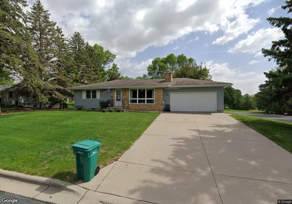
This home is located at 304 4th St NE, Mayer, MN 55360 and is currently estimated at $316,350, approximately $289 per square foot. 304 4th St NE is a home located in Carver County with nearby schools including Watertown-Mayer Elementary School, Watertown-Mayer Middle School, and Watertown Mayer High School.
Ownership History
Date
Name
Owned For
Owner Type
Purchase Details
Closed on
May 27, 2025
Sold by
Jueckstock Robert E and Jueckstock Lynda J
Bought by
Trust Agreement Of Robert And Lynda Jueckstoc and Jueckstock
Current Estimated Value
Purchase Details
Closed on
Sep 13, 2018
Sold by
Jueckstock Robert E and Jueckstock Lynda J
Bought by
Jueckstock Robert E and Jueckstock Lynda J
Home Financials for this Owner
Home Financials are based on the most recent Mortgage that was taken out on this home.
Original Mortgage
$80,000
Interest Rate
4.5%
Mortgage Type
New Conventional
Purchase Details
Closed on
Jan 9, 2018
Sold by
Hindmand Claudine
Bought by
Jueckstock Lynda J
Create a Home Valuation Report for This Property
The Home Valuation Report is an in-depth analysis detailing your home's value as well as a comparison with similar homes in the area
Home Values in the Area
Average Home Value in this Area
Purchase History
| Date | Buyer | Sale Price | Title Company |
|---|---|---|---|
| Trust Agreement Of Robert And Lynda Jueckstoc | $500 | None Listed On Document | |
| Jueckstock Robert E | -- | Title Mark Llc | |
| Jueckstock Lynda J | -- | None Available |
Source: Public Records
Mortgage History
| Date | Status | Borrower | Loan Amount |
|---|---|---|---|
| Previous Owner | Jueckstock Robert E | $80,000 |
Source: Public Records
Tax History Compared to Growth
Tax History
| Year | Tax Paid | Tax Assessment Tax Assessment Total Assessment is a certain percentage of the fair market value that is determined by local assessors to be the total taxable value of land and additions on the property. | Land | Improvement |
|---|---|---|---|---|
| 2025 | $35 | $264,800 | $60,000 | $204,800 |
| 2024 | $33 | $245,700 | $55,000 | $190,700 |
| 2023 | $968 | $237,600 | $55,000 | $182,600 |
| 2022 | $968 | $230,200 | $46,000 | $184,200 |
| 2021 | $666 | $195,300 | $37,900 | $157,400 |
| 2020 | $702 | $197,000 | $37,900 | $159,100 |
| 2019 | $2,404 | $187,700 | $36,100 | $151,600 |
| 2018 | $2,150 | $187,700 | $36,100 | $151,600 |
| 2017 | $1,772 | $163,400 | $32,400 | $131,000 |
| 2016 | $1,770 | $107,400 | $0 | $0 |
| 2015 | $1,488 | $106,000 | $0 | $0 |
| 2014 | $1,488 | $81,500 | $0 | $0 |
Source: Public Records
Map
Nearby Homes
- 337 2nd St NW
- 190 Morning Dr
- 344 2nd St NW
- 2208 Coldwater Crossing
- 2083 River Bend Trail
- 2091 River Bend Trail
- 2095 River Bend Trail
- 2102 River Bend Trail
- 2103 River Bend Trail
- 2107 River Bend Trail
- 5190 Prairie Point
- 2119 River Bend Trail
- XXX 62nd St
- The Calhoun Plan at Coldwater Crossing
- The Rockwell Plan at Coldwater Crossing
- The Hemlock Plan at Coldwater Crossing
- The Mulberry Plan at Coldwater Crossing
- The Wentworth Plan at Coldwater Crossing
- The Meadow Plan at Coldwater Crossing
- The Hickory Plan at Coldwater Crossing