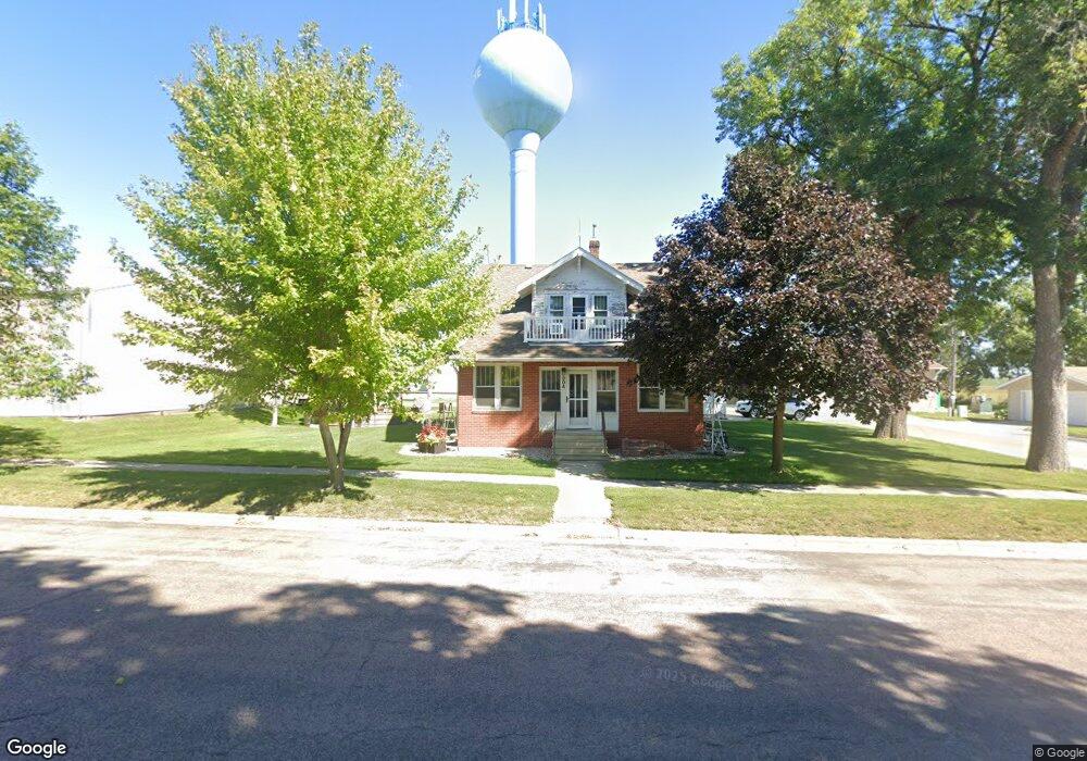
304 Broad St Whittemore, IA 50598
Estimated Value: $87,000 - $134,627
--
Bed
1
Bath
1,678
Sq Ft
$72/Sq Ft
Est. Value
About This Home
This home is located at 304 Broad St, Whittemore, IA 50598 and is currently estimated at $120,157, approximately $71 per square foot. 304 Broad St is a home located in Kossuth County with nearby schools including Bertha Godfrey Elementary School, Bryant Elementary School, and Lucia Wallace Elementary School.
Ownership History
Date
Name
Owned For
Owner Type
Purchase Details
Closed on
Dec 30, 2024
Sold by
Knecht Jerome F and Knecht Nancy E
Bought by
Jerome And Nancy Knecht Revocable Living Trus and Knecht
Current Estimated Value
Purchase Details
Closed on
Jan 4, 2013
Sold by
Dixon Nancy E and Knecht Jerome F
Bought by
Knecht Nancy E Dixon and Knecht Jerome F
Create a Home Valuation Report for This Property
The Home Valuation Report is an in-depth analysis detailing your home's value as well as a comparison with similar homes in the area
Home Values in the Area
Average Home Value in this Area
Purchase History
| Date | Buyer | Sale Price | Title Company |
|---|---|---|---|
| Jerome And Nancy Knecht Revocable Living Trus | -- | None Listed On Document | |
| Jerome And Nancy Knecht Revocable Living Trus | -- | None Listed On Document | |
| Knecht Nancy E Dixon | -- | None Available |
Source: Public Records
Tax History Compared to Growth
Tax History
| Year | Tax Paid | Tax Assessment Tax Assessment Total Assessment is a certain percentage of the fair market value that is determined by local assessors to be the total taxable value of land and additions on the property. | Land | Improvement |
|---|---|---|---|---|
| 2025 | $1,628 | $124,402 | $8,040 | $116,362 |
| 2024 | $1,628 | $107,134 | $8,040 | $99,094 |
| 2023 | $5 | $107,134 | $8,040 | $99,094 |
| 2022 | $1,416 | $100,448 | $8,040 | $92,408 |
| 2021 | $972 | $86,628 | $8,040 | $78,588 |
| 2020 | $952 | $61,774 | $9,309 | $52,465 |
| 2019 | $926 | $58,204 | $0 | $0 |
| 2018 | $888 | $58,204 | $0 | $0 |
| 2017 | $888 | $49,681 | $0 | $0 |
| 2016 | $1,136 | $71,625 | $0 | $0 |
| 2015 | $1,136 | $63,691 | $0 | $0 |
| 2014 | $592 | $41,747 | $0 | $0 |
Source: Public Records
Map
Nearby Homes