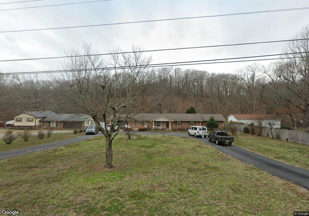
304 Brookside Dr Unit 1 Killen, AL 35645
Estimated Value: $321,000 - $400,373
5
Beds
4
Baths
3,836
Sq Ft
$95/Sq Ft
Est. Value
About This Home
This home is located at 304 Brookside Dr Unit 1, Killen, AL 35645 and is currently estimated at $364,093, approximately $94 per square foot. 304 Brookside Dr Unit 1 is a home located in Lauderdale County with nearby schools including Brooks Elementary School and Underwood Elementary School.
Ownership History
Date
Name
Owned For
Owner Type
Purchase Details
Closed on
May 4, 2025
Sold by
Devey Keith and Devey Shannon
Bought by
Bell Gerald F
Current Estimated Value
Home Financials for this Owner
Home Financials are based on the most recent Mortgage that was taken out on this home.
Original Mortgage
$330,687
Outstanding Balance
$324,047
Interest Rate
0.68%
Mortgage Type
FHA
Estimated Equity
$40,046
Purchase Details
Closed on
Mar 30, 2020
Sold by
James Robert L and James June
Bought by
Devey Keith
Purchase Details
Closed on
Nov 21, 2019
Sold by
Mccaig Ronnie S and Mccaig Judy S
Bought by
James June and James Robert L
Create a Home Valuation Report for This Property
The Home Valuation Report is an in-depth analysis detailing your home's value as well as a comparison with similar homes in the area
Home Values in the Area
Average Home Value in this Area
Purchase History
| Date | Buyer | Sale Price | Title Company |
|---|---|---|---|
| Bell Gerald F | $345,000 | Attorney Only | |
| Devey Keith | $292,600 | None Available | |
| James June | $251,500 | None Available |
Source: Public Records
Mortgage History
| Date | Status | Borrower | Loan Amount |
|---|---|---|---|
| Open | Bell Gerald F | $330,687 |
Source: Public Records
Tax History
| Year | Tax Paid | Tax Assessment Tax Assessment Total Assessment is a certain percentage of the fair market value that is determined by local assessors to be the total taxable value of land and additions on the property. | Land | Improvement |
|---|---|---|---|---|
| 2025 | $1,486 | $36,420 | $0 | $0 |
| 2024 | $1,486 | $34,040 | $5,340 | $28,700 |
| 2023 | $1,388 | $5,340 | $5,340 | $0 |
| 2022 | $1,138 | $27,940 | $0 | $0 |
| 2021 | $1,023 | $25,140 | $0 | $0 |
| 2020 | $787 | $22,280 | $0 | $0 |
| 2019 | $784 | $22,200 | $0 | $0 |
| 2018 | $746 | $21,100 | $0 | $0 |
| 2017 | $746 | $21,100 | $0 | $0 |
| 2016 | $751 | $21,240 | $0 | $0 |
| 2015 | $854 | $21,000 | $0 | $0 |
| 2014 | $940 | $23,120 | $0 | $0 |
Source: Public Records
Map
Nearby Homes
- 1008 Brookhill Dr
- 233 Brookside Dr
- 964 Joan Ln
- 58 Cole Creek Cove
- 538 Heron Cove Rd
- 0 Heron CV Rd Unit 525440
- 318 Shaler Dr
- 88 Cole Creek Cove
- 55 Spinnaker Ln
- 132 Cole Creek Cove
- 0 County Road 465
- 00 Highway 72
- 300 Beech Dr
- 145 Harbor Close
- 135 Harbor Close
- 20 Harbor Close
- 0 Simpson St
- 645 Turtle Cove
- 019 Lingerlost Rd
- lot 21 Lingerlost Rd
- 308 Brookside Dr
- 00 Brookside Dr
- 000 Brookside Dr
- 0 Brookside Dr
- 322 Brookside Dr
- 252 Brookside Dr
- 312 Brookside Dr
- 305 Brookside Dr
- 316 Brookside Dr
- 244 Brookside Dr
- 311 Brookside Dr
- 324 Brookside Dr
- 240 Brookside Dr
- 239 Brookside Dr
- 317 Brookside Dr
- 255 Brookside Dr
- 328 Brookside Dr
- 235 Brookside Dr
- 240 Chasebrook Dr
- 420 Shoreline Dr
Your Personal Tour Guide
Ask me questions while you tour the home.