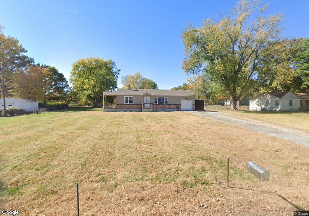
304 Campbell Dr Liberty, MO 64068
Estimated Value: $239,000 - $288,000
3
Beds
1
Bath
1,040
Sq Ft
$248/Sq Ft
Est. Value
About This Home
This home is located at 304 Campbell Dr, Liberty, MO 64068 and is currently estimated at $257,654, approximately $247 per square foot. 304 Campbell Dr is a home located in Clay County with nearby schools including Alexander Doniphan Elementary School, Discovery Middle School, and Liberty High School.
Ownership History
Date
Name
Owned For
Owner Type
Purchase Details
Closed on
Aug 24, 2017
Sold by
Expression Re Llc
Bought by
Odneal Kevan P and Odneal Paul M
Current Estimated Value
Home Financials for this Owner
Home Financials are based on the most recent Mortgage that was taken out on this home.
Original Mortgage
$126,467
Outstanding Balance
$105,270
Interest Rate
3.87%
Mortgage Type
FHA
Estimated Equity
$152,384
Purchase Details
Closed on
Sep 8, 2008
Sold by
Miles Ronald W and Miles Sandra D
Bought by
Revenaugh Michael Kevin and Revenaugh Cheryl A
Home Financials for this Owner
Home Financials are based on the most recent Mortgage that was taken out on this home.
Original Mortgage
$93,600
Interest Rate
6.66%
Mortgage Type
Purchase Money Mortgage
Purchase Details
Closed on
Apr 18, 2007
Sold by
Miles John W and Miles Theodora Jo
Bought by
Miles Ronald W and Miles Sandra D
Home Financials for this Owner
Home Financials are based on the most recent Mortgage that was taken out on this home.
Original Mortgage
$80,000
Interest Rate
6.1%
Mortgage Type
Credit Line Revolving
Create a Home Valuation Report for This Property
The Home Valuation Report is an in-depth analysis detailing your home's value as well as a comparison with similar homes in the area
Home Values in the Area
Average Home Value in this Area
Purchase History
| Date | Buyer | Sale Price | Title Company |
|---|---|---|---|
| Odneal Kevan P | -- | Kansas City Title Inc | |
| Revenaugh Michael Kevin | -- | United Title Company Inc | |
| Miles Ronald W | -- | Title Enterprises |
Source: Public Records
Mortgage History
| Date | Status | Borrower | Loan Amount |
|---|---|---|---|
| Open | Odneal Kevan P | $126,467 | |
| Previous Owner | Revenaugh Michael Kevin | $93,600 | |
| Previous Owner | Miles Ronald W | $80,000 |
Source: Public Records
Tax History Compared to Growth
Tax History
| Year | Tax Paid | Tax Assessment Tax Assessment Total Assessment is a certain percentage of the fair market value that is determined by local assessors to be the total taxable value of land and additions on the property. | Land | Improvement |
|---|---|---|---|---|
| 2025 | $1,791 | $27,870 | -- | -- |
| 2024 | $1,791 | $24,260 | -- | -- |
| 2023 | $1,817 | $24,260 | $0 | $0 |
| 2022 | $1,726 | $22,780 | $0 | $0 |
| 2021 | $1,733 | $22,781 | $7,790 | $14,991 |
| 2020 | $1,707 | $21,170 | $0 | $0 |
| 2019 | $1,708 | $21,170 | $0 | $0 |
| 2018 | $1,416 | $17,230 | $0 | $0 |
| 2017 | $1,400 | $17,230 | $3,760 | $13,470 |
| 2016 | $1,400 | $17,230 | $3,760 | $13,470 |
| 2015 | $1,400 | $17,230 | $3,760 | $13,470 |
| 2014 | $1,438 | $17,650 | $3,760 | $13,890 |
Source: Public Records
Map
Nearby Homes
- 1991 Harvest Rd
- 1841 Vintage Ln
- 1852 Vintage Ln
- 2153 Black Walnut Dr
- 2152 Black Walnut Dr
- 2157 Black Walnut Dr
- 1929 Longview Dr
- 1845 Arbor Trail
- 2156 Black Walnut Dr
- 1975 Harvest Rd
- 1979 Harvest Rd
- 1971 Harvest Rd
- 1733 Welleslay Ln
- 1980 Longview Dr
- 1912 Longview Dr
- 1985 Longview Dr
- 1916 Longview Dr
- 1989 Longview Dr
- 1836 Green Meadow Dr
- 1984 Longview Dr
- 302 Campbell Dr
- 306 Campbell Dr
- 303 Bonnie Ln
- 405 Norton Ave
- 300 Campbell Dr
- 308 Campbell Dr
- 403 Norton Ave
- 307 Campbell Dr
- 309 Bonnie Ln
- 305 Campbell Dr
- 303 Campbell Dr
- 310 Campbell Dr
- 311 Bonnie Ln
- 401 Norton Ave
- 309 Campbell Dr
- 301 Campbell Dr
- 313 Bonnie Ln
- 406 Norton Ave
- 404 Norton Ave
- 312 Campbell Dr