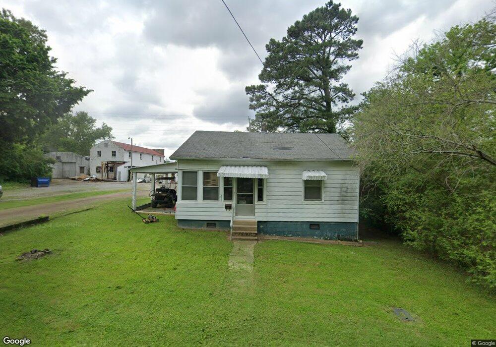
304 Central Ave South Fulton, TN 38257
Estimated Value: $41,000 - $127,000
--
Bed
1
Bath
898
Sq Ft
$89/Sq Ft
Est. Value
About This Home
This home is located at 304 Central Ave, South Fulton, TN 38257 and is currently estimated at $79,546, approximately $88 per square foot. 304 Central Ave is a home located in Obion County.
Ownership History
Date
Name
Owned For
Owner Type
Purchase Details
Closed on
Nov 24, 2008
Sold by
Teems Dwight
Bought by
Yates Michael L
Current Estimated Value
Home Financials for this Owner
Home Financials are based on the most recent Mortgage that was taken out on this home.
Original Mortgage
$8,744
Interest Rate
6.01%
Mortgage Type
Cash
Purchase Details
Closed on
Jun 28, 2004
Sold by
Darnell Valda J
Bought by
Dwight Teems
Purchase Details
Closed on
Jan 1, 1986
Bought by
Darnell William Thomas and Darnell Valda J
Purchase Details
Closed on
Jan 1, 1952
Create a Home Valuation Report for This Property
The Home Valuation Report is an in-depth analysis detailing your home's value as well as a comparison with similar homes in the area
Home Values in the Area
Average Home Value in this Area
Purchase History
| Date | Buyer | Sale Price | Title Company |
|---|---|---|---|
| Yates Michael L | $10,000 | -- | |
| Dwight Teems | $16,500 | -- | |
| Darnell William Thomas | $7,000 | -- | |
| -- | -- | -- |
Source: Public Records
Mortgage History
| Date | Status | Borrower | Loan Amount |
|---|---|---|---|
| Closed | Not Available | $8,744 |
Source: Public Records
Tax History Compared to Growth
Tax History
| Year | Tax Paid | Tax Assessment Tax Assessment Total Assessment is a certain percentage of the fair market value that is determined by local assessors to be the total taxable value of land and additions on the property. | Land | Improvement |
|---|---|---|---|---|
| 2025 | -- | $13,525 | $0 | $0 |
| 2024 | -- | $13,525 | $1,250 | $12,275 |
| 2023 | $340 | $13,525 | $1,250 | $12,275 |
| 2022 | $146 | $7,675 | $750 | $6,925 |
| 2021 | $143 | $7,675 | $750 | $6,925 |
| 2020 | $146 | $7,675 | $750 | $6,925 |
| 2019 | $275 | $7,675 | $750 | $6,925 |
| 2018 | $275 | $7,675 | $750 | $6,925 |
| 2017 | $266 | $7,075 | $750 | $6,325 |
| 2016 | $266 | $7,075 | $750 | $6,325 |
| 2015 | $266 | $7,075 | $750 | $6,325 |
| 2014 | $266 | $7,075 | $750 | $6,325 |
Source: Public Records
Map
Nearby Homes
- 0 State Route 129
- 104 Park Ave Unit F
- 407 Oliver Dr
- 304 Eddings St
- 204 Park St
- 803 Walnut St
- 310 2nd St Unit F
- 508 Vancil St
- 507 Vancil St
- 509 Vancil St
- 109 West St
- 411 Honey Locust Dr
- 709 Tennessee St
- 413 Honey Locust Dr
- 219 4th St Unit F
- 505 Park Ave Unit F
- 311 4th St Unit 311 Fourth Street
- 811 Key St
- 608 Green St
- 1015 W 4th St
- 220 Central Ave
- 301 Broadway St
- 216 Central Ave
- 305 Broadway St
- 214 Central Ave
- 308 Central Ave
- 309 Broadway St
- 309 Broadway St
- 212 Central Ave
- 313 Broadway St
- 309 Central Ave
- 304 Broadway St
- 306 Broadway St
- 310 Central Ave
- 302 Broadway St
- 300 Broadway St
- 315 Broadway St
- 313 Central Ave
- 312 Broadway St
- 314 Central Ave