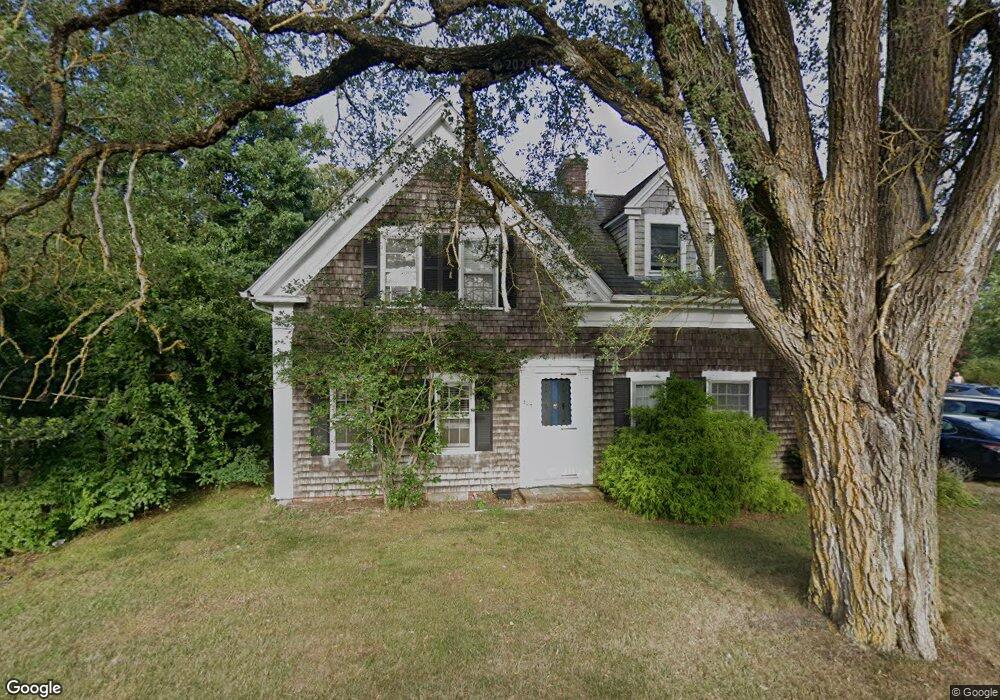
304 Depot St Dennis Port, MA 02639
Dennis Port NeighborhoodEstimated Value: $638,000 - $724,775
2
Beds
2
Baths
2,185
Sq Ft
$312/Sq Ft
Est. Value
About This Home
This home is located at 304 Depot St, Dennis Port, MA 02639 and is currently estimated at $682,694, approximately $312 per square foot. 304 Depot St is a home located in Barnstable County with nearby schools including Dennis-Yarmouth Regional High School and St. Pius X. School.
Ownership History
Date
Name
Owned For
Owner Type
Purchase Details
Closed on
Jul 26, 1996
Sold by
Howard Helen C
Bought by
Christensen Stevev A and Christensen Kimberle A
Current Estimated Value
Create a Home Valuation Report for This Property
The Home Valuation Report is an in-depth analysis detailing your home's value as well as a comparison with similar homes in the area
Home Values in the Area
Average Home Value in this Area
Purchase History
| Date | Buyer | Sale Price | Title Company |
|---|---|---|---|
| Christensen Stevev A | $80,000 | -- |
Source: Public Records
Mortgage History
| Date | Status | Borrower | Loan Amount |
|---|---|---|---|
| Open | Christensen Stevev A | $15,000 | |
| Open | Christensen Stevev A | $89,500 | |
| Closed | Christensen Stevev A | $25,000 | |
| Closed | Christensen Stevev A | $70,000 |
Source: Public Records
Tax History Compared to Growth
Tax History
| Year | Tax Paid | Tax Assessment Tax Assessment Total Assessment is a certain percentage of the fair market value that is determined by local assessors to be the total taxable value of land and additions on the property. | Land | Improvement |
|---|---|---|---|---|
| 2025 | $2,587 | $597,400 | $201,700 | $395,700 |
| 2024 | $2,477 | $564,200 | $205,400 | $358,800 |
| 2023 | $1,762 | $377,200 | $186,700 | $190,500 |
| 2022 | $1,853 | $330,900 | $186,800 | $144,100 |
| 2021 | $2,717 | $295,400 | $164,900 | $130,500 |
| 2020 | $1,795 | $294,300 | $164,900 | $129,400 |
| 2019 | $2,716 | $296,600 | $161,600 | $135,000 |
| 2018 | $1,724 | $272,000 | $153,900 | $118,100 |
| 2017 | $2,422 | $276,100 | $153,900 | $122,200 |
| 2016 | $1,800 | $275,700 | $171,000 | $104,700 |
| 2015 | $1,764 | $275,700 | $171,000 | $104,700 |
| 2014 | $1,600 | $252,000 | $136,800 | $115,200 |
Source: Public Records
Map
Nearby Homes
- 9 Country Ln
- 47 Telegraph Rd Unit 1
- 11 Lane Rd
- 12 Candlewood Ln Unit 2-9
- 10 Candlewood Ln Unit 2-1
- 141 Division St
- 141 Division St
- 78 Upper County Rd Unit A&B
- 78 Upper County Rd
- 24 Indian Trail
- 91 Depot Rd W
- 45 Route 28
- 73 Division St
- 9 Bells Neck Rd Unit 10
- 40 Willow St
- 12 Cross St
- 268 Main St
- 79 Massachusetts 28
- 104 Toms Path
- 104 Toms Path