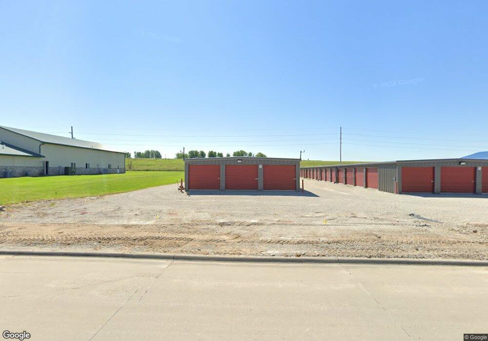
304 Enterprise Ct Independence, IA 50644
--
Bed
--
Bath
4,950
Sq Ft
1.26
Acres
About This Home
This home is located at 304 Enterprise Ct, Independence, IA 50644. 304 Enterprise Ct is a home located in Buchanan County with nearby schools including West Elementary School, East Elementary School, and Independence Junior/Senior High School.
Ownership History
Date
Name
Owned For
Owner Type
Purchase Details
Closed on
Oct 28, 2015
Sold by
Independence Enterprises Inc
Bought by
Independence Affordable Storage Llc
Home Financials for this Owner
Home Financials are based on the most recent Mortgage that was taken out on this home.
Original Mortgage
$294,240
Interest Rate
3.82%
Mortgage Type
New Conventional
Create a Home Valuation Report for This Property
The Home Valuation Report is an in-depth analysis detailing your home's value as well as a comparison with similar homes in the area
Home Values in the Area
Average Home Value in this Area
Purchase History
| Date | Buyer | Sale Price | Title Company |
|---|---|---|---|
| Independence Affordable Storage Llc | $35,000 | None Available |
Source: Public Records
Mortgage History
| Date | Status | Borrower | Loan Amount |
|---|---|---|---|
| Closed | Independence Affordable Storage Llc | $294,240 |
Source: Public Records
Tax History Compared to Growth
Tax History
| Year | Tax Paid | Tax Assessment Tax Assessment Total Assessment is a certain percentage of the fair market value that is determined by local assessors to be the total taxable value of land and additions on the property. | Land | Improvement |
|---|---|---|---|---|
| 2025 | $15,470 | $477,910 | $66,190 | $411,720 |
| 2024 | $15,470 | $477,910 | $66,190 | $411,720 |
| 2023 | $15,296 | $477,910 | $66,190 | $411,720 |
| 2022 | $10,634 | $386,430 | $51,500 | $334,930 |
| 2021 | $10,840 | $386,430 | $51,500 | $334,930 |
| 2020 | $10,840 | $386,430 | $51,500 | $334,930 |
| 2019 | $10,700 | $386,430 | $51,500 | $334,930 |
| 2018 | $10,506 | $386,430 | $51,500 | $334,930 |
| 2017 | $714 | $386,430 | $51,500 | $334,930 |
| 2016 | $980 | $31,870 | $31,870 | $0 |
| 2015 | $980 | $44,500 | $44,500 | $0 |
| 2014 | $1,106 | $44,500 | $44,500 | $0 |
Source: Public Records
Map
Nearby Homes
- 2325 Jamestown Ave
- 1606 Kellie Ave SW
- 1020 6th Ave SW
- 810 3rd Ave SW
- 206 8th St SW
- 312 7th Ave NE
- 721 8th St SE
- 406 6th Ave SW
- 513 4th St SW
- 519 3rd St SE
- 2086 3 Elms Park Rd
- 206 7th Ave SW
- 523 Upper Terrace Dr
- 400 2nd St NW
- 812 1st St E
- 707 2nd St NE
- 111 Terrace Dr
- 611 3rd St NE
- 507 2nd Ave NE
- 1706 2nd St SW
- 400 Enterprise Dr
- 307 Enterprise Dr
- 401 Enterprise Dr
- 0 Enterprise Dr
- 2016 Enterprise Ct
- 2012 Enterprise Ct
- 2010 Enterprise Ct
- 2008 Enterprise Ct
- 2006 Enterprise Ct
- 402 Enterprise Dr
- 2004 Enterprise Ct
- 402 Enterprise Ct Unit Lot 11
- 402 Enterprise Ct
- 2002 Enterprise Ct
- 405 Enterprise Dr
- 507 Enterprise Ct
- 500 Enterprise Dr
- 505 Enterprise Ct
- 501 Enterprise Dr
- 501 Enterprise Ct