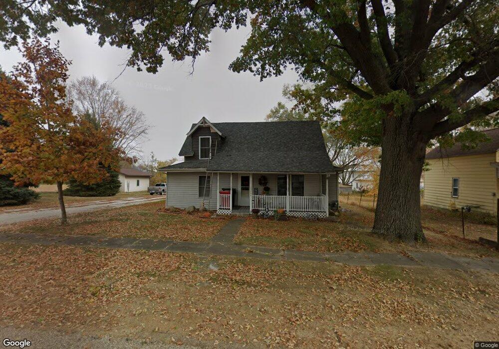
304 Lewis St Mount Auburn, IA 52313
Estimated Value: $106,000 - $156,000
3
Beds
1
Bath
1,634
Sq Ft
$80/Sq Ft
Est. Value
About This Home
This home is located at 304 Lewis St, Mount Auburn, IA 52313 and is currently estimated at $131,300, approximately $80 per square foot. 304 Lewis St is a home located in Benton County with nearby schools including Union High School.
Create a Home Valuation Report for This Property
The Home Valuation Report is an in-depth analysis detailing your home's value as well as a comparison with similar homes in the area
Home Values in the Area
Average Home Value in this Area
Tax History Compared to Growth
Tax History
| Year | Tax Paid | Tax Assessment Tax Assessment Total Assessment is a certain percentage of the fair market value that is determined by local assessors to be the total taxable value of land and additions on the property. | Land | Improvement |
|---|---|---|---|---|
| 2025 | $1,290 | $117,100 | $6,900 | $110,200 |
| 2024 | $1,290 | $105,800 | $6,100 | $99,700 |
| 2023 | $1,054 | $105,800 | $6,100 | $99,700 |
| 2022 | $1,054 | $77,700 | $4,900 | $72,800 |
| 2021 | $1,054 | $77,700 | $4,900 | $72,800 |
| 2020 | $838 | $64,100 | $3,700 | $60,400 |
| 2019 | $838 | $64,100 | $3,700 | $60,400 |
| 2018 | $814 | $63,000 | $3,700 | $59,300 |
| 2017 | $834 | $63,000 | $3,700 | $59,300 |
| 2016 | $814 | $63,000 | $3,700 | $59,300 |
| 2015 | $814 | $63,000 | $3,700 | $59,300 |
| 2014 | $860 | $65,800 | $0 | $0 |
Source: Public Records
Map
Nearby Homes
- 5141 22nd Ave
- 5454 22nd Ave Unit Lot 24
- 5454 22nd Ave Unit 65 & 66
- 5589 22nd Avenue Trail
- PARCEL "A" LOCA 55th St
- 54th St
- TBD 54th St
- 5141 25th Ave
- 5758 20th Avenue Dr
- 0 Tbd 325th St
- 12334 Carr Rd
- 2492 55th St
- 13518 King Rd
- 0 25th Ave
- 0 Garling Rd
- 1308 South St
- 1101 E Main St
- 705 South St
- 903 Poplar St Unit 905
- 100 Spruce St