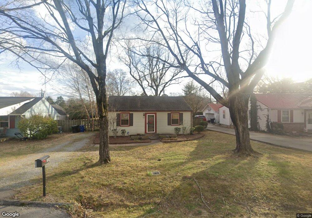
304 Mercury Dr Franklin, TN 37064
Central Franklin NeighborhoodEstimated Value: $447,000 - $645,000
--
Bed
1
Bath
868
Sq Ft
$651/Sq Ft
Est. Value
About This Home
This home is located at 304 Mercury Dr, Franklin, TN 37064 and is currently estimated at $564,897, approximately $650 per square foot. 304 Mercury Dr is a home located in Williamson County with nearby schools including Franklin Elementary School, Freedom Intermediate School, and Freedom Middle School.
Ownership History
Date
Name
Owned For
Owner Type
Purchase Details
Closed on
Jun 26, 2011
Sold by
Simpson Patricia H
Bought by
Johnson Megan Green
Current Estimated Value
Purchase Details
Closed on
Jan 25, 1999
Sold by
Chunn Michael B
Bought by
Simpson Patricia H
Home Financials for this Owner
Home Financials are based on the most recent Mortgage that was taken out on this home.
Original Mortgage
$71,200
Interest Rate
6.72%
Create a Home Valuation Report for This Property
The Home Valuation Report is an in-depth analysis detailing your home's value as well as a comparison with similar homes in the area
Home Values in the Area
Average Home Value in this Area
Purchase History
| Date | Buyer | Sale Price | Title Company |
|---|---|---|---|
| Johnson Megan Green | $15,000 | Heritage Title & Escrow | |
| Simpson Patricia H | $88,975 | Heritage Title & Escrow Co I |
Source: Public Records
Mortgage History
| Date | Status | Borrower | Loan Amount |
|---|---|---|---|
| Previous Owner | Simpson Patricia H | $71,200 |
Source: Public Records
Tax History Compared to Growth
Tax History
| Year | Tax Paid | Tax Assessment Tax Assessment Total Assessment is a certain percentage of the fair market value that is determined by local assessors to be the total taxable value of land and additions on the property. | Land | Improvement |
|---|---|---|---|---|
| 2024 | $2,054 | $72,525 | $51,250 | $21,275 |
| 2023 | $1,974 | $72,525 | $51,250 | $21,275 |
| 2022 | $1,974 | $72,525 | $51,250 | $21,275 |
| 2021 | $1,974 | $72,525 | $51,250 | $21,275 |
| 2020 | $1,390 | $43,100 | $22,500 | $20,600 |
| 2019 | $1,390 | $43,100 | $22,500 | $20,600 |
| 2018 | $1,360 | $43,100 | $22,500 | $20,600 |
| 2017 | $1,339 | $43,100 | $22,500 | $20,600 |
| 2016 | $1,334 | $43,100 | $22,500 | $20,600 |
| 2015 | -- | $32,525 | $15,000 | $17,525 |
| 2014 | -- | $32,525 | $15,000 | $17,525 |
Source: Public Records
Map
Nearby Homes
- 301 Mercury Dr
- 1408 Adams St
- 153 Generals Retreat Place Unit 153
- 1405 Adams St
- 312 Bel Aire Dr
- 108 Carolyn Ave
- 200 James Ave
- 1335 Adams St
- 308 Meadowlawn Dr
- 425 Herringbone Ct
- 402 Herringbone Ct
- 437 Herringbone Ct
- 219 Ribbon Ln
- 468 Herringbone Ct
- 1324 Adams St
- 450 Herringbone Ct
- 508 Herringbone Ct
- 514 Herringbone Ct
- 520 Herringbone Ct
- 102 Battlefield Dr
- 306 Mercury Dr
- 302 Mercury Dr
- 308 Mercury Dr
- 305 Highland Ave
- 307 Highland Ave
- 303 Highland Ave
- 1415 Adams St
- 309 Highland Ave
- 305 Mercury Dr
- 1419 Adams St
- 303 Mercury Dr
- 311 Highland Ave
- 1413 Adams St
- 1421 Adams St
- 307 Mercury Dr
- 313 Highland Ave
- 314 Mercury Dr
- 303 Bel Aire Dr
- 309 Mercury Dr
- 308 Highland Ave