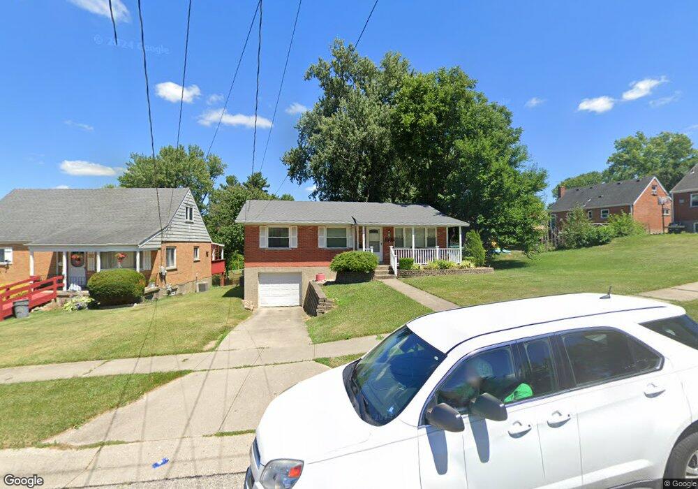
304 Robben Ln Cincinnati, OH 45238
Delshire NeighborhoodEstimated Value: $212,000 - $234,000
3
Beds
2
Baths
1,131
Sq Ft
$194/Sq Ft
Est. Value
About This Home
This home is located at 304 Robben Ln, Cincinnati, OH 45238 and is currently estimated at $219,864, approximately $194 per square foot. 304 Robben Ln is a home located in Hamilton County with nearby schools including Delshire Elementary School, Delhi Middle School, and Oak Hills High School.
Ownership History
Date
Name
Owned For
Owner Type
Purchase Details
Closed on
Aug 15, 2019
Sold by
Schirmer Vincent R
Bought by
Schirmer Joseph L
Current Estimated Value
Purchase Details
Closed on
Feb 2, 2015
Sold by
Hauck Jennifer M
Bought by
Schirmer Vincent R and Vincent R Schirmer Revocable Trust
Purchase Details
Closed on
Jun 26, 2002
Sold by
Bross Gary A and Bross Peggy Anne
Bought by
Hauck Jennifer M
Home Financials for this Owner
Home Financials are based on the most recent Mortgage that was taken out on this home.
Original Mortgage
$103,174
Interest Rate
6.82%
Mortgage Type
FHA
Purchase Details
Closed on
Sep 18, 1987
Sold by
Ross Thomas D and Ross Dorothy
Bought by
Bross Gary A and Bross Peggy Anne
Create a Home Valuation Report for This Property
The Home Valuation Report is an in-depth analysis detailing your home's value as well as a comparison with similar homes in the area
Home Values in the Area
Average Home Value in this Area
Purchase History
| Date | Buyer | Sale Price | Title Company |
|---|---|---|---|
| Schirmer Joseph L | $85,000 | None Available | |
| Schirmer Vincent R | $85,000 | Attorney | |
| Hauck Jennifer M | $104,000 | -- | |
| Bross Gary A | $63,200 | -- |
Source: Public Records
Mortgage History
| Date | Status | Borrower | Loan Amount |
|---|---|---|---|
| Previous Owner | Hauck Jennifer M | $103,174 |
Source: Public Records
Tax History
| Year | Tax Paid | Tax Assessment Tax Assessment Total Assessment is a certain percentage of the fair market value that is determined by local assessors to be the total taxable value of land and additions on the property. | Land | Improvement |
|---|---|---|---|---|
| 2025 | $3,140 | $52,742 | $7,070 | $45,672 |
| 2024 | $3,063 | $52,742 | $7,070 | $45,672 |
| 2023 | $3,072 | $52,742 | $7,070 | $45,672 |
| 2022 | $2,264 | $34,510 | $6,335 | $28,175 |
| 2021 | $2,218 | $34,510 | $6,335 | $28,175 |
| 2020 | $2,249 | $34,510 | $6,335 | $28,175 |
| 2019 | $2,229 | $29,750 | $5,460 | $24,290 |
| 2018 | $2,229 | $29,750 | $5,460 | $24,290 |
| 2017 | $2,044 | $29,750 | $5,460 | $24,290 |
| 2016 | $2,074 | $29,922 | $5,719 | $24,203 |
| 2015 | $1,960 | $29,922 | $5,719 | $24,203 |
| 2014 | $1,962 | $29,922 | $5,719 | $24,203 |
| 2013 | $1,944 | $31,497 | $6,020 | $25,477 |
Source: Public Records
Map
Nearby Homes
- 337 Greenwell Ave
- 4457 Delhi Rd
- 4938 Mount Alverno Rd
- 4635 Mayhew Ave
- 4380 Glenhaven Rd
- 439 Pedretti Ave
- 4279 Paul Rd
- 4271 Champdale Ln
- 4209 Delryan Dr
- 4994 Troubador Ct
- 4294 Mayhew Ave
- 4979 Bonaventure Ct
- 5062 Orangelawn Dr
- 4924 Alvernovalley Ct
- 4729 Shadylawn Terrace
- 5140 Old Oak Trail
- 5160 Old Oak Trail
- 517 Trenton Ave
- 4968 Francisview Dr
- 5210 Old Oak Trail
- 310 Robben Ln
- 4599 Patron Ct
- 4594 Mount Alverno Rd
- 4608 Mount Alverno Rd
- 4586 Mount Alverno Rd
- 4591 Patron Ct
- 4564 Mount Alverno Rd
- 4583 Patron Ct
- 307 Robben Ln
- 311 Robben Ln
- 4554 Mount Alverno Rd
- 313 Robben Ln
- 4640 Mount Alverno Rd
- 4575 Patron Ct
- 319 Robben Ln
- 4586 Patron Ct
- 4652 Mount Alverno Rd
- 4540 Mount Alverno Rd
- 4607 Mount Alverno Rd
- 321 Robben Ln
Your Personal Tour Guide
Ask me questions while you tour the home.