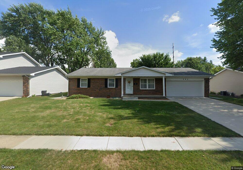
304 Saxon Dr Springfield, IL 62704
Westchester NeighborhoodEstimated Value: $204,000 - $226,000
Studio
--
Bath
--
Sq Ft
11,238
Sq Ft Lot
About This Home
This home is located at 304 Saxon Dr, Springfield, IL 62704 and is currently estimated at $213,041. 304 Saxon Dr is a home located in Sangamon County with nearby schools including Sandburg Elementary School, Benjamin Franklin Middle School, and Springfield Southeast High School.
Ownership History
Date
Name
Owned For
Owner Type
Purchase Details
Closed on
Apr 21, 2025
Sold by
Killebrew Group Inc
Bought by
Broken Road Mcjc Llc
Current Estimated Value
Purchase Details
Closed on
Feb 11, 2025
Sold by
Jane A Dosland Living Trust and Dosland Jane A
Bought by
Killebrew Group Inc
Purchase Details
Closed on
May 31, 2017
Sold by
Dosland Jane A
Bought by
Jane A Dosland Living Trust
Create a Home Valuation Report for This Property
The Home Valuation Report is an in-depth analysis detailing your home's value as well as a comparison with similar homes in the area
Home Values in the Area
Average Home Value in this Area
Purchase History
| Date | Buyer | Sale Price | Title Company |
|---|---|---|---|
| Broken Road Mcjc Llc | $200,000 | None Listed On Document | |
| Killebrew Group Inc | $155,000 | None Listed On Document | |
| Jane A Dosland Living Trust | -- | -- |
Source: Public Records
Tax History
| Year | Tax Paid | Tax Assessment Tax Assessment Total Assessment is a certain percentage of the fair market value that is determined by local assessors to be the total taxable value of land and additions on the property. | Land | Improvement |
|---|---|---|---|---|
| 2024 | $3,725 | $55,346 | $9,264 | $46,082 |
| 2023 | $3,497 | $50,554 | $8,462 | $42,092 |
| 2022 | $3,279 | $47,597 | $8,028 | $39,569 |
| 2021 | $3,134 | $45,814 | $7,727 | $38,087 |
| 2020 | $3,073 | $45,883 | $7,739 | $38,144 |
| 2019 | $3,012 | $45,723 | $7,712 | $38,011 |
| 2018 | $3,000 | $46,512 | $7,673 | $38,839 |
| 2017 | $2,926 | $45,911 | $7,574 | $38,337 |
| 2016 | $2,856 | $45,242 | $7,464 | $37,778 |
| 2015 | $2,817 | $44,701 | $7,375 | $37,326 |
| 2014 | $2,631 | $44,412 | $7,327 | $37,085 |
| 2013 | $2,572 | $42,748 | $7,326 | $35,422 |
Source: Public Records
Map
Nearby Homes
- 51 Squires Rd
- 21 Drawbridge Rd
- 49 Foresters Ln
- 3132 Elmhurst Dr
- 53 Friars Ln
- 3300 Haviland Dr
- 3434 Freedom Dr
- 41 Belhaven Dr
- 3304 Ellendale Dr
- 2709 Clifton Dr
- 3120 Cascade Dr
- 10 Andover Dr
- 2944 Rainier Dr
- 3104 Constitution Dr
- 2216 Charlack Ave
- 3608 Wittington Ct
- 90 Brookside Place Unit 57
- 3506 Aberdeen Ct
- 3500 Sandwood Dr
- 2234 Warson Rd
- 300 Saxon Dr
- 308 Saxon Dr
- 268 Saxon Dr
- 312 Saxon Dr
- 301 Saxon Dr
- 309 Saxon Dr
- 264 Saxon Dr
- 316 Saxon Dr
- 106 Crusaders Rd
- 2479 Idlewild Dr
- 107 Drawbridge Rd
- 2475 Idlewild Dr
- 260 Saxon Dr
- 108 Drawbridge Rd
- 102 Crusaders Rd
- 2483 Idlewild Dr
- 103 Drawbridge Rd
- 104 Drawbridge Rd
- 2471 Idlewild Dr
- 256 Saxon Dr
Your Personal Tour Guide
Ask me questions while you tour the home.