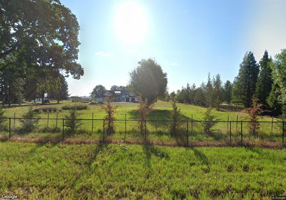
30432 S Barlow Rd Hubbard, OR 97032
Estimated Value: $2,277,000 - $2,792,312
--
Bed
--
Bath
4,427
Sq Ft
$573/Sq Ft
Est. Value
About This Home
This home is located at 30432 S Barlow Rd, Hubbard, OR 97032 and is currently estimated at $2,534,656, approximately $572 per square foot. 30432 S Barlow Rd is a home located in Clackamas County with nearby schools including Philander Lee Elementary School, Baker Prairie Middle School, and Canby High School.
Ownership History
Date
Name
Owned For
Owner Type
Purchase Details
Closed on
Aug 19, 2020
Sold by
Cloyd Vicki Diane and Estate Of Patsy Ann Lewis Clac
Bought by
Gernhart Michael and Gemhart Kelly
Current Estimated Value
Home Financials for this Owner
Home Financials are based on the most recent Mortgage that was taken out on this home.
Original Mortgage
$279,300
Outstanding Balance
$198,320
Interest Rate
3%
Mortgage Type
New Conventional
Estimated Equity
$2,336,336
Purchase Details
Closed on
Aug 3, 2020
Sold by
Demsher Ruth
Bought by
Agan Jack
Home Financials for this Owner
Home Financials are based on the most recent Mortgage that was taken out on this home.
Original Mortgage
$279,300
Outstanding Balance
$198,320
Interest Rate
3%
Mortgage Type
New Conventional
Estimated Equity
$2,336,336
Create a Home Valuation Report for This Property
The Home Valuation Report is an in-depth analysis detailing your home's value as well as a comparison with similar homes in the area
Home Values in the Area
Average Home Value in this Area
Purchase History
| Date | Buyer | Sale Price | Title Company |
|---|---|---|---|
| Gernhart Michael | $399,000 | Wfg Title | |
| Agan Jack | -- | None Available |
Source: Public Records
Mortgage History
| Date | Status | Borrower | Loan Amount |
|---|---|---|---|
| Open | Gernhart Michael | $279,300 |
Source: Public Records
Tax History Compared to Growth
Tax History
| Year | Tax Paid | Tax Assessment Tax Assessment Total Assessment is a certain percentage of the fair market value that is determined by local assessors to be the total taxable value of land and additions on the property. | Land | Improvement |
|---|---|---|---|---|
| 2024 | $16,420 | $1,297,335 | -- | -- |
| 2023 | $16,420 | $1,259,549 | $0 | $0 |
| 2022 | $7,448 | $609,757 | $0 | $0 |
| 2021 | $2,238 | $185,468 | $0 | $0 |
| 2020 | $2,318 | $189,006 | $0 | $0 |
| 2019 | $2,188 | $183,501 | $0 | $0 |
| 2018 | $2,189 | $178,156 | $0 | $0 |
| 2017 | $2,136 | $172,967 | $0 | $0 |
| 2016 | $2,061 | $167,929 | $0 | $0 |
| 2015 | $2,004 | $163,038 | $0 | $0 |
| 2014 | $1,947 | $158,289 | $0 | $0 |
Source: Public Records
Map
Nearby Homes
- 30413 S Stuwe Rd
- 6150 S Miller Rd
- 8487 S Sconce Rd
- 29497 S Meridian Rd
- 8601 S Sconce Rd
- 30700 S Highway 170
- 29474 S Highway 170
- 9060 S Highway 211
- 17765 Monnier Rd NE
- 27200 S Barlow Rd
- 8949 S Gribble Rd
- 26882 S Bolland Rd
- 30593 S Elisha Rd
- 9573 S Gribble Rd
- 9750 S Gribble Rd
- 12875 Peggys Place NE
- 3197 Rainbow Loop Unit 10
- 3370 Maple St Unit 44
- 3370 Maple St
- 18767 Highway 99e
- 30432 S Barlow Rd
- 30400 S Barlow Rd
- 30277 S Barlow Rd
- 6886 S Miller Rd
- 30570 S Barlow Rd
- 30273 Barlow Rd
- 6846 S Miller Rd
- 30248 S Barlow Rd
- 6806 S Miller Rd
- 7194 S Barnards Rd Unit 1
- 7194 S Barnards Rd
- 30050 S Barlow Rd
- 30742 Barlow Rd
- 30725 S Barlow Rd
- 7236 S Barnards Rd
- 30621 S Stuwe Rd
- 30751 S Barlow Rd
- 7150 S Barnards Rd
- 7290 S Barnards Rd
- 7034 S Barnards Rd