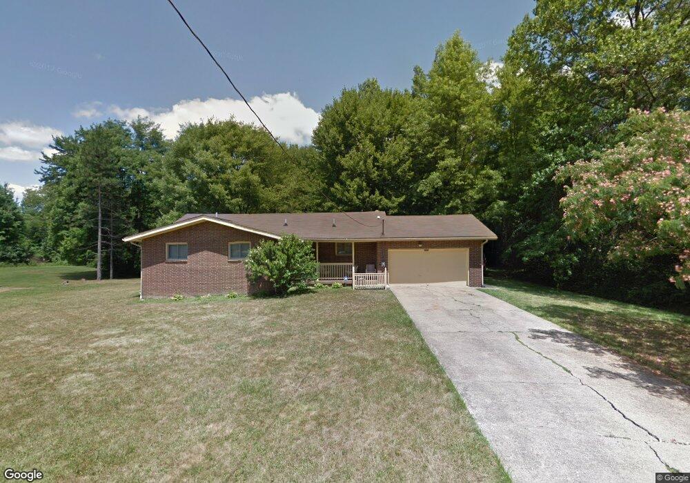
3044 Myron Ave Youngstown, OH 44505
McGuffey Heights NeighborhoodEstimated Value: $76,000 - $120,000
3
Beds
2
Baths
1,336
Sq Ft
$71/Sq Ft
Est. Value
About This Home
This home is located at 3044 Myron Ave, Youngstown, OH 44505 and is currently estimated at $94,753, approximately $70 per square foot. 3044 Myron Ave is a home located in Mahoning County with nearby schools including M.L. King Elementary School, Williamson Elementary School, and East High School.
Ownership History
Date
Name
Owned For
Owner Type
Purchase Details
Closed on
Aug 31, 2005
Sold by
Bryson Jan Prisby
Bought by
Brown Anderson C
Current Estimated Value
Home Financials for this Owner
Home Financials are based on the most recent Mortgage that was taken out on this home.
Original Mortgage
$48,000
Outstanding Balance
$25,632
Interest Rate
5.82%
Mortgage Type
Fannie Mae Freddie Mac
Estimated Equity
$69,121
Purchase Details
Closed on
Jul 24, 1990
Bought by
Prisby Russell E and Prisby Vivian
Create a Home Valuation Report for This Property
The Home Valuation Report is an in-depth analysis detailing your home's value as well as a comparison with similar homes in the area
Home Values in the Area
Average Home Value in this Area
Purchase History
| Date | Buyer | Sale Price | Title Company |
|---|---|---|---|
| Brown Anderson C | $48,000 | -- | |
| Prisby Russell E | -- | -- |
Source: Public Records
Mortgage History
| Date | Status | Borrower | Loan Amount |
|---|---|---|---|
| Open | Brown Anderson C | $48,000 |
Source: Public Records
Tax History Compared to Growth
Tax History
| Year | Tax Paid | Tax Assessment Tax Assessment Total Assessment is a certain percentage of the fair market value that is determined by local assessors to be the total taxable value of land and additions on the property. | Land | Improvement |
|---|---|---|---|---|
| 2024 | $704 | $14,750 | $1,190 | $13,560 |
| 2023 | $698 | $14,750 | $1,190 | $13,560 |
| 2022 | $683 | $11,110 | $1,140 | $9,970 |
| 2021 | $684 | $11,110 | $1,140 | $9,970 |
| 2020 | $687 | $11,110 | $1,140 | $9,970 |
| 2019 | $711 | $10,290 | $1,060 | $9,230 |
| 2018 | $718 | $10,290 | $1,060 | $9,230 |
| 2017 | $731 | $10,290 | $1,060 | $9,230 |
| 2016 | $746 | $11,560 | $1,060 | $10,500 |
| 2015 | $731 | $11,560 | $1,060 | $10,500 |
| 2014 | $726 | $11,560 | $1,060 | $10,500 |
| 2013 | $715 | $11,560 | $1,060 | $10,500 |
Source: Public Records
Map
Nearby Homes
- 1720 Jacobs Rd
- 2051 Blair Ave
- 1214 Brighton St
- V/L Jacobs Rd
- 2951 Megan Cir
- 2831 Benford Ln
- 2954 Megan Cir
- 1003 Liberty Rd
- 665 Wendemere Dr
- 1325 Miami Ave
- 663 Meadowland Dr
- 366 Westview Ave
- 531 Meadowland Dr
- 902 Miami St
- 279 Parish Ave
- 269 Westview Ave
- 229 Jacobs Rd
- 5843 Fairlawn Ave
- 1538 Republic Ave
- 0 Homestead Rd
- 3033 Myron Ave
- 3039 Myron Ave
- 3073 Myron Ave
- 3050 Myron Ave
- 3105 Myron Ave
- 3039 Gerwig Ave
- 1759 Jacobs Rd
- 1813 Jacobs Rd
- 3107 Gerwig Ave
- 3034 Gerwig Ave
- 3177 Myron Ave
- 1729 Jacobs Rd
- 1802 Jacobs Rd
- 3104 Gerwig Ave
- 3131 Myron Ave
- 1828 Jacobs Rd
- 1725 Jacobs Rd
- 3130 Myron Ave
- 3041 Orrin Ave
- 3045 Orrin Ave