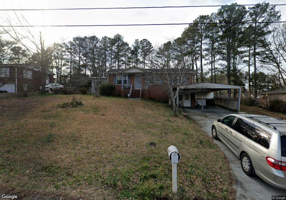
3048 Michael Dr SW Marietta, GA 30060
Southwestern Marietta NeighborhoodEstimated Value: $331,027 - $349,000
3
Beds
2
Baths
1,413
Sq Ft
$239/Sq Ft
Est. Value
About This Home
This home is located at 3048 Michael Dr SW, Marietta, GA 30060 and is currently estimated at $337,257, approximately $238 per square foot. 3048 Michael Dr SW is a home located in Cobb County with nearby schools including Birney Elementary School, Floyd Middle School, and Osborne High School.
Ownership History
Date
Name
Owned For
Owner Type
Purchase Details
Closed on
Mar 12, 2024
Sold by
Vo Tuan and Dong Thuy Tien
Bought by
Tuan Kim Vo And Thuytien Thi Dong Living Trus and Vo
Current Estimated Value
Purchase Details
Closed on
Sep 14, 2000
Sold by
Graham Ronald L and Graham Laurie E
Bought by
Vo Tuan
Home Financials for this Owner
Home Financials are based on the most recent Mortgage that was taken out on this home.
Original Mortgage
$82,800
Interest Rate
7.92%
Mortgage Type
New Conventional
Purchase Details
Closed on
Apr 12, 1996
Sold by
Mcgee H R Evelyn
Bought by
Graham Ronald L Laurie
Create a Home Valuation Report for This Property
The Home Valuation Report is an in-depth analysis detailing your home's value as well as a comparison with similar homes in the area
Home Values in the Area
Average Home Value in this Area
Purchase History
| Date | Buyer | Sale Price | Title Company |
|---|---|---|---|
| Tuan Kim Vo And Thuytien Thi Dong Living Trus | -- | None Listed On Document | |
| Vo Tuan | $110,500 | -- | |
| Graham Ronald L Laurie | $79,900 | -- |
Source: Public Records
Mortgage History
| Date | Status | Borrower | Loan Amount |
|---|---|---|---|
| Previous Owner | Vo Tuan | $82,800 | |
| Closed | Graham Ronald L Laurie | $0 |
Source: Public Records
Tax History Compared to Growth
Tax History
| Year | Tax Paid | Tax Assessment Tax Assessment Total Assessment is a certain percentage of the fair market value that is determined by local assessors to be the total taxable value of land and additions on the property. | Land | Improvement |
|---|---|---|---|---|
| 2025 | $1,095 | $117,060 | $26,000 | $91,060 |
| 2024 | $1,098 | $117,060 | $26,000 | $91,060 |
| 2023 | $892 | $117,060 | $26,000 | $91,060 |
| 2022 | $2,985 | $98,368 | $12,800 | $85,568 |
| 2021 | $1,959 | $64,532 | $12,800 | $51,732 |
| 2020 | $1,959 | $64,532 | $12,800 | $51,732 |
| 2019 | $1,959 | $64,532 | $12,800 | $51,732 |
| 2018 | $1,503 | $49,520 | $14,000 | $35,520 |
| 2017 | $1,424 | $49,520 | $14,000 | $35,520 |
| 2016 | $1,424 | $49,520 | $14,000 | $35,520 |
| 2015 | $1,166 | $39,592 | $15,840 | $23,752 |
| 2014 | $1,176 | $39,592 | $0 | $0 |
Source: Public Records
Map
Nearby Homes
- 3004 Michael Dr SW
- 1108 Byers Dr SW
- 3141 Holbrook Dr SW
- 2964 Edgemont Ln SW
- 1308 Willamette Way
- 1020 Hicksmil Dr SW
- 1427 Lost Bridge Rd
- 1086 Mornington Way
- 959 Old Milford Church Rd SW
- 2940 Caller Ct SW
- 2907 Crest Ridge Ct SW
- 825 Winfield Ct SW
- 3309 Raes Creek Rd Unit 13
- 3075 Milford Chase SW
- 3123 Milford Chase SW
- 3383 Raes Creek Rd Unit 4
- 1345 Windage Ct SW Unit 6
- 3060 Michael Dr SW
- 3036 Michael Dr SW
- 3045 Austell Rd SW
- 3024 Michael Dr SW
- 3035 Michael Dr SW
- 3069 Michael Dr SW
- 3023 Michael Dr SW
- 3014 Michael Dr SW
- 3065 Austell Rd SW
- 1119 Travis St SW
- 3079 Michael Dr SW
- 3077 Austell Rd SW
- 3088 Michael Dr SW
- 3091 Michael Dr SW
- 1176 Byers Dr SW
- 1115 Travis St SW
- 1118 Travis St SW
- 0 Travis St SW Unit 8065899
- 0 Travis St SW Unit 3254676
- 3040 Austell Rd SW Unit 3040