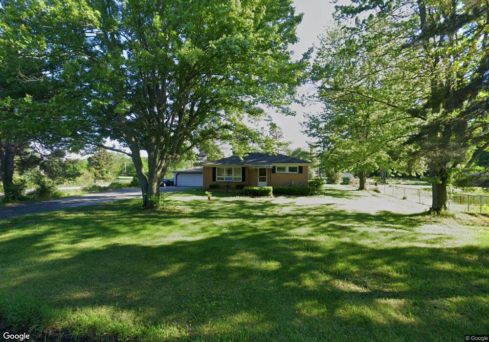
305 Angle Rd Lapeer, MI 48446
Estimated Value: $279,000 - $292,000
2
Beds
2
Baths
1,604
Sq Ft
$178/Sq Ft
Est. Value
About This Home
This home is located at 305 Angle Rd, Lapeer, MI 48446 and is currently estimated at $285,927, approximately $178 per square foot. 305 Angle Rd is a home located in Lapeer County with nearby schools including Rolland-Warner Middle School, Lapeer High School, and Chatfield School.
Ownership History
Date
Name
Owned For
Owner Type
Purchase Details
Closed on
Nov 25, 2025
Sold by
Hauxwell Michael
Bought by
Hauxwell Michael and Kreiner Amanda Erin
Current Estimated Value
Home Financials for this Owner
Home Financials are based on the most recent Mortgage that was taken out on this home.
Original Mortgage
$213,000
Outstanding Balance
$212,396
Interest Rate
6.3%
Mortgage Type
New Conventional
Estimated Equity
$73,531
Purchase Details
Closed on
Nov 18, 2025
Sold by
Golaszewski Jeff
Bought by
Hauxwell Michael
Home Financials for this Owner
Home Financials are based on the most recent Mortgage that was taken out on this home.
Original Mortgage
$213,000
Outstanding Balance
$212,396
Interest Rate
6.3%
Mortgage Type
New Conventional
Estimated Equity
$73,531
Purchase Details
Closed on
Dec 18, 2024
Sold by
Lengemann James A
Bought by
Golaszewski Jeffrey J
Purchase Details
Closed on
Dec 4, 2024
Sold by
Sheriff In And For Lapeer County Michiga
Bought by
Golaszewski Jeff
Purchase Details
Closed on
Nov 25, 2024
Sold by
Shaw Bradley P
Bought by
Lengemann James A
Purchase Details
Closed on
Jan 13, 2012
Sold by
Monteleone Debbie A and Monteleone John L
Bought by
Shaw Bradley P
Home Financials for this Owner
Home Financials are based on the most recent Mortgage that was taken out on this home.
Original Mortgage
$88,434
Interest Rate
3.98%
Mortgage Type
Unknown
Create a Home Valuation Report for This Property
The Home Valuation Report is an in-depth analysis detailing your home's value as well as a comparison with similar homes in the area
Home Values in the Area
Average Home Value in this Area
Purchase History
| Date | Buyer | Sale Price | Title Company |
|---|---|---|---|
| Hauxwell Michael | -- | None Listed On Document | |
| Hauxwell Michael | $290,000 | Premier Title | |
| Golaszewski Jeffrey J | $5,000 | None Listed On Document | |
| Golaszewski Jeff | $125,000 | None Listed On Document | |
| Lengemann James A | $5,000 | None Listed On Document | |
| Lengemann James A | $5,000 | None Listed On Document | |
| Shaw Bradley P | $86,700 | -- |
Source: Public Records
Mortgage History
| Date | Status | Borrower | Loan Amount |
|---|---|---|---|
| Open | Hauxwell Michael | $213,000 | |
| Previous Owner | Shaw Bradley P | $88,434 |
Source: Public Records
Tax History
| Year | Tax Paid | Tax Assessment Tax Assessment Total Assessment is a certain percentage of the fair market value that is determined by local assessors to be the total taxable value of land and additions on the property. | Land | Improvement |
|---|---|---|---|---|
| 2025 | $2,663 | $122,700 | $0 | $0 |
| 2024 | $658 | $108,500 | $0 | $0 |
| 2023 | $629 | $93,500 | $0 | $0 |
| 2022 | $1,291 | $90,300 | $0 | $0 |
| 2021 | $1,175 | $79,500 | $0 | $0 |
| 2020 | $1,164 | $80,600 | $0 | $0 |
| 2019 | $1,190 | $66,800 | $0 | $0 |
| 2018 | $1,162 | $65,000 | $65,000 | $0 |
| 2017 | $1,141 | $63,800 | $0 | $0 |
| 2016 | $540 | $60,400 | $60,400 | $0 |
| 2015 | -- | $62,400 | $0 | $0 |
| 2014 | -- | $53,700 | $53,700 | $0 |
| 2013 | -- | $58,500 | $58,500 | $0 |
Source: Public Records
Map
Nearby Homes
- 1821 N Lapeer Rd
- 00 N Saginaw St
- 94 Twin Oaks Dr
- 1519 W Ridgeview Dr
- 1466 Luxington Dr
- 1470 Lincoln St
- 1437 Luxington Dr
- 1435 Luxington Dr
- 1468 Lincoln St
- 0 N Lapeer Rd Unit 50132752
- 1408 Lincoln St
- 1389 Luxington Dr
- 210 N Saginaw St
- 1322 N Monroe St
- 1747 Westbrooke Dr
- 1441 Candace Dr
- 1240 Farnsworth Rd
- 1138 W Oregon St
- 350 N Jackson St
- 90 Mill St
- 287 Angle Rd
- 324 Angle Rd
- 255 Angle Rd
- 1937 Gardner Dr
- 1919 Gardner Dr
- 1919 Gardner Dr
- 0 Mayfield Unit 4267817
- 0 Mayfield Unit 913514
- 1939 Mayfield Rd
- 1911 Gardner Dr
- 1926 Mayfield Rd
- 1929 Mayfield Rd
- 1896 Gardner Dr
- 1896 Gardner Dr
- 1892 Gardner Dr
- 1891 Gardner Dr
- 1891 Gardner Dr
- 1938 Mayfield Rd
- 1936 Mayfield Rd
- 382 Angle Rd
Your Personal Tour Guide
Ask me questions while you tour the home.