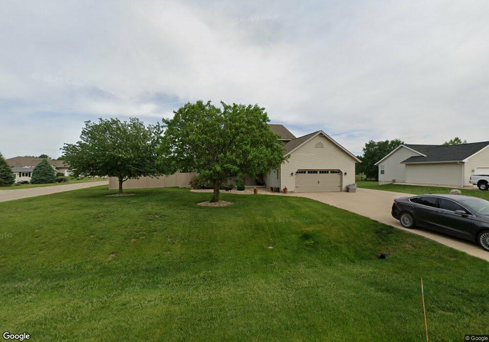
305 Brougham Rd Robins, IA 52328
Estimated Value: $414,000 - $432,000
4
Beds
3
Baths
2,182
Sq Ft
$194/Sq Ft
Est. Value
About This Home
This home is located at 305 Brougham Rd, Robins, IA 52328 and is currently estimated at $423,908, approximately $194 per square foot. 305 Brougham Rd is a home located in Linn County with nearby schools including Echo Hill Elementary School, Oak Ridge School, and Linn-Mar High School.
Ownership History
Date
Name
Owned For
Owner Type
Purchase Details
Closed on
Aug 1, 2017
Sold by
Paul Patrick J and Paul Mary E
Bought by
Walters Brian C and Salat Hillerie J
Current Estimated Value
Home Financials for this Owner
Home Financials are based on the most recent Mortgage that was taken out on this home.
Original Mortgage
$201,500
Outstanding Balance
$168,136
Interest Rate
3.96%
Mortgage Type
VA
Estimated Equity
$255,772
Purchase Details
Closed on
Dec 18, 2000
Sold by
Manley Dennis R and Manley Janie L
Bought by
Paul Patrick J and Paul Mary E
Home Financials for this Owner
Home Financials are based on the most recent Mortgage that was taken out on this home.
Original Mortgage
$110,000
Interest Rate
7.83%
Create a Home Valuation Report for This Property
The Home Valuation Report is an in-depth analysis detailing your home's value as well as a comparison with similar homes in the area
Home Values in the Area
Average Home Value in this Area
Purchase History
| Date | Buyer | Sale Price | Title Company |
|---|---|---|---|
| Walters Brian C | $285,000 | None Available | |
| Paul Patrick J | $216,500 | -- |
Source: Public Records
Mortgage History
| Date | Status | Borrower | Loan Amount |
|---|---|---|---|
| Open | Walters Brian C | $201,500 | |
| Previous Owner | Paul Patrick J | $110,000 |
Source: Public Records
Tax History
| Year | Tax Paid | Tax Assessment Tax Assessment Total Assessment is a certain percentage of the fair market value that is determined by local assessors to be the total taxable value of land and additions on the property. | Land | Improvement |
|---|---|---|---|---|
| 2025 | $4,706 | $412,000 | $54,600 | $357,400 |
| 2024 | $5,024 | $324,800 | $54,600 | $270,200 |
| 2023 | $5,024 | $324,800 | $54,600 | $270,200 |
| 2022 | $5,212 | $307,700 | $54,600 | $253,100 |
| 2021 | $5,264 | $307,700 | $54,600 | $253,100 |
| 2020 | $5,264 | $290,300 | $54,600 | $235,700 |
| 2019 | $5,314 | $293,700 | $54,600 | $239,100 |
Source: Public Records
Map
Nearby Homes
- 0 Maple St
- 8932 Norway Dr NE
- 8608 Flatbush Ct NE
- 165 Timber Ln
- 625 Freeseway Dr
- 804 Palmyra Dr NE
- 70.78 Acres M L Quass Rd
- 8201 Council St NE
- 345 Dutch Dr
- 929 Messina Dr NE
- 629 Winterberry Place NE Unit 629
- 207 Meadows Field Dr NE
- 222 Mccarran Ave NE
- 226 Mccarran Ave NE
- 1623 Petrus Dr NE
- 219 Mccarran Ave NE
- 233 Mccarran Ave NE
- 8806 Zeppelin Ave
- 3230 N Center Point Rd Unit Lot 3
- 8800 Zeppelin Ave
- 315 Brougham Rd
- 320 Phaeton Dr
- 225 Brougham Rd
- 325 Brougham Rd
- 307 Brougham Ct
- 330 Phaeton Dr
- 305 Phaeton Dr
- 335 Brougham Rd
- 215 Brougham Rd
- 230 Brougham Rd
- 350 Phaeton Dr
- 315 Phaeton Dr
- 220 Brougham Rd
- 309 Brougham Ct
- 355 Brougham Rd
- 312 Brougham Ct
- 325 Phaeton Dr
- 260 Landau St
- 205 Brougham Rd
- 370 Phaeton Dr
Your Personal Tour Guide
Ask me questions while you tour the home.