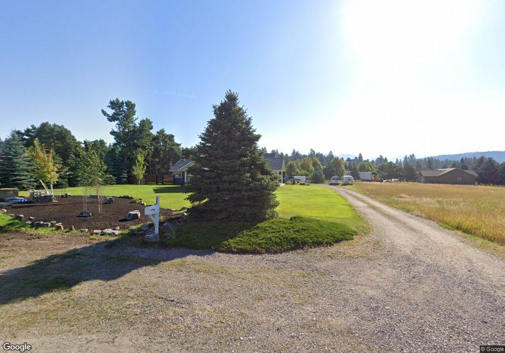
305 Chapman Hill Rd Bigfork, MT 59911
Estimated Value: $903,000 - $1,070,000
3
Beds
3
Baths
3,071
Sq Ft
$312/Sq Ft
Est. Value
About This Home
This home is located at 305 Chapman Hill Rd, Bigfork, MT 59911 and is currently estimated at $959,324, approximately $312 per square foot. 305 Chapman Hill Rd is a home located in Flathead County with nearby schools including Bigfork Elementary School, Bigfork Middle School, and Bigfork High School.
Ownership History
Date
Name
Owned For
Owner Type
Purchase Details
Closed on
Apr 11, 2023
Sold by
Sgrenci Peter M
Bought by
Sgrenci Family Trust
Current Estimated Value
Purchase Details
Closed on
Apr 30, 2019
Sold by
Vineyard Glenna
Bought by
Sgrenci Peter M and Sgrenci Tanya M
Home Financials for this Owner
Home Financials are based on the most recent Mortgage that was taken out on this home.
Original Mortgage
$460,500
Interest Rate
4.3%
Mortgage Type
Commercial
Create a Home Valuation Report for This Property
The Home Valuation Report is an in-depth analysis detailing your home's value as well as a comparison with similar homes in the area
Home Values in the Area
Average Home Value in this Area
Purchase History
| Date | Buyer | Sale Price | Title Company |
|---|---|---|---|
| Sgrenci Family Trust | -- | None Listed On Document | |
| Sgrenci Peter M | -- | First Title Of Montana |
Source: Public Records
Mortgage History
| Date | Status | Borrower | Loan Amount |
|---|---|---|---|
| Previous Owner | Sgrenci Peter M | $460,500 |
Source: Public Records
Tax History
| Year | Tax Paid | Tax Assessment Tax Assessment Total Assessment is a certain percentage of the fair market value that is determined by local assessors to be the total taxable value of land and additions on the property. | Land | Improvement |
|---|---|---|---|---|
| 2025 | $3,590 | $915,200 | $0 | $0 |
| 2024 | $3,999 | $716,600 | $0 | $0 |
| 2023 | $4,089 | $716,600 | $0 | $0 |
| 2022 | $3,848 | $481,300 | $0 | $0 |
| 2021 | $3,784 | $481,300 | $0 | $0 |
| 2020 | $3,656 | $442,808 | $0 | $0 |
| 2019 | $3,487 | $442,808 | $0 | $0 |
| 2018 | $2,135 | $411,268 | $0 | $0 |
| 2017 | $2,087 | $411,268 | $0 | $0 |
| 2016 | $2,237 | $432,100 | $0 | $0 |
| 2015 | $2,059 | $432,100 | $0 | $0 |
| 2014 | $1,980 | $237,334 | $0 | $0 |
Source: Public Records
Map
Nearby Homes
- 623 Mill Pond Place
- 39 Golf Terrace Unit 5
- 130 S Crestview Terrace
- 73 Golf Terrace
- 172 Holt Dr Unit A, B & C
- 101 S Crestview Terrace
- 107 S Crestview Terrace
- 112 O'Brien Terrace Unit A
- 94 Golf Terrace
- 109 O'Brien Terrace Unit C
- 112 Sunrise Terrace
- 486 Hogue Dr
- 260 Crestview Dr
- 667 Commerce St
- 1114 Lake Pointe Dr
- 180 Vista Ln Unit 137
- 180 Vista Ln Unit 111
- 180 Vista Ln Unit 254
- 180 Vista Ln Unit 301
- 324 Lake Hills Dr
- 305 Chapman Hill Dr
- 307 Chapman Hill Dr
- 307 Chapman Hill Rd
- 215 Chapman Hill Rd
- 251 Bluebunch Ct
- 243 Bluebunch Ct
- 723 Doug Fir Cir
- 236 Bluebunch Ct Unit 43
- 235 Bluebunch Ct
- 235 Bluebunch Ct Unit Lot 40
- 3 Crossbuck Trail
- 3 Crossbuck Trail Unit Lots 98-113
- 3 Crossbuck Trail
- 3 Crossbuck Trail
- 731 Doug Fir Cir Unit Lot 21
- 731 Doug Fir Cir
- 5 Crossbuck Trail
- 228 Bluebunch Ct Unit Lot 44 Ponderosa Boa
- 228 Bluebunch Ct Unit Lot 44
- 228 Bluebunch Ct
Your Personal Tour Guide
Ask me questions while you tour the home.