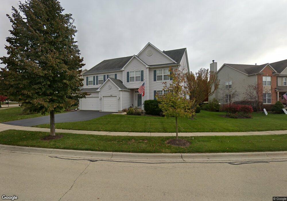
305 Denton Ln South Elgin, IL 60177
Thornwood NeighborhoodEstimated Value: $565,000 - $630,000
4
Beds
3
Baths
3,150
Sq Ft
$188/Sq Ft
Est. Value
About This Home
This home is located at 305 Denton Ln, South Elgin, IL 60177 and is currently estimated at $591,356, approximately $187 per square foot. 305 Denton Ln is a home located in Kane County with nearby schools including Corron Elementary School, Wredling Middle School, and St Charles North High School.
Ownership History
Date
Name
Owned For
Owner Type
Purchase Details
Closed on
Sep 4, 2003
Sold by
Kwasnick Michael A and Kwasnick Arlene R
Bought by
Kwasnick Michael A and Kwasnick Arlene R
Current Estimated Value
Home Financials for this Owner
Home Financials are based on the most recent Mortgage that was taken out on this home.
Original Mortgage
$87,400
Interest Rate
6.33%
Mortgage Type
Purchase Money Mortgage
Create a Home Valuation Report for This Property
The Home Valuation Report is an in-depth analysis detailing your home's value as well as a comparison with similar homes in the area
Home Values in the Area
Average Home Value in this Area
Purchase History
| Date | Buyer | Sale Price | Title Company |
|---|---|---|---|
| Kwasnick Michael A | -- | -- | |
| Kwasnick Michael A | $364,000 | Chicago Title Insurance Co |
Source: Public Records
Mortgage History
| Date | Status | Borrower | Loan Amount |
|---|---|---|---|
| Closed | Kwasnick Michael A | $87,400 |
Source: Public Records
Tax History Compared to Growth
Tax History
| Year | Tax Paid | Tax Assessment Tax Assessment Total Assessment is a certain percentage of the fair market value that is determined by local assessors to be the total taxable value of land and additions on the property. | Land | Improvement |
|---|---|---|---|---|
| 2024 | -- | $160,527 | $44,683 | $115,844 |
| 2023 | $2,501 | $145,024 | $40,368 | $104,656 |
| 2022 | $9,606 | $132,237 | $36,809 | $95,428 |
| 2021 | $8,988 | $123,632 | $34,414 | $89,218 |
| 2020 | $8,672 | $118,025 | $32,853 | $85,172 |
| 2019 | $8,231 | $112,427 | $31,295 | $81,132 |
| 2018 | $7,625 | $123,190 | $29,482 | $93,708 |
| 2017 | $8,963 | $116,459 | $27,871 | $88,588 |
| 2016 | $8,972 | $108,043 | $25,857 | $82,186 |
| 2015 | -- | $99,031 | $23,700 | $75,331 |
| 2014 | -- | $97,808 | $23,407 | $74,401 |
| 2013 | -- | $86,615 | $24,024 | $62,591 |
Source: Public Records
Map
Nearby Homes
- 284 Nicole Dr Unit C
- 675 Oak Ln
- 598 Lake Ridge Dr
- 552 Waters Edge Dr
- 8N465 Shady Ln
- 1251 Lansbrook Dr
- 4 Persimmon Ln
- 3547 Doral Dr
- 2538 Hatfield Ct
- 2440 Daybreak Ct
- 731 Lake Ridge Dr
- 2452 Daybreak Ct Unit 2452
- 7N949 Stevens Rd
- 2437 Daybreak Ct
- 2550 Stony Ln
- 7N919 Cloverfield Rd
- 2193 W Thornwood Dr
- 1828 Coralito Ln
- 852 Sunrise Dr
- 7N235 Windsor Dr Unit 4