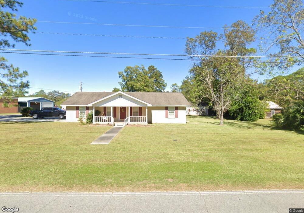
305 E Carter Ave Blackshear, GA 31516
Estimated Value: $236,000 - $304,000
4
Beds
3
Baths
2,816
Sq Ft
$99/Sq Ft
Est. Value
About This Home
This home is located at 305 E Carter Ave, Blackshear, GA 31516 and is currently estimated at $277,752, approximately $98 per square foot. 305 E Carter Ave is a home located in Pierce County with nearby schools including Pierce County High School, Southeast Christian Academy, and Truth Christian Academy.
Ownership History
Date
Name
Owned For
Owner Type
Purchase Details
Closed on
May 4, 2021
Sold by
Thornton Janice L
Bought by
Strickland Edward
Current Estimated Value
Home Financials for this Owner
Home Financials are based on the most recent Mortgage that was taken out on this home.
Original Mortgage
$173,895
Outstanding Balance
$156,583
Interest Rate
3.1%
Mortgage Type
FHA
Estimated Equity
$121,169
Purchase Details
Closed on
Jun 3, 2015
Sold by
Thornton Janice L
Bought by
Thornton Janice L and Thornton Kerry
Home Financials for this Owner
Home Financials are based on the most recent Mortgage that was taken out on this home.
Original Mortgage
$113,960
Interest Rate
3.75%
Mortgage Type
FHA
Purchase Details
Closed on
May 22, 2015
Sold by
Wright Terry L
Bought by
Thornton Janice L
Home Financials for this Owner
Home Financials are based on the most recent Mortgage that was taken out on this home.
Original Mortgage
$113,960
Interest Rate
3.75%
Mortgage Type
FHA
Purchase Details
Closed on
Aug 18, 2011
Sold by
Wright Terry L
Bought by
Wright Terry L and Moore Michelle L
Purchase Details
Closed on
Jun 29, 2007
Sold by
Griffis C S
Bought by
Wright Terry L
Home Financials for this Owner
Home Financials are based on the most recent Mortgage that was taken out on this home.
Original Mortgage
$118,750
Interest Rate
6.37%
Mortgage Type
New Conventional
Purchase Details
Closed on
Dec 13, 2000
Sold by
Griffis C S
Bought by
Griffis Annie Belle
Purchase Details
Closed on
Dec 12, 1997
Sold by
Pitts Robert A and Pitts Pyong H
Bought by
Griffis C S
Purchase Details
Closed on
Dec 15, 1992
Sold by
K A Woodalll Trustee
Bought by
Pitts Robert A and Pitts Pyong H
Purchase Details
Closed on
May 22, 1981
Sold by
Sapp L O Est By Exec
Bought by
Iris Woodall E and Iris Woodall
Purchase Details
Closed on
Jun 5, 1972
Sold by
Mullis Alice Clark
Bought by
Clark Joe P
Purchase Details
Closed on
Mar 5, 1963
Sold by
Carter Mack
Bought by
Clark Joe R and Everlean Clark
Purchase Details
Closed on
Oct 20, 1956
Sold by
Carter Mack
Bought by
Sapp L O
Create a Home Valuation Report for This Property
The Home Valuation Report is an in-depth analysis detailing your home's value as well as a comparison with similar homes in the area
Home Values in the Area
Average Home Value in this Area
Purchase History
| Date | Buyer | Sale Price | Title Company |
|---|---|---|---|
| Strickland Edward | $179,900 | -- | |
| Thornton Janice L | -- | -- | |
| Thornton Janice L | $144,000 | -- | |
| Wright Terry L | -- | -- | |
| Wright Terry L | $125,000 | -- | |
| Griffis Annie Belle | -- | -- | |
| Griffis C S | $68,000 | -- | |
| Pitts Robert A | $60,000 | -- | |
| Iris Woodall E | -- | -- | |
| Clark Joe P | -- | -- | |
| Clark Joe R | -- | -- | |
| Sapp L O | -- | -- |
Source: Public Records
Mortgage History
| Date | Status | Borrower | Loan Amount |
|---|---|---|---|
| Open | Strickland Edward | $173,895 | |
| Previous Owner | Thornton Janice L | $113,960 | |
| Previous Owner | Wright Terry L | $118,750 |
Source: Public Records
Tax History
| Year | Tax Paid | Tax Assessment Tax Assessment Total Assessment is a certain percentage of the fair market value that is determined by local assessors to be the total taxable value of land and additions on the property. | Land | Improvement |
|---|---|---|---|---|
| 2025 | $3,379 | $107,189 | $23,100 | $84,089 |
| 2024 | $3,379 | $105,352 | $23,100 | $82,252 |
| 2023 | $3,311 | $103,256 | $23,100 | $80,156 |
| 2022 | $2,611 | $68,751 | $5,572 | $63,179 |
| 2021 | $2,307 | $66,354 | $5,572 | $60,782 |
| 2020 | $2,308 | $63,956 | $5,572 | $58,384 |
| 2019 | $2,308 | $63,956 | $5,572 | $58,384 |
| 2018 | $2,255 | $60,586 | $5,572 | $55,014 |
| 2017 | $2,463 | $59,158 | $5,572 | $53,586 |
| 2016 | $2,174 | $59,158 | $5,572 | $53,586 |
| 2015 | -- | $59,157 | $5,572 | $53,586 |
| 2014 | -- | $59,157 | $5,572 | $53,586 |
| 2013 | -- | $59,157 | $5,571 | $53,585 |
Source: Public Records
Map
Nearby Homes
- 6034 Turkey Oak Rd
- 331 Central Ave W
- 322 Mcgregor St
- 402 Mcgregor St
- 315 Strickland Ave
- 911 Hendry St
- ST. ROUTE 121 Georgia 121
- 420 Greenleaf St
- 622 E Main St
- 816 Porter St
- 818 Porter St
- 3019 Aragon Ct
- TBD Trudie Rd
- 517 Lazy Ln
- 3551 Cason Rd
- 121 Beaver Dr
- 854 Jenkins St
- 918 Main St
- 00 Yeomans St
- 4055 Tamrose Ct
Your Personal Tour Guide
Ask me questions while you tour the home.