Estimated Value: $311,858 - $406,000
3
Beds
2
Baths
1,852
Sq Ft
$183/Sq Ft
Est. Value
About This Home
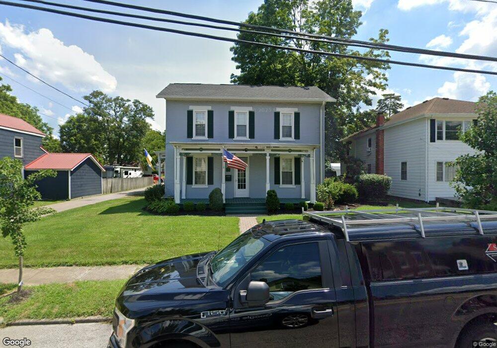
This home is located at 305 E Main St, Mason, OH 45040 and is currently estimated at $339,715, approximately $183 per square foot. 305 E Main St is a home located in Warren County with nearby schools including Mason Intermediate Elementary School, Mason Middle School, and William Mason High School.
Ownership History
Date
Name
Owned For
Owner Type
Purchase Details
Closed on
Nov 4, 1993
Sold by
Thomas Denoma and Thomas M.
Bought by
Parks Parks and Parks Jason P
Current Estimated Value
Purchase Details
Closed on
Jun 9, 1993
Sold by
Randall Hobson and Randall E.
Bought by
Thomas Denoma and Thomas M.
Purchase Details
Closed on
Oct 18, 1989
Sold by
Franklin Bravard and Franklin O.
Bought by
Randall Hobson and Randall E.
Purchase Details
Closed on
Jan 17, 1986
Sold by
Bravard Bravard and Bravard Beverly K
Bought by
Franklin Bravard and Franklin O.
Purchase Details
Closed on
Jun 3, 1981
Sold by
Wortman Wortman and Wortman Gregroy J
Create a Home Valuation Report for This Property
The Home Valuation Report is an in-depth analysis detailing your home's value as well as a comparison with similar homes in the area
Home Values in the Area
Average Home Value in this Area
Purchase History
| Date | Buyer | Sale Price | Title Company |
|---|---|---|---|
| Parks Parks | $87,500 | -- | |
| Thomas Denoma | $76,500 | -- | |
| Randall Hobson | $61,000 | -- | |
| Franklin Bravard | -- | -- | |
| -- | $51,000 | -- |
Source: Public Records
Tax History
| Year | Tax Paid | Tax Assessment Tax Assessment Total Assessment is a certain percentage of the fair market value that is determined by local assessors to be the total taxable value of land and additions on the property. | Land | Improvement |
|---|---|---|---|---|
| 2025 | $3,513 | $86,490 | $32,440 | $54,050 |
| 2024 | $3,513 | $86,490 | $32,440 | $54,050 |
| 2023 | $3,071 | $63,861 | $15,960 | $47,901 |
| 2022 | $3,031 | $63,861 | $15,960 | $47,901 |
| 2021 | $2,872 | $63,861 | $15,960 | $47,901 |
| 2020 | $2,723 | $51,919 | $12,975 | $38,945 |
| 2019 | $2,503 | $51,919 | $12,975 | $38,945 |
| 2018 | $2,512 | $51,919 | $12,975 | $38,945 |
| 2017 | $2,600 | $50,169 | $12,698 | $37,471 |
| 2016 | $2,679 | $50,169 | $12,698 | $37,471 |
| 2015 | $2,684 | $50,169 | $12,698 | $37,471 |
| 2014 | $2,795 | $48,710 | $12,330 | $36,380 |
| 2013 | $2,801 | $51,260 | $12,970 | $38,290 |
Source: Public Records
Map
Nearby Homes
- 308 E Main St
- 306 E Main St
- 304 E Main St
- 107 Cowan Dr
- 5130 Franklin Park St
- 5173 Franklin Park St
- 4922 Bordeaux Ln Unit 4922
- 404 W Church St
- 200 Woodland Rd
- 4897 Bordeaux Ln Unit 4897
- 4943 Isaac Ln
- 4782 Bordeaux Ln
- 4776 Bordeaux Ln
- 4268 Fontenay
- 4734 Margaret Ct
- 4684 Court Yard Dr
- 600 W Church St
- 3 Carnell Place
- 4163 Spyglass Hill Unit 4163
- 4521 Springhouse Ct
- 307 E Main St
- 311 E Main St
- 304 Cox St
- 300 Cox St
- 308 Cox St
- 306 E Main St Unit A
- 304 E Main St Unit A
- 302 E Main St
- 310 Cox St
- 300 E Main St
- 209 E Main St
- 313 E Main St
- 308 E Main St Unit A
- 310 E Main St
- 310 E Main St Unit A
- 312 E Main St
- 312 E Main St Unit A
- 212 E Main St
- 201 E Main St
- 207 E Main St
Your Personal Tour Guide
Ask me questions while you tour the home.