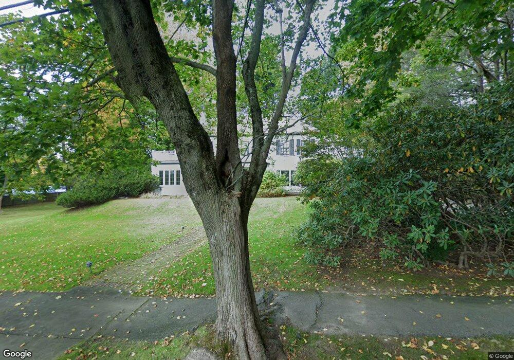
305 Fuller St West Newton, MA 02465
West Newton NeighborhoodEstimated Value: $2,681,043 - $3,571,000
4
Beds
5
Baths
3,919
Sq Ft
$791/Sq Ft
Est. Value
About This Home
This home is located at 305 Fuller St, West Newton, MA 02465 and is currently estimated at $3,098,011, approximately $790 per square foot. 305 Fuller St is a home located in Middlesex County with nearby schools including Peirce Elementary School, F.A. Day Middle School, and Newton North High School.
Ownership History
Date
Name
Owned For
Owner Type
Purchase Details
Closed on
Jan 3, 2013
Sold by
Herzog David
Bought by
David A Herzog T
Current Estimated Value
Purchase Details
Closed on
Jan 18, 1994
Sold by
Herzog Terese J
Bought by
Herzog David A
Create a Home Valuation Report for This Property
The Home Valuation Report is an in-depth analysis detailing your home's value as well as a comparison with similar homes in the area
Home Values in the Area
Average Home Value in this Area
Purchase History
| Date | Buyer | Sale Price | Title Company |
|---|---|---|---|
| David A Herzog T | -- | -- | |
| Herzog David A | $55,000 | -- |
Source: Public Records
Mortgage History
| Date | Status | Borrower | Loan Amount |
|---|---|---|---|
| Previous Owner | Herzog David A | $100,000 | |
| Previous Owner | Herzog David A | $120,000 | |
| Previous Owner | Herzog David A | $99,000 |
Source: Public Records
Tax History Compared to Growth
Tax History
| Year | Tax Paid | Tax Assessment Tax Assessment Total Assessment is a certain percentage of the fair market value that is determined by local assessors to be the total taxable value of land and additions on the property. | Land | Improvement |
|---|---|---|---|---|
| 2025 | $22,703 | $2,316,600 | $1,540,000 | $776,600 |
| 2024 | $21,951 | $2,249,100 | $1,495,100 | $754,000 |
| 2023 | $21,215 | $2,084,000 | $1,206,100 | $877,900 |
| 2022 | $20,253 | $1,925,200 | $1,116,800 | $808,400 |
| 2021 | $19,542 | $1,816,200 | $1,053,600 | $762,600 |
| 2020 | $18,961 | $1,816,200 | $1,053,600 | $762,600 |
| 2019 | $18,426 | $1,763,300 | $1,022,900 | $740,400 |
| 2018 | $17,659 | $1,632,100 | $905,200 | $726,900 |
| 2017 | $17,121 | $1,539,700 | $854,000 | $685,700 |
| 2016 | $16,376 | $1,439,000 | $798,100 | $640,900 |
| 2015 | $15,614 | $1,344,900 | $745,900 | $599,000 |
Source: Public Records
Map
Nearby Homes
- 10 Ruane Rd
- 1754 Washington St
- 40 Sewall St
- 1639 Washington St
- 18 Sewall St
- 283 Woodland Rd
- 17 Gilbert St
- 51 Bourne St
- 222 Prince St
- 0 Duncan Rd Unit 72925240
- 1488 Washington St Unit 1488
- 39 Valentine Park
- 115 Windsor Rd
- 157 Stanton Ave
- 513 Chestnut St
- 12 Inis Cir
- 13 Weir St
- 308 Prince St
- 36 Troy Ln
- 17 Crescent St
- 293 Fuller St
- 1600 Commonwealth Ave
- 1592 Commonwealth Ave
- 1580 Commonwealth Ave
- 279 Fuller St
- 5 Pickwick Rd
- 6 Pickwick Rd
- 1572 Commonwealth Ave
- 1603 Commonwealth Ave
- 1603 Commonwealth Ave Unit 2
- 8 Pickwick Rd
- 1611 Commonwealth Ave
- 1595 Commonwealth Ave
- 21 Pickwick Rd
- 1640 Commonwealth Ave
- 1585 Commonwealth Ave
- 246 Temple St
- 1564 Commonwealth Ave
- 16 Pickwick Rd
- 1633 Commonwealth Ave