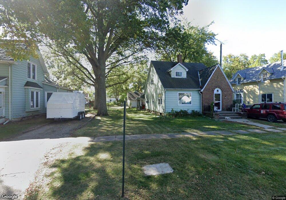
305 Hill St Harlan, IA 51537
Estimated Value: $96,000 - $143,000
3
Beds
2
Baths
1,473
Sq Ft
$80/Sq Ft
Est. Value
About This Home
This home is located at 305 Hill St, Harlan, IA 51537 and is currently estimated at $117,687, approximately $79 per square foot. 305 Hill St is a home located in Shelby County with nearby schools including Harlan Primary School, Harlan Intermediate School, and Harlan Community Middle School.
Ownership History
Date
Name
Owned For
Owner Type
Purchase Details
Closed on
Jan 10, 2017
Sold by
Stinn Lee F and Stinn Kathaleen A
Bought by
Phifer Fredrick H and Phifer Adam L
Current Estimated Value
Purchase Details
Closed on
Mar 22, 2005
Sold by
Brensel Harold Lee and Brensel Marlene
Bought by
Stinn Jason Lee
Home Financials for this Owner
Home Financials are based on the most recent Mortgage that was taken out on this home.
Original Mortgage
$50,000
Interest Rate
5.61%
Mortgage Type
New Conventional
Create a Home Valuation Report for This Property
The Home Valuation Report is an in-depth analysis detailing your home's value as well as a comparison with similar homes in the area
Home Values in the Area
Average Home Value in this Area
Purchase History
| Date | Buyer | Sale Price | Title Company |
|---|---|---|---|
| Phifer Fredrick H | $50,000 | None Available | |
| Stinn Jason Lee | $62,500 | None Available |
Source: Public Records
Mortgage History
| Date | Status | Borrower | Loan Amount |
|---|---|---|---|
| Previous Owner | Stinn Jason Lee | $50,000 |
Source: Public Records
Tax History Compared to Growth
Tax History
| Year | Tax Paid | Tax Assessment Tax Assessment Total Assessment is a certain percentage of the fair market value that is determined by local assessors to be the total taxable value of land and additions on the property. | Land | Improvement |
|---|---|---|---|---|
| 2025 | $1,170 | $83,510 | $7,700 | $75,810 |
| 2024 | $1,170 | $72,784 | $7,700 | $65,084 |
| 2023 | $1,230 | $72,784 | $7,700 | $65,084 |
| 2022 | $1,230 | $59,035 | $7,700 | $51,335 |
| 2021 | $1,150 | $59,035 | $7,700 | $51,335 |
| 2020 | $1,156 | $56,284 | $7,700 | $48,584 |
| 2019 | $1,086 | $51,656 | $0 | $0 |
| 2018 | $1,060 | $51,656 | $0 | $0 |
| 2017 | $1,060 | $51,656 | $0 | $0 |
| 2016 | $1,214 | $66,876 | $0 | $0 |
| 2015 | $1,214 | $64,821 | $0 | $0 |
| 2014 | $1,170 | $64,821 | $0 | $0 |
Source: Public Records
Map
Nearby Homes