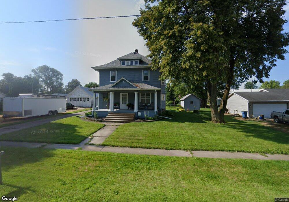
305 Main St Calamus, IA 52729
Estimated Value: $128,000 - $181,000
3
Beds
2
Baths
1,952
Sq Ft
$82/Sq Ft
Est. Value
About This Home
This home is located at 305 Main St, Calamus, IA 52729 and is currently estimated at $160,502, approximately $82 per square foot. 305 Main St is a home located in Clinton County with nearby schools including Calamus Wheatland High School.
Ownership History
Date
Name
Owned For
Owner Type
Purchase Details
Closed on
Mar 12, 2008
Sold by
Kruse Jason J and Kruse Angela B
Bought by
Barkhurst Cornell M and Barkhurst Melaia K
Current Estimated Value
Home Financials for this Owner
Home Financials are based on the most recent Mortgage that was taken out on this home.
Original Mortgage
$80,000
Outstanding Balance
$49,972
Interest Rate
5.79%
Mortgage Type
New Conventional
Estimated Equity
$110,530
Create a Home Valuation Report for This Property
The Home Valuation Report is an in-depth analysis detailing your home's value as well as a comparison with similar homes in the area
Home Values in the Area
Average Home Value in this Area
Purchase History
| Date | Buyer | Sale Price | Title Company |
|---|---|---|---|
| Barkhurst Cornell M | $12,720 | None Available |
Source: Public Records
Mortgage History
| Date | Status | Borrower | Loan Amount |
|---|---|---|---|
| Open | Barkhurst Cornell M | $80,000 |
Source: Public Records
Tax History Compared to Growth
Tax History
| Year | Tax Paid | Tax Assessment Tax Assessment Total Assessment is a certain percentage of the fair market value that is determined by local assessors to be the total taxable value of land and additions on the property. | Land | Improvement |
|---|---|---|---|---|
| 2025 | $1,798 | $144,800 | $12,600 | $132,200 |
| 2024 | $1,798 | $144,290 | $12,600 | $131,690 |
| 2023 | $1,784 | $144,290 | $12,600 | $131,690 |
| 2022 | $1,012 | $133,460 | $12,600 | $120,860 |
| 2021 | $892 | $71,610 | $10,080 | $61,530 |
| 2020 | $892 | $62,140 | $10,080 | $52,060 |
| 2019 | $876 | $62,140 | $0 | $0 |
| 2018 | $860 | $62,140 | $0 | $0 |
| 2017 | $860 | $62,140 | $0 | $0 |
| 2016 | $1,258 | $88,990 | $0 | $0 |
| 2015 | $1,258 | $88,990 | $0 | $0 |
| 2014 | $1,230 | $88,990 | $0 | $0 |
| 2013 | $1,202 | $0 | $0 | $0 |
Source: Public Records
Map
Nearby Homes