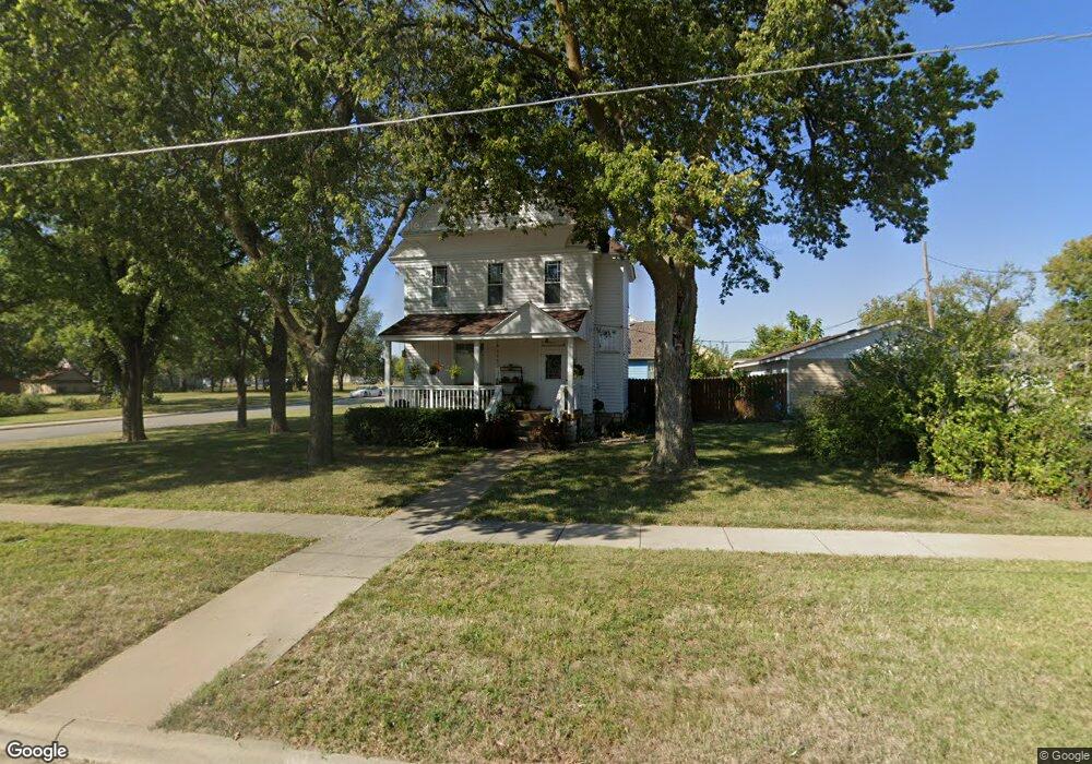
305 N Rothsay Ave Minneapolis, KS 67467
Estimated Value: $171,000 - $205,000
3
Beds
2
Baths
1,560
Sq Ft
$120/Sq Ft
Est. Value
About This Home
This home is located at 305 N Rothsay Ave, Minneapolis, KS 67467 and is currently estimated at $187,818, approximately $120 per square foot. 305 N Rothsay Ave is a home located in Ottawa County with nearby schools including Minneapolis Elementary School and Minneapolis High School.
Create a Home Valuation Report for This Property
The Home Valuation Report is an in-depth analysis detailing your home's value as well as a comparison with similar homes in the area
Home Values in the Area
Average Home Value in this Area
Tax History Compared to Growth
Tax History
| Year | Tax Paid | Tax Assessment Tax Assessment Total Assessment is a certain percentage of the fair market value that is determined by local assessors to be the total taxable value of land and additions on the property. | Land | Improvement |
|---|---|---|---|---|
| 2025 | $3,466 | $19,520 | $461 | $19,059 |
| 2024 | $3,466 | $19,520 | $461 | $19,059 |
| 2023 | $2,984 | $16,973 | $461 | $16,512 |
| 2022 | $2,878 | $15,571 | $461 | $15,110 |
| 2021 | $2,732 | $14,306 | $461 | $13,845 |
| 2020 | $2,732 | $14,001 | $461 | $13,540 |
| 2019 | $2,735 | $13,768 | $461 | $13,307 |
| 2018 | $2,625 | $13,202 | $461 | $12,741 |
| 2017 | $2,544 | $12,648 | $461 | $12,187 |
| 2016 | $2,551 | $12,523 | $461 | $12,062 |
| 2015 | -- | $12,194 | $461 | $11,733 |
| 2014 | -- | $12,194 | $461 | $11,733 |
Source: Public Records
Map
Nearby Homes
- 116 E 3rd St
- 110 Spruce Ave
- 116 W 4th St
- 222 Mackenzie St
- 813 N Rock St
- 529 N Sheridan St
- 716 N Rothsay Ave
- 725 Argyle Ave
- 608 N Concord St
- 532 Laurel St
- 432 Mockingbird Ln
- 00000 Frontier Rd
- 1059 N 190th Rd
- 1027 N 190th Rd
- 1009 N 190th Rd
- 0 Ivy Rd
- 00000 N 190th Rd
- 751 N 190th Rd
- 00000 N 170th Rd L3 Blk 2
- 325 N Nelson St