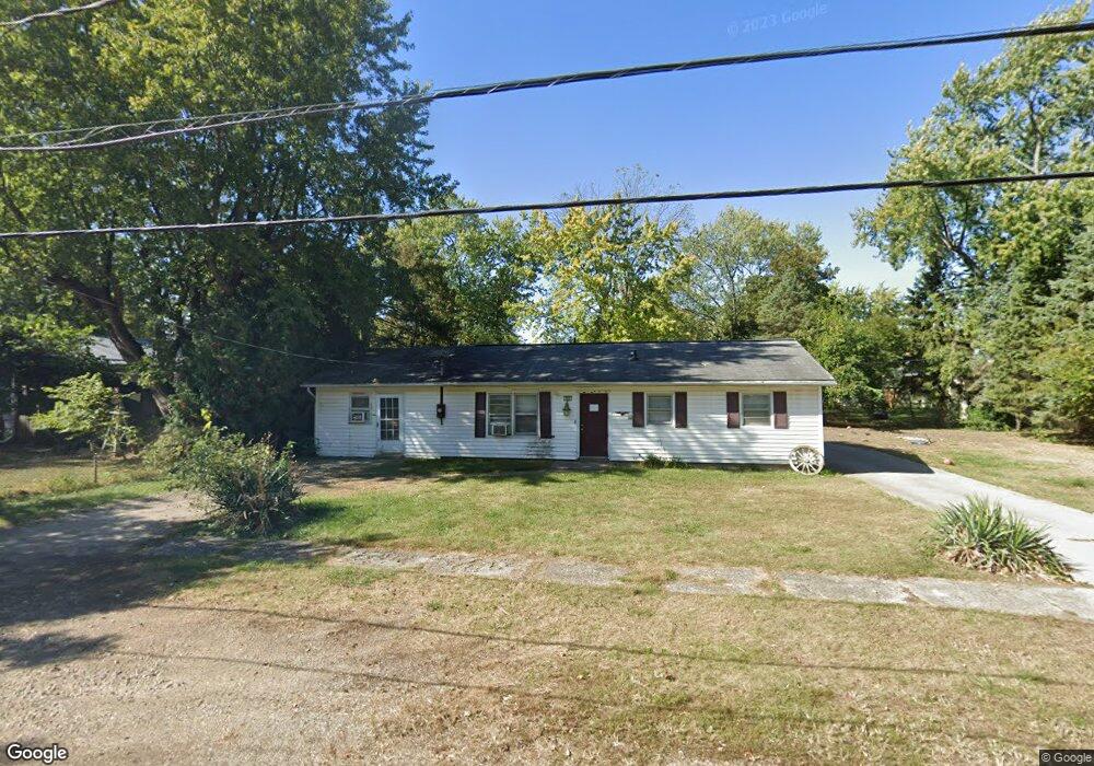
305 Oliver St Marion, OH 43302
Estimated Value: $114,000 - $175,645
3
Beds
1
Bath
1,768
Sq Ft
$83/Sq Ft
Est. Value
About This Home
This home is located at 305 Oliver St, Marion, OH 43302 and is currently estimated at $147,161, approximately $83 per square foot. 305 Oliver St is a home located in Marion County with nearby schools including James A. Garfield Elementary School, Ulysses S. Grant Middle School, and Harding High School.
Ownership History
Date
Name
Owned For
Owner Type
Purchase Details
Closed on
Aug 16, 2016
Sold by
Liberty National Bank
Bought by
Fields Preston W
Current Estimated Value
Purchase Details
Closed on
Mar 9, 2016
Sold by
D&R Investment Ltd
Bought by
Liberty National Bank
Purchase Details
Closed on
Jun 3, 2005
Sold by
Cumston Ralph and Cumston Patricia
Bought by
D&R Investment Ltd
Purchase Details
Closed on
Jun 28, 2004
Bought by
Liberty National Bank
Purchase Details
Closed on
Feb 26, 2002
Bought by
Liberty National Bank
Purchase Details
Closed on
Apr 20, 1998
Bought by
Liberty National Bank
Create a Home Valuation Report for This Property
The Home Valuation Report is an in-depth analysis detailing your home's value as well as a comparison with similar homes in the area
Home Values in the Area
Average Home Value in this Area
Purchase History
| Date | Buyer | Sale Price | Title Company |
|---|---|---|---|
| Fields Preston W | $87,500 | None Available | |
| Liberty National Bank | $119,535 | Attorney | |
| D&R Investment Ltd | -- | Chicago Title | |
| Liberty National Bank | $65,000 | -- | |
| Liberty National Bank | -- | -- | |
| Liberty National Bank | -- | -- | |
| Liberty National Bank | -- | -- | |
| Liberty National Bank | -- | -- |
Source: Public Records
Tax History Compared to Growth
Tax History
| Year | Tax Paid | Tax Assessment Tax Assessment Total Assessment is a certain percentage of the fair market value that is determined by local assessors to be the total taxable value of land and additions on the property. | Land | Improvement |
|---|---|---|---|---|
| 2024 | $1,953 | $38,980 | $3,910 | $35,070 |
| 2023 | $1,953 | $38,980 | $3,910 | $35,070 |
| 2022 | $2,076 | $38,980 | $3,910 | $35,070 |
| 2021 | $2,029 | $30,380 | $3,400 | $26,980 |
| 2020 | $1,897 | $30,380 | $3,400 | $26,980 |
| 2019 | $1,790 | $30,380 | $3,400 | $26,980 |
| 2018 | $1,890 | $21,460 | $3,400 | $18,060 |
| 2017 | $1,592 | $21,460 | $3,400 | $18,060 |
| 2016 | $1,107 | $27,720 | $3,400 | $24,320 |
| 2015 | $1,096 | $26,860 | $3,030 | $23,830 |
| 2014 | $1,497 | $26,860 | $3,030 | $23,830 |
| 2012 | $1,106 | $26,880 | $4,390 | $22,490 |
Source: Public Records
Map
Nearby Homes
- 383 Brentwood Dr
- 472 Clinton St
- 407 Latourette St
- 403 Uncapher Ave
- 213 Sharp St
- 625 Rochelle Dr
- 512 Henry St
- 889 Oak Grove Ave
- 824 Oak Grove Ave
- 579 Henry St
- 355 Lee St
- 1117 Woodrow Ave
- 645 Henry St
- 668 Uncapher Ave
- 904 Merkle Ave
- 796 Woodrow Ave
- 716 Uncapher Ave
- 681 Davids St
- 720 Woodrow Ave
- 678 Marshall St
- 287 Oliver St
- 1092 Glenwood Dr
- 300 Brentwood Dr
- 308 Brentwood Dr
- 292 Brentwood Dr
- 277 Oliver St
- 284 Brentwood Dr
- 1108 Glenwood Dr
- 288 Oliver St
- 310 Oliver St
- 286 Oliver St
- 278 Brentwood Dr
- 269 Oliver St
- 1093 Glenwood Dr
- 276 Oliver St
- 272 Brentwood Dr
- 1109 Glenwood Dr
- 299 Clinton St
- 295 Clinton St
- 301 Brentwood Dr