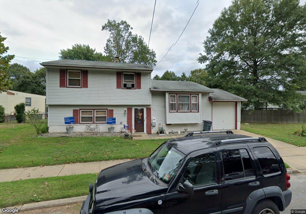
305 Otter Branch Dr Magnolia, NJ 08049
Estimated Value: $309,000 - $337,000
--
Bed
--
Bath
1,418
Sq Ft
$230/Sq Ft
Est. Value
About This Home
This home is located at 305 Otter Branch Dr, Magnolia, NJ 08049 and is currently estimated at $326,657, approximately $230 per square foot. 305 Otter Branch Dr is a home located in Camden County with nearby schools including Magnolia Elementary School, Sterling High School, and St. Teresa Regional School.
Ownership History
Date
Name
Owned For
Owner Type
Purchase Details
Closed on
Nov 30, 2006
Sold by
Grant Craig A
Bought by
Firman Joseph and Lambert Elizabeth A
Current Estimated Value
Home Financials for this Owner
Home Financials are based on the most recent Mortgage that was taken out on this home.
Original Mortgage
$183,549
Outstanding Balance
$109,618
Interest Rate
6.29%
Mortgage Type
FHA
Estimated Equity
$217,039
Create a Home Valuation Report for This Property
The Home Valuation Report is an in-depth analysis detailing your home's value as well as a comparison with similar homes in the area
Home Values in the Area
Average Home Value in this Area
Purchase History
| Date | Buyer | Sale Price | Title Company |
|---|---|---|---|
| Firman Joseph | $185,000 | -- |
Source: Public Records
Mortgage History
| Date | Status | Borrower | Loan Amount |
|---|---|---|---|
| Open | Firman Joseph | $183,549 |
Source: Public Records
Tax History Compared to Growth
Tax History
| Year | Tax Paid | Tax Assessment Tax Assessment Total Assessment is a certain percentage of the fair market value that is determined by local assessors to be the total taxable value of land and additions on the property. | Land | Improvement |
|---|---|---|---|---|
| 2025 | $7,557 | $157,400 | $49,500 | $107,900 |
| 2024 | $7,373 | $157,400 | $49,500 | $107,900 |
| 2023 | $7,373 | $157,400 | $49,500 | $107,900 |
| 2022 | $7,181 | $157,400 | $49,500 | $107,900 |
| 2021 | $7,111 | $157,400 | $49,500 | $107,900 |
| 2020 | $6,976 | $157,400 | $49,500 | $107,900 |
| 2019 | $6,844 | $157,400 | $49,500 | $107,900 |
| 2018 | $6,705 | $157,400 | $49,500 | $107,900 |
| 2017 | $6,510 | $157,400 | $49,500 | $107,900 |
| 2016 | $6,327 | $157,400 | $49,500 | $107,900 |
| 2015 | $6,109 | $157,400 | $49,500 | $107,900 |
| 2014 | $6,022 | $157,400 | $49,500 | $107,900 |
Source: Public Records
Map
Nearby Homes
- 706 Brooke Ave
- 709 Lincoln Ave
- 711 Lincoln Ave
- 707 Lincoln Ave
- 704 Brooke Ave
- 705 Lincoln Ave
- 713 Lincoln Ave
- 306 Otter Branch Dr
- 304 Otter Branch Dr
- 702 Brooke Ave
- 312 Otter Branch Dr
- 703 Lincoln Ave
- 703 W Lincoln Ave
- 302 Otter Branch Dr
- 713 Brooke Ave
- 708 W Lincoln Ave
- 710 Lincoln Ave
- 706 Lincoln Ave
- 504 Wilson Rd
- 712 Lincoln Ave