Estimated Value: $298,027 - $398,000
4
Beds
2
Baths
2,460
Sq Ft
$132/Sq Ft
Est. Value
About This Home
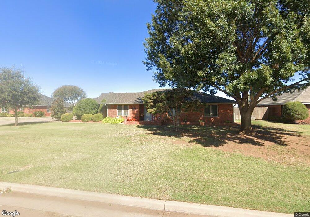
This home is located at 305 Pheasant Cir, Altus, OK 73521 and is currently estimated at $325,507, approximately $132 per square foot. 305 Pheasant Cir is a home located in Jackson County with nearby schools including Altus High School and Altus Christian Academy.
Ownership History
Date
Name
Owned For
Owner Type
Purchase Details
Closed on
Nov 13, 2020
Sold by
Ward Brandi Leigh
Bought by
Ward Wesley Shane
Current Estimated Value
Purchase Details
Closed on
Feb 4, 2005
Sold by
Weaver Floyd W and Weaver Jeannette L
Bought by
Hope Jeanette C
Home Financials for this Owner
Home Financials are based on the most recent Mortgage that was taken out on this home.
Original Mortgage
$157,945
Outstanding Balance
$80,271
Interest Rate
5.85%
Mortgage Type
VA
Estimated Equity
$245,236
Create a Home Valuation Report for This Property
The Home Valuation Report is an in-depth analysis detailing your home's value as well as a comparison with similar homes in the area
Home Values in the Area
Average Home Value in this Area
Purchase History
| Date | Buyer | Sale Price | Title Company |
|---|---|---|---|
| Ward Wesley Shane | -- | None Available | |
| Hope Jeanette C | $152,900 | None Available |
Source: Public Records
Mortgage History
| Date | Status | Borrower | Loan Amount |
|---|---|---|---|
| Open | Hope Jeanette C | $157,945 |
Source: Public Records
Tax History Compared to Growth
Tax History
| Year | Tax Paid | Tax Assessment Tax Assessment Total Assessment is a certain percentage of the fair market value that is determined by local assessors to be the total taxable value of land and additions on the property. | Land | Improvement |
|---|---|---|---|---|
| 2025 | $2,004 | $24,830 | $5,809 | $19,021 |
| 2024 | $2,004 | $24,830 | $5,809 | $19,021 |
| 2023 | $2,004 | $23,405 | $5,809 | $17,596 |
| 2022 | $1,841 | $22,724 | $5,809 | $16,915 |
| 2021 | $1,799 | $22,062 | $5,809 | $16,253 |
| 2020 | $1,822 | $22,062 | $5,809 | $16,253 |
| 2019 | $1,924 | $23,054 | $5,809 | $17,245 |
| 2018 | $1,646 | $23,054 | $5,809 | $17,245 |
| 2017 | $1,646 | $23,054 | $5,809 | $17,245 |
| 2016 | $1,706 | $23,851 | $4,322 | $19,529 |
| 2015 | $1,699 | $23,762 | $2,988 | $20,774 |
| 2014 | $1,665 | $23,300 | $2,988 | $20,312 |
Source: Public Records
Map
Nearby Homes
- 409 Pheasant Cir
- 3309 Continental Ct
- 3208 Quail Cir
- 504 Quail Run N
- 3112 Partridge Place
- 516 Quail Run S
- 3109 Stephanie Ln
- 3616 Kings Way
- 2921 Stephanie Ln
- 809 Jamestown Dr
- 1001 Stephanie Ln
- 905 N Towne Cir
- 3516 Prairie Dr W
- 1008 Trail Dr S
- 1016 Sheryl Ln
- 3212 Wendy Ln
- 1100 Prairie Dr N
- 1101 Wendy Ln
- 2524 N Robin St
- 3509 Prairie Dr E
- 309 Pheasant Cir
- 301 Pheasant Cir
- 401 Pheasant Cir
- 304 Pheasant Cir
- 308 Pheasant Cir
- 221 Pheasant Cir
- 405 Pheasant Cir
- 400 Pheasant Cir
- 300 Pheasant Cir
- 224 Pheasant Cir
- 309 Quail Run N
- 313 Quail Run N
- 305 Quail Run N
- 404 Pheasant Cir
- 317 Quail Run N
- 301 Quail Run N
- 401 Quail Run N
- 225 Quail Run N
- 405 Quail Run N
- 217 Quail Run N