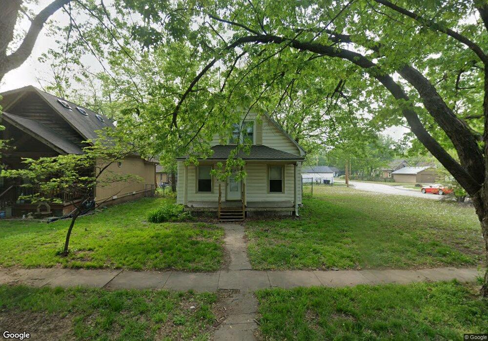
305 SW Roosevelt St Topeka, KS 66606
Greater Auburndale NeighborhoodEstimated Value: $108,000 - $125,000
3
Beds
1
Bath
1,290
Sq Ft
$89/Sq Ft
Est. Value
About This Home
This home is located at 305 SW Roosevelt St, Topeka, KS 66606 and is currently estimated at $115,123, approximately $89 per square foot. 305 SW Roosevelt St is a home located in Shawnee County with nearby schools including Rosenwald Elementary School, Martin Park Elementary School, and Meadows Elementary School.
Ownership History
Date
Name
Owned For
Owner Type
Purchase Details
Closed on
Jun 17, 2008
Sold by
Secretary Of Housing & Urban Developme
Bought by
Wm Investments Llc
Current Estimated Value
Purchase Details
Closed on
Nov 5, 2007
Sold by
Coble Jared W
Bought by
The Secretary Of Housing & Urban Develop
Purchase Details
Closed on
Jun 27, 2005
Sold by
Carswell Ryan H
Bought by
Brough Brandi M and Coble Jared W
Home Financials for this Owner
Home Financials are based on the most recent Mortgage that was taken out on this home.
Original Mortgage
$51,688
Interest Rate
5.64%
Mortgage Type
FHA
Create a Home Valuation Report for This Property
The Home Valuation Report is an in-depth analysis detailing your home's value as well as a comparison with similar homes in the area
Home Values in the Area
Average Home Value in this Area
Purchase History
| Date | Buyer | Sale Price | Title Company |
|---|---|---|---|
| Wm Investments Llc | -- | First American Title | |
| The Secretary Of Housing & Urban Develop | $57,075 | None Available | |
| Brough Brandi M | -- | Kansas Secured Title |
Source: Public Records
Mortgage History
| Date | Status | Borrower | Loan Amount |
|---|---|---|---|
| Previous Owner | Brough Brandi M | $51,688 |
Source: Public Records
Tax History Compared to Growth
Tax History
| Year | Tax Paid | Tax Assessment Tax Assessment Total Assessment is a certain percentage of the fair market value that is determined by local assessors to be the total taxable value of land and additions on the property. | Land | Improvement |
|---|---|---|---|---|
| 2025 | $1,279 | $10,041 | -- | -- |
| 2023 | $1,279 | $9,110 | $0 | $0 |
| 2022 | $1,133 | $7,922 | $0 | $0 |
| 2021 | $1,057 | $6,888 | $0 | $0 |
| 2020 | $993 | $6,561 | $0 | $0 |
| 2019 | $978 | $6,432 | $0 | $0 |
| 2018 | $949 | $6,244 | $0 | $0 |
| 2017 | $952 | $6,244 | $0 | $0 |
| 2014 | $1,021 | $6,612 | $0 | $0 |
Source: Public Records
Map
Nearby Homes
- 200 SW Orchard St
- 208 SW MacVicar Ave
- 348 SW Jewell Ave
- 700 SW Roosevelt St
- 1830 SW Willow Ave
- 2235 SW Kenilworth Ct
- 0000 SW Elmwood Ave Unit Lots 5,6 Laurel Park
- 719 SW Jewell Ave
- 312 SW Elmwood Ave
- 734 SW Lindenwood Ave
- 626 SW Medford Ave
- 808 SW Lindenwood Ave
- 618 SW Randolph Ave
- 614 SW Webster Ave
- 2330 SW Hazelton Ct
- 801 SW Wayne Ave
- 3005 SW 6th Ave Unit 6th
- 2204 SW Kensington Ct
- 2012 SW 10th Ave
- 215 SW Courtland Ave
- 307 SW Roosevelt St
- 301 SW Roosevelt St
- 315 SW Roosevelt St
- 319 SW Roosevelt St
- 304 SW Orchard St
- 310 SW Orchard St
- 300 SW Orchard St
- 312 SW Orchard St
- 2304 SW Duane St
- 2300 SW Duane St
- 321 SW Roosevelt St
- 300 SW Roosevelt St
- 308 SW Roosevelt St
- 314 SW Orchard St
- 312 SW Roosevelt St
- 325 SW Roosevelt St
- 318 SW Orchard St
- 2212 SW Duane St
- 316 SW Roosevelt St
- 224 SW Orchard St